Franconia Ridge Trail Loop
Mt. Lafayette 5260 ft | Mt. Lincoln 5089 ft
By the beginning of August I was closing in on the New Hampshire 48. I still had the five peaks in Vermont, the Bigelows in western Maine, and Katahdin’s two monsters to complete the New England 67, but the New Hampshire finish line was in sight. Based on my intended 100 Mile Wilderness start date, I was at the point of zero room for error. That meant I’d hike my last peaks in whatever conditions Mother Nature threw at me. And this summer, she sure did seem to be throwing a lot of rain.
I headed out to Franconia Ridge on an overcast Thursday to tag Lincoln and Lafayette. My last experience on the ridge was clawing my way up the Flume Slide to reach the Flume and Liberty summits, both of which were fully socked in. I’d heard plenty of rave reviews about hiking Franconia Ridge and the outlooks from the top, and I was hopeful to see more than just clouds this time.
Lafayette Place Campground, just off I-93, is the starting point for multiple hikes on both sides of the highway. The lot fills up very fast in the summer. There is also a trailhead parking lot across the highway that can be reached via a path under the road. If both lots are full, park on the grassy shoulder of the road, but be aware this is a parkway and traffic is zipping along.*
*UPDATE: a reader comment prompted me to look into this. It is, in fact, illegal and unsafe to park anywhere on I-93. NH State Parks started a shuttle program in 2019 to deal with the parking overflow on busy weekends. It leaves from Cannon Mountain’s Peabody Base Lodge (Exit 34C) parking lot, runs 8am-8pm Saturday, Sunday, and holiday Mondays, and costs $5 (CASH) round trip. More info here.
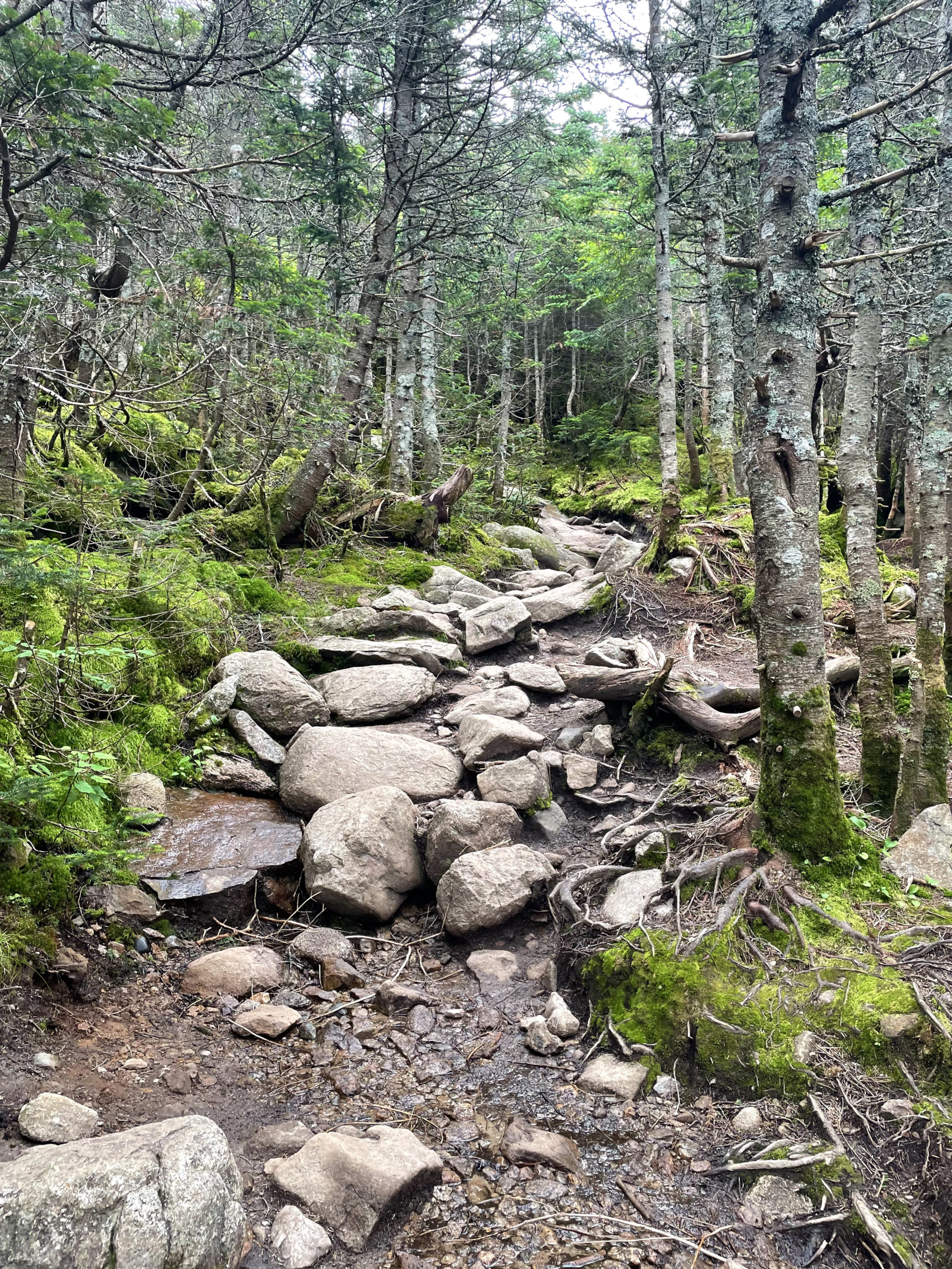
Old Bridle Path leaves from the parking lot on the east side of I-93, and shortly after crossing Walker Brook, Falling Waters Trail diverges to the right. According to the AMC White Mountain Guide, Falling Waters is steep and rough in parts and generally better for ascent than descent, although it isn’t technically dangerous unless the ledge near the brook is icy.
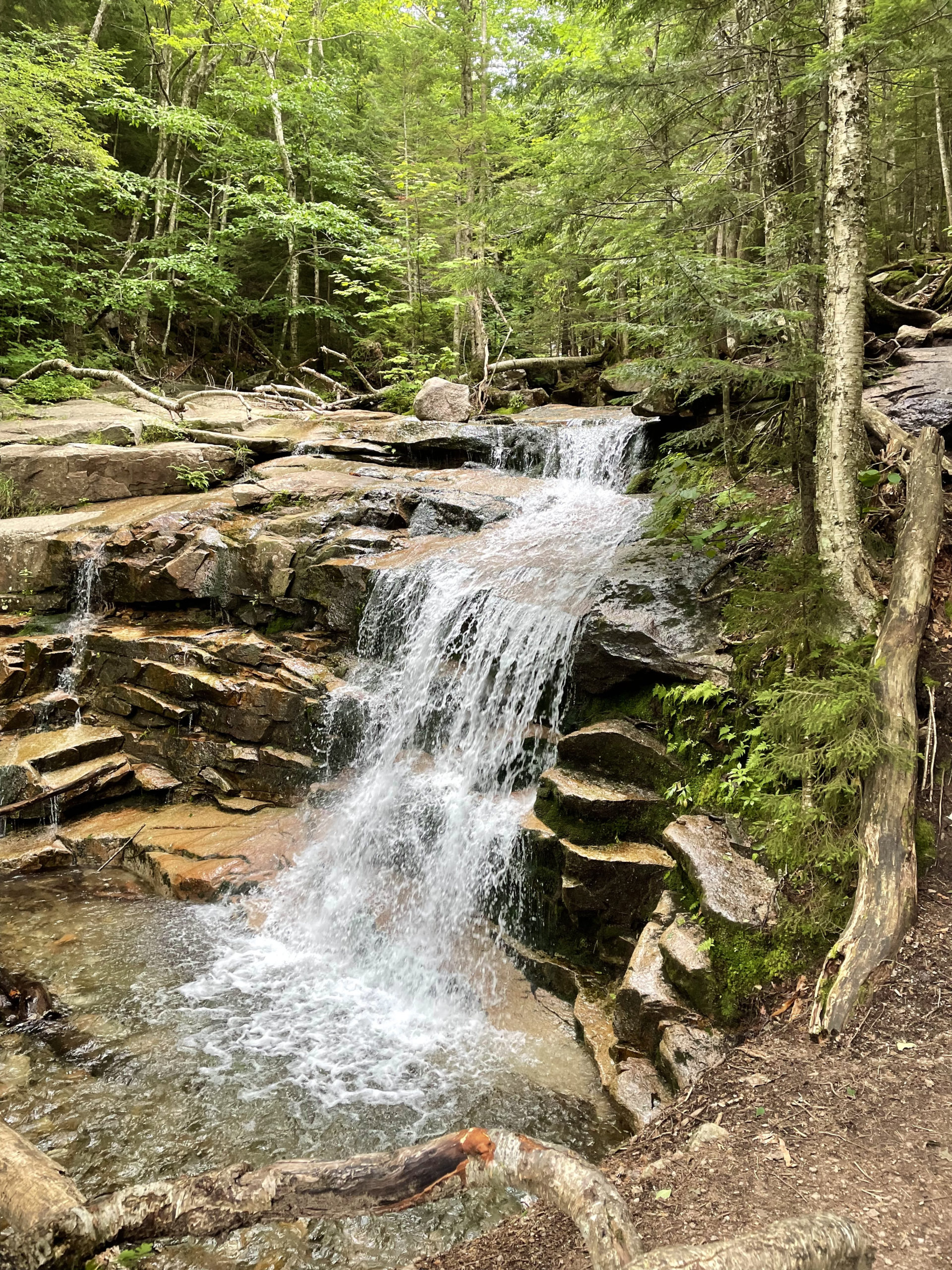
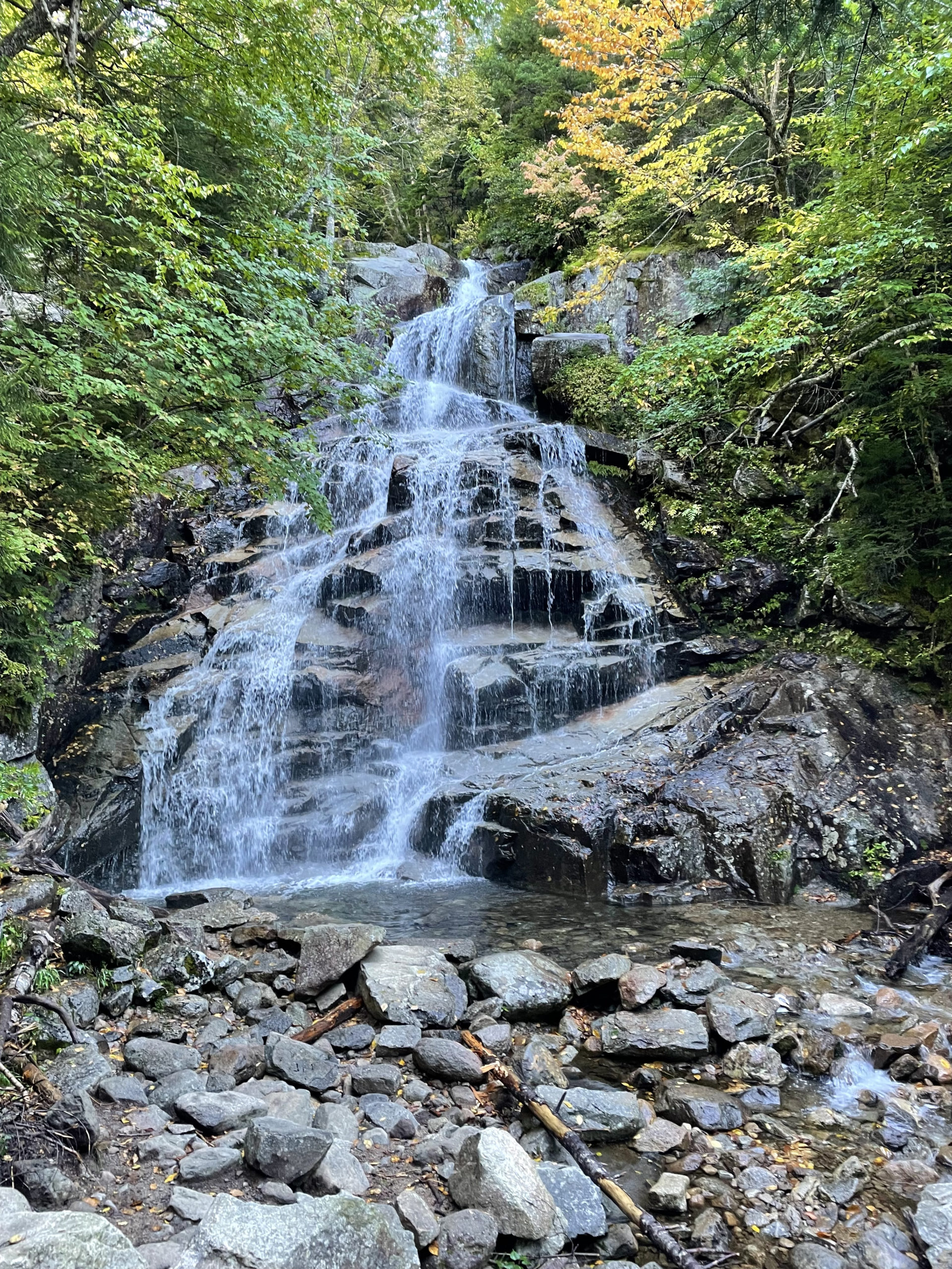
Falling Waters Trail follows Dry Brook for several miles, passing and crossing many beautiful cascades. There are three significant falls worth hiking up to see, even if your goal isn’t to climb the full three miles to the ridge. Stairs Falls, Swiftwater Falls, and Cloudland Falls are all within the first half of the trail, and each is unique.
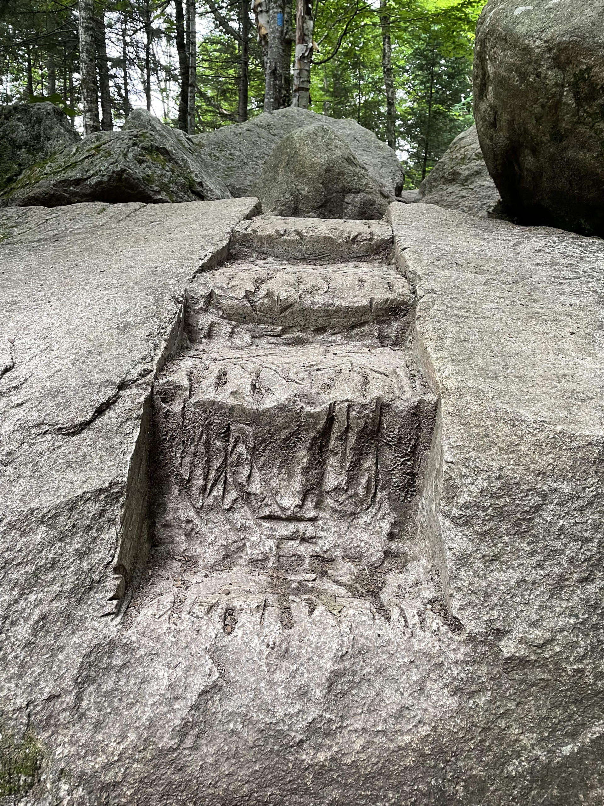
There are steep sections of trail near the falls, and the rock is always wet, so use caution. In several spots, steps cut into the stone help manage the scrambles.
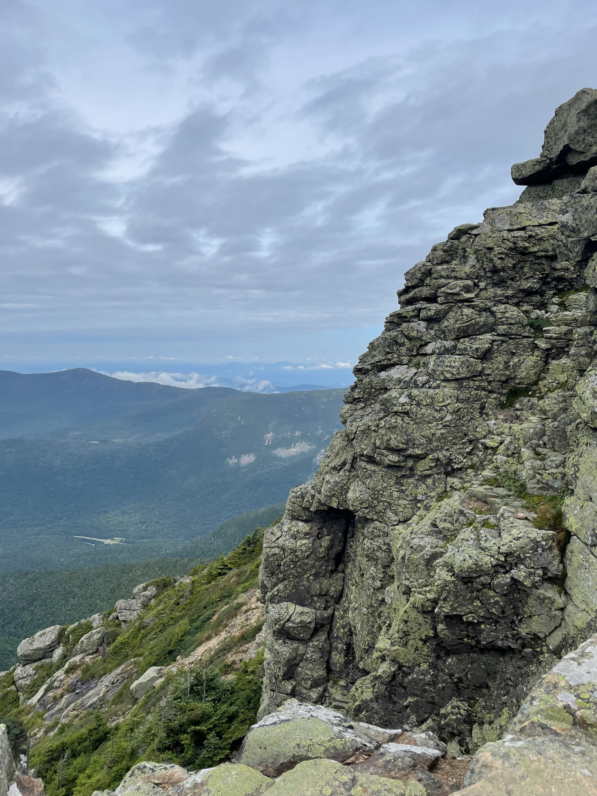
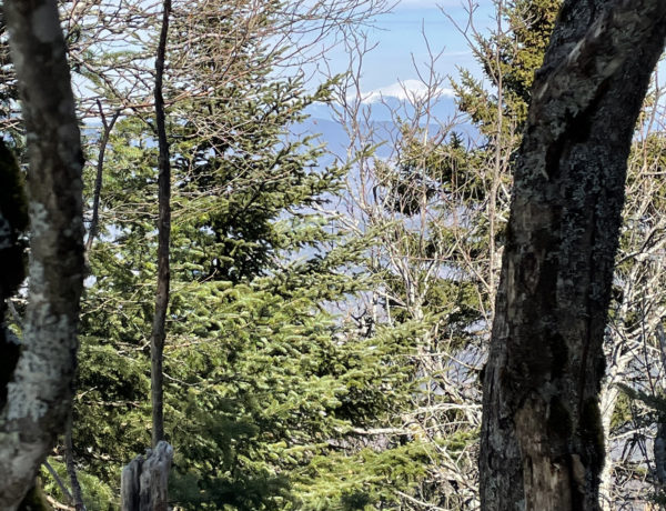
At about a mile and a half, Falling Waters Trail continues onto an old logging road and climbs Franconia Ridge via a series of switchbacks. Just before reaching the ridge, the trail passes Shining Rock. This shear granite ledge is over 200 feet tall and 800 feet wide and is usually covered with water from springs in the woods above it. When viewed from across the notch, the ledge glows like a mirror in the sunlight.
The AMC guidebook would like us all to know that several serious injuries have occurred when hikers tried to climb this ledge without rock climbing gear (or experience). So, look but don’t touch unless you know what you’re doing. It’s a lovely spot to stop for a break and enjoy the view even without climbing it!
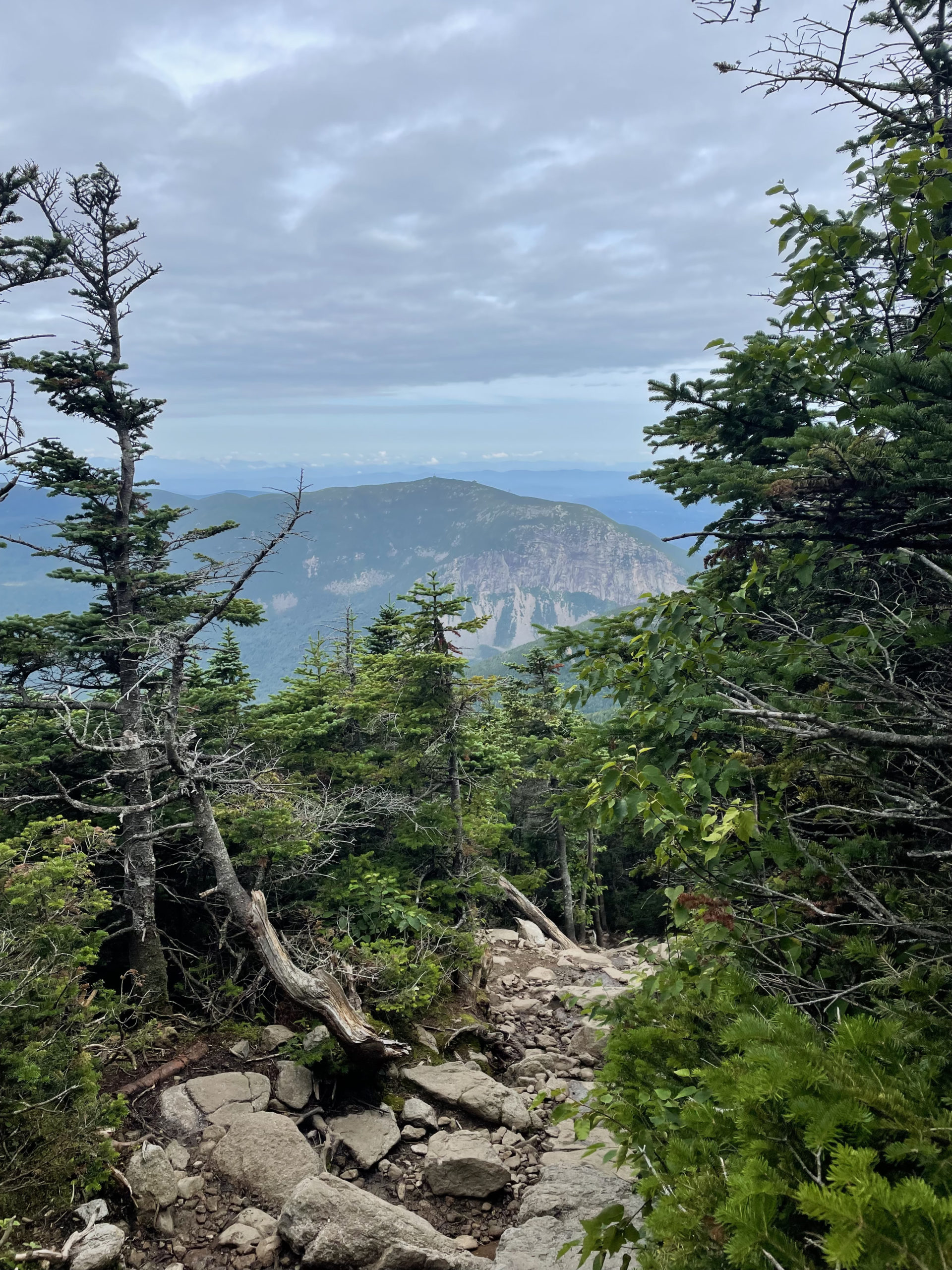
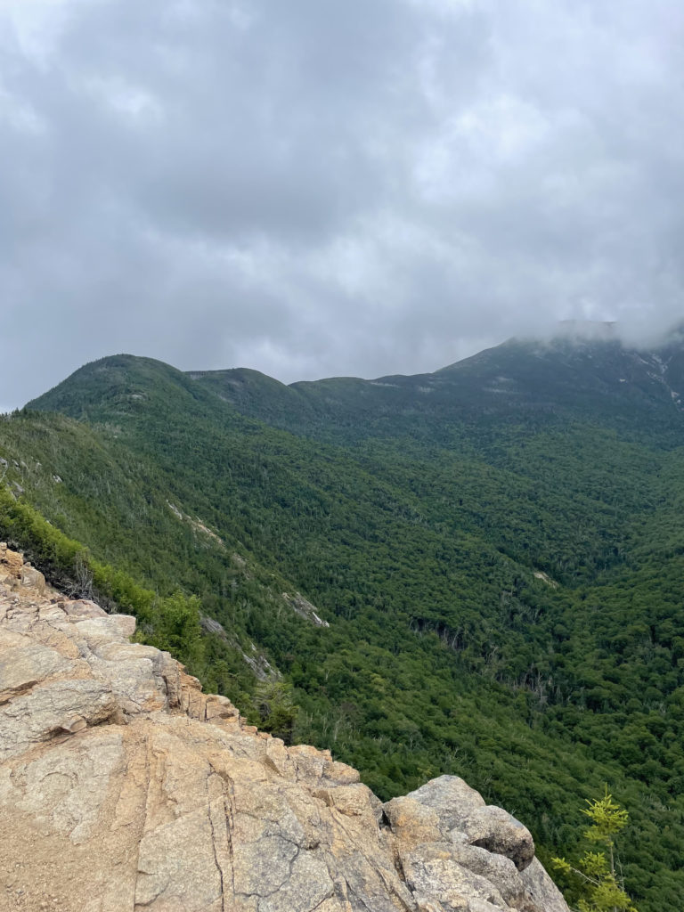
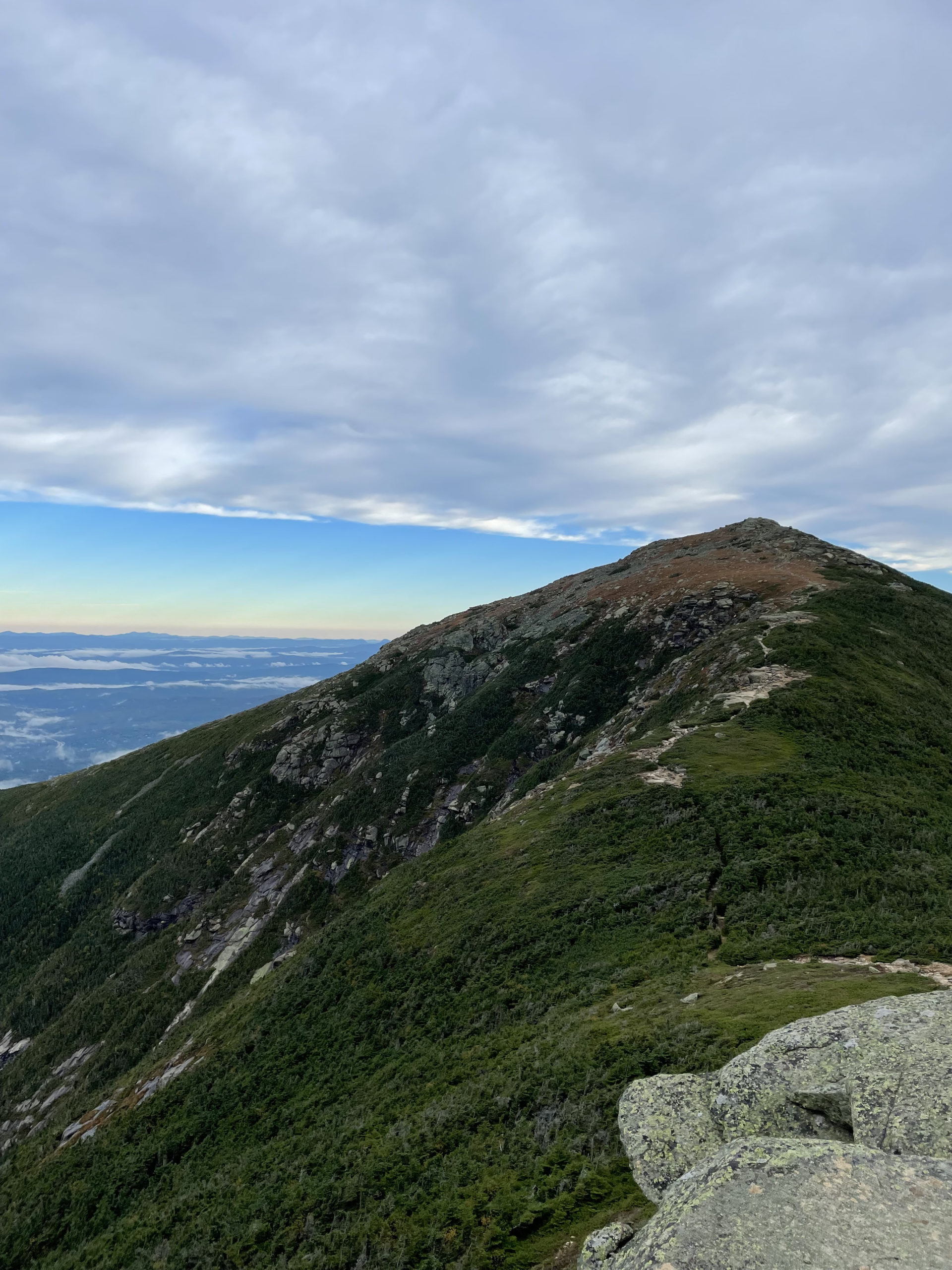
After Shining Rock, the trail climbs a steep, rough rock pile to the summit of Little Haystack Mountain (4760 feet). From there, the westward view across the notch to the slab-sided Cannon Mountain and the Kinsman Ridge is incredible. Looking east into the Pemigewasset Wilderness, Owl’s Head is the closest peak with the Bonds visible in the distance.
Franconia Ridge Trail above the treeline between Little Haystack and Mt. Lafayette (and Mt. Lincoln between them) is narrow, at points considered a ‘knife’s edge ridge’, and is almost constantly exposed. This stretch of trail takes the full force of any storm, and because of the sharp ridge, the risk for lightning strikes is unusually high. I learned a lot about lightning safety during my Mt. Osceola trip, and Franconia Ridge is an area to be avoided at all costs when a storm starts brewing.
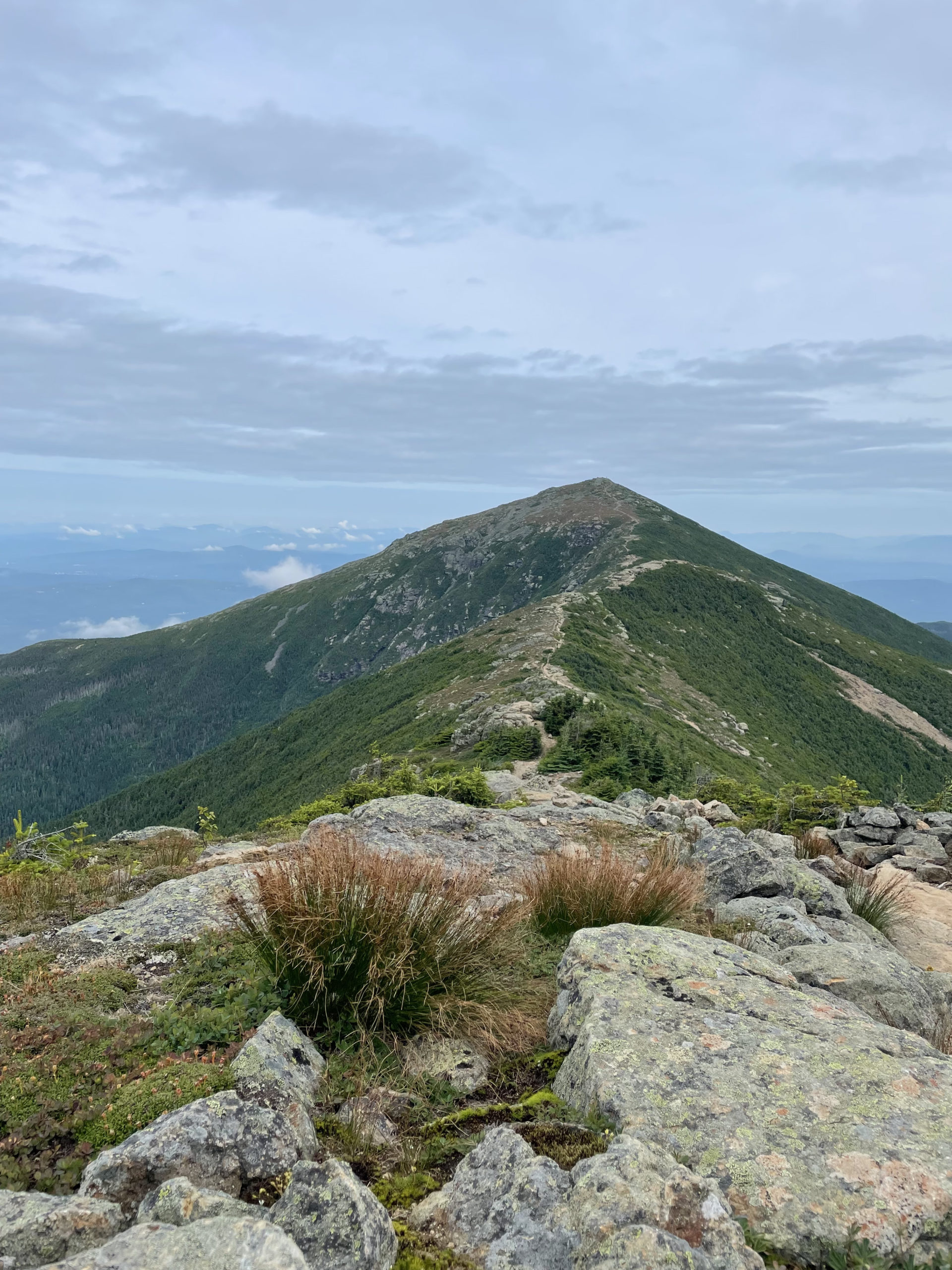
Luckily, this wasn’t a stormy day and the steep, rocky ups and downs between Lincoln and Lafayette were very manageable. At the top of Mt. Lafayette there are remains of an 1850s summit house. According to White Mountain History, the structure was built as a shelter for those traveling on horseback to and from the various mountaintop hotels that were popping up around the same time. None of these structures remain. Most succumbed to fire, or in the case of the Mt. Kearsarge House, blew off the mountain.
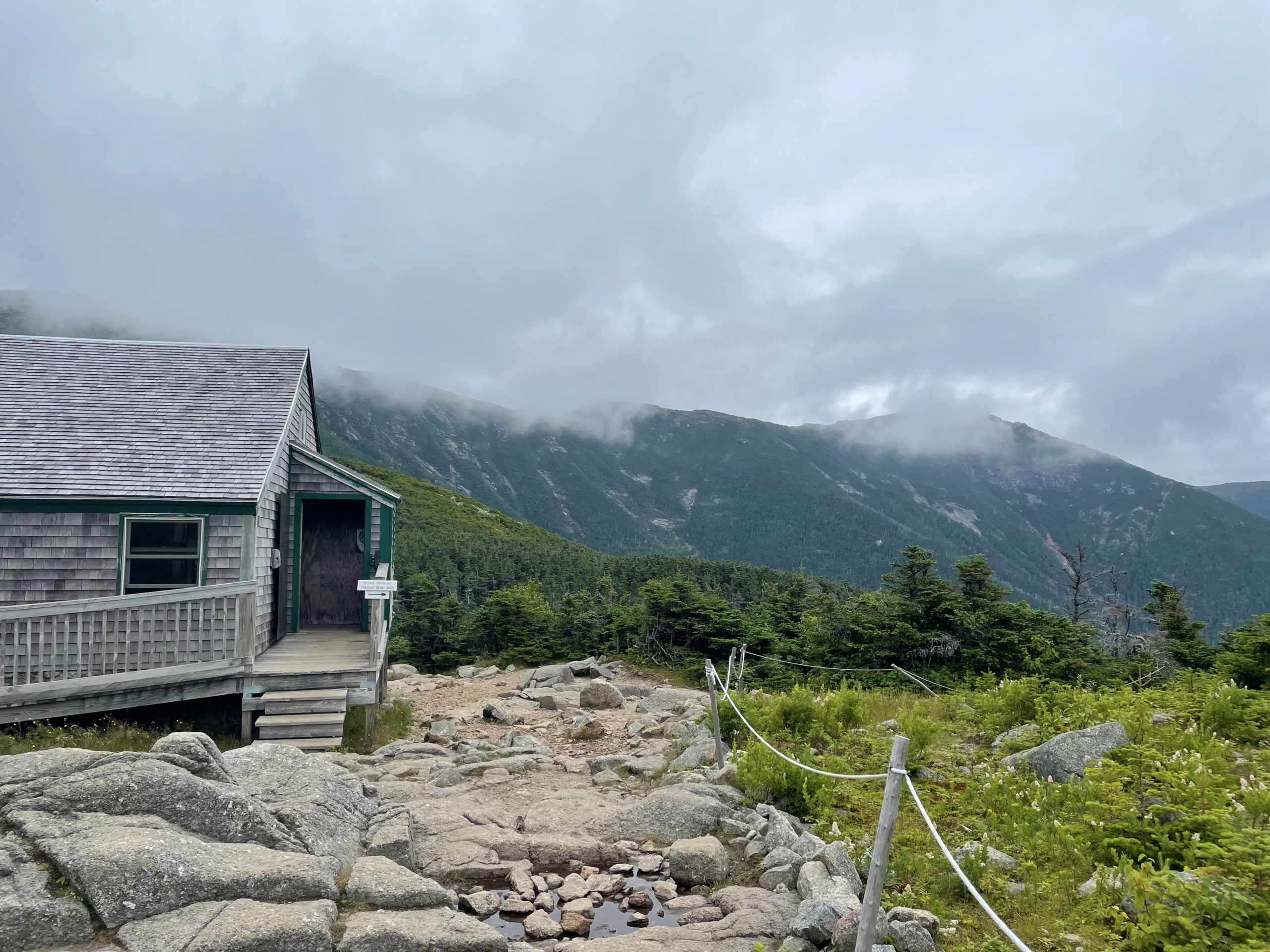
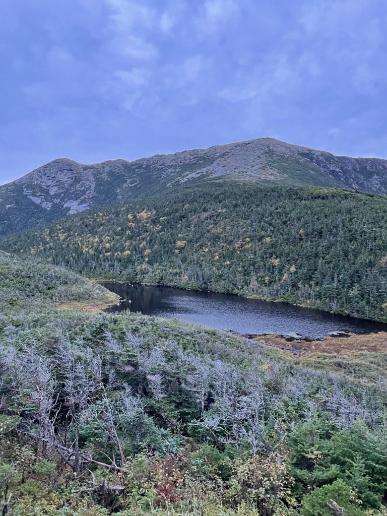
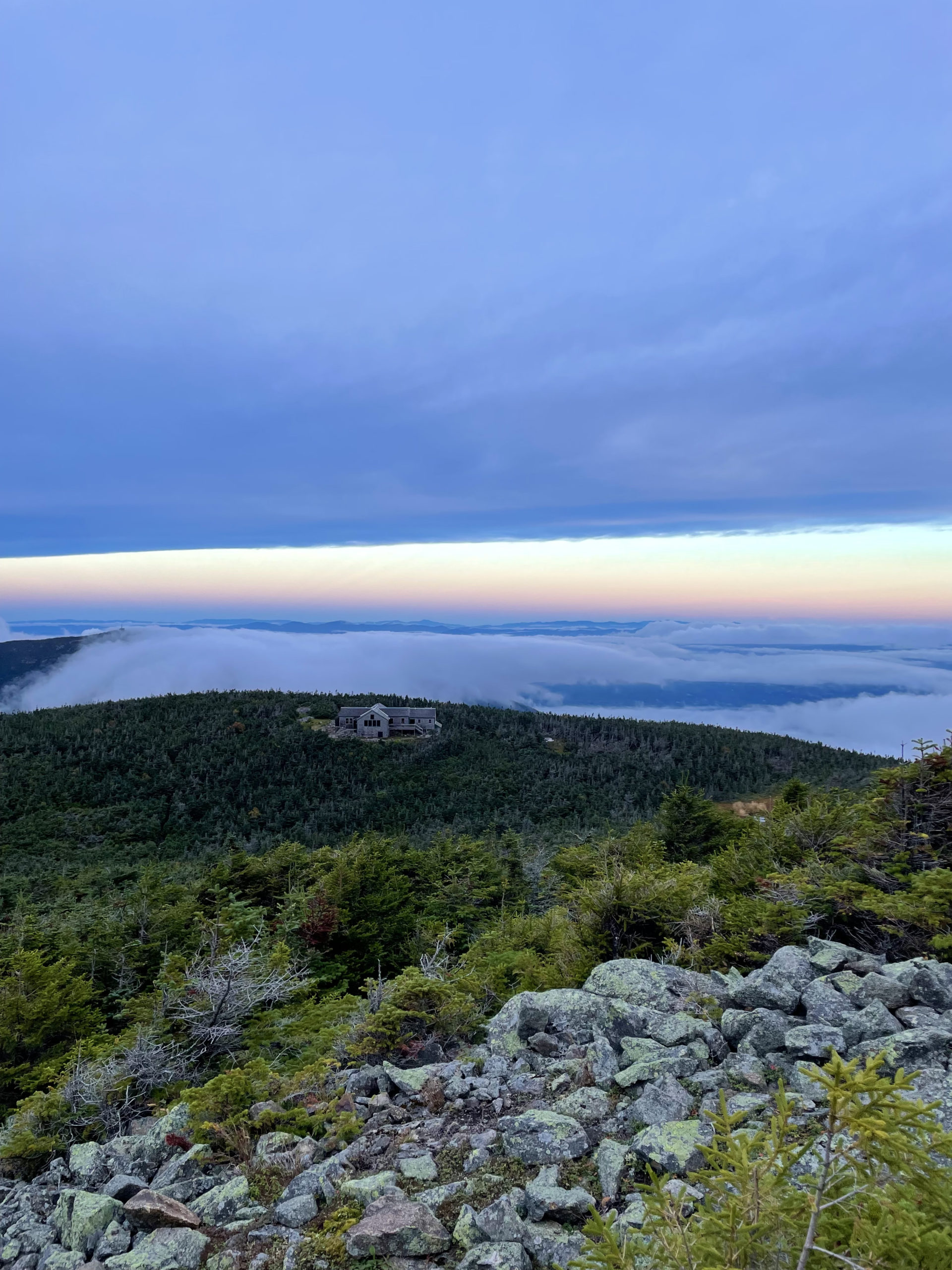
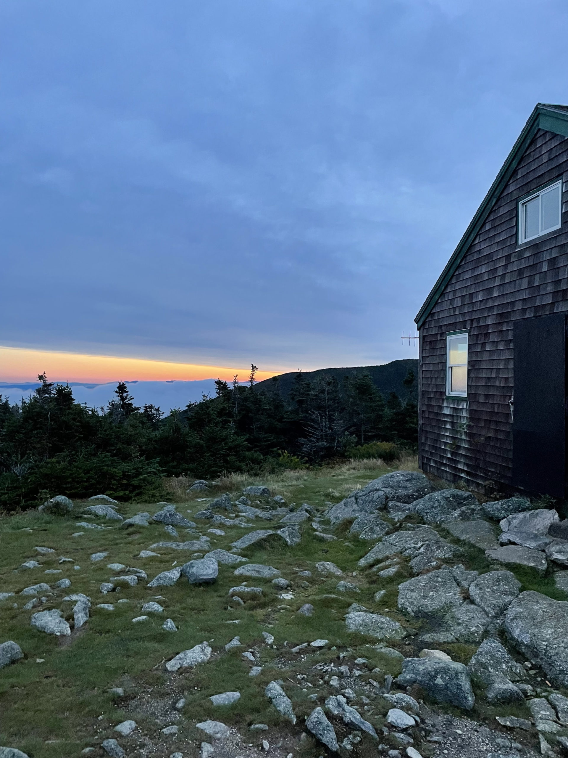
From Mt. Lafayette, Greenleaf Trail descends at a moderate grade down rock steps and over loose gravel footing. Eventually the trail enters the scrub, passes a sandy area, climbs several minor knobs, and reaches the Eagle Lakes. These are technically tarns, although the upper lake is becoming a bog. The AMC Greenleaf Hut is just beyond the lakes, and its location offers an incredible view of Franconia Ridge above it.
Hiker term: Tarn
A small, shallow mountain lake.
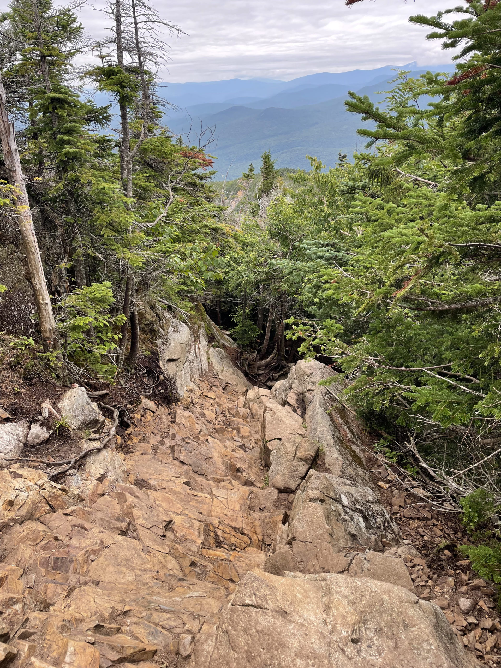
After a quick stop at the hut, I headed for Old Bridle Path. The top section of Old Bridle Path provides views in all directions, but the going is tough. There is a wall of slippery red-brown rock called Red Rocks that descends at an aggressive angle. After this is a steep climb known as Agony Ridge (named by the staff who have to pack heavy loads up to the hut, according to AMC), and then rough footing over ledges near the brink of a ravine. The knee-crushing descent goes on for the better part of two miles before the trail becomes more moderate and eventually reconnects with Falling Waters Trail.
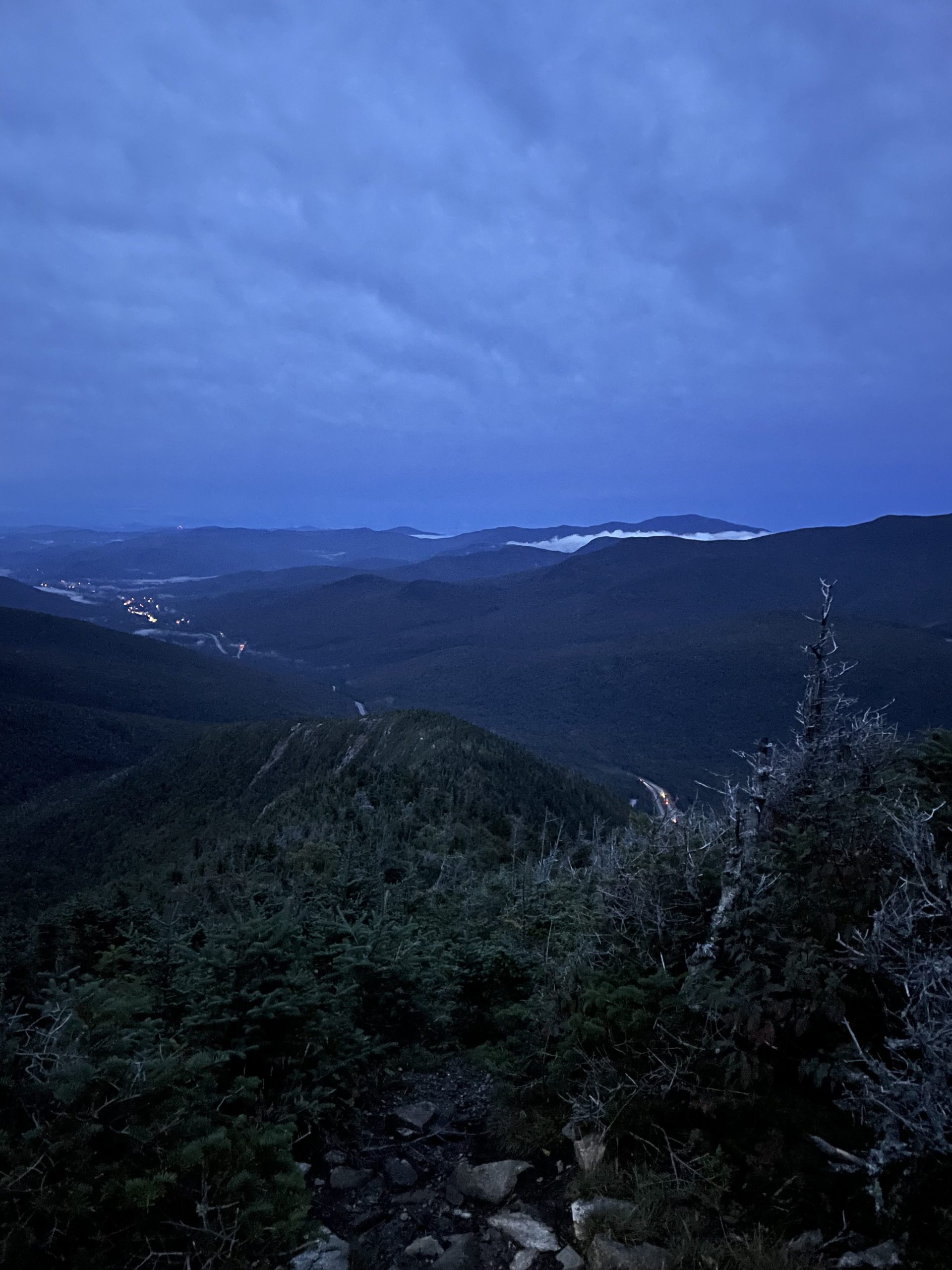
I revisited this hike in September and planned to reach Franconia Ridge for sunrise. Despite well-laid plans, at the last minute I almost didn’t go. It was raining the night before, dark by the time I got to the campground, and later than I’d planned. I barely slept and everything was wet in the morning. Breaking down a soggy tent by the light of a headlamp is miserable. I was tempted to stay in my warm sleeping bag and hike later in the day. But this was supposed to be my first sunrise hike. If I stayed in my tent, it would be just another hike. Enjoyable as always, but not the hike I’d intended.
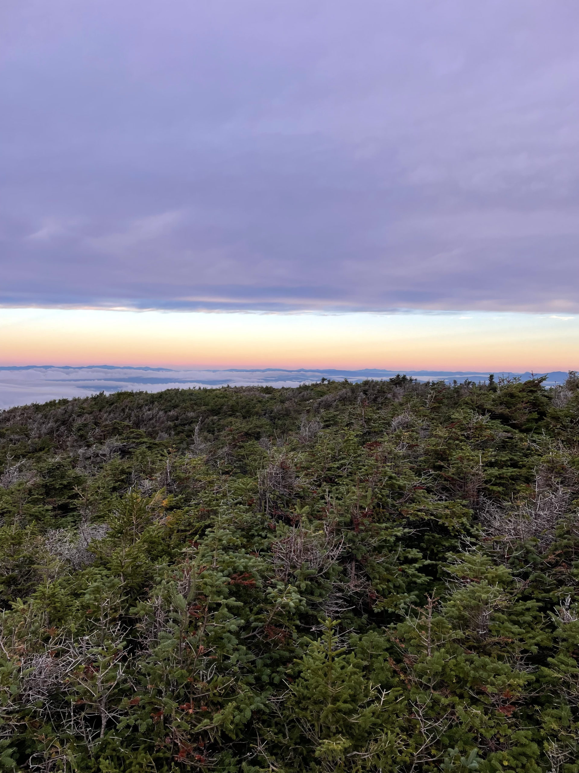
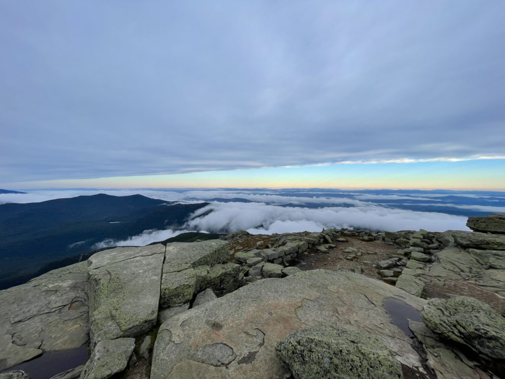
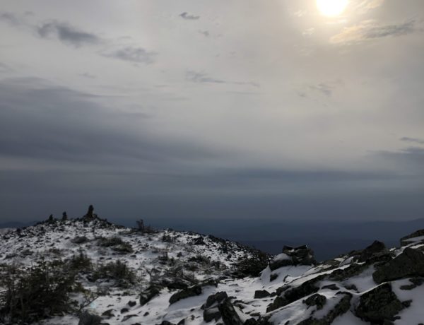
I considered my options… and then before I could change my mind again, I hauled myself out of bed, threw all my wet gear in the back of my car, and hit the trail. I completed the same loop in the opposite direction, starting up Old Bridle Path and finishing with Falling Waters. Both directions are challenging; there is no way around the steep elevation, wet rock, and inevitable scrambles at this height. I reached the ridge as the sun was rising. It was the first (and remains the only) time I’ve seen an undercast. It was like looking out at the ocean, but the water was clouds. I’ve never seen anything like it. It was so spectacular that it was difficult to understand, truly awe-inspiring in the way only nature can be.
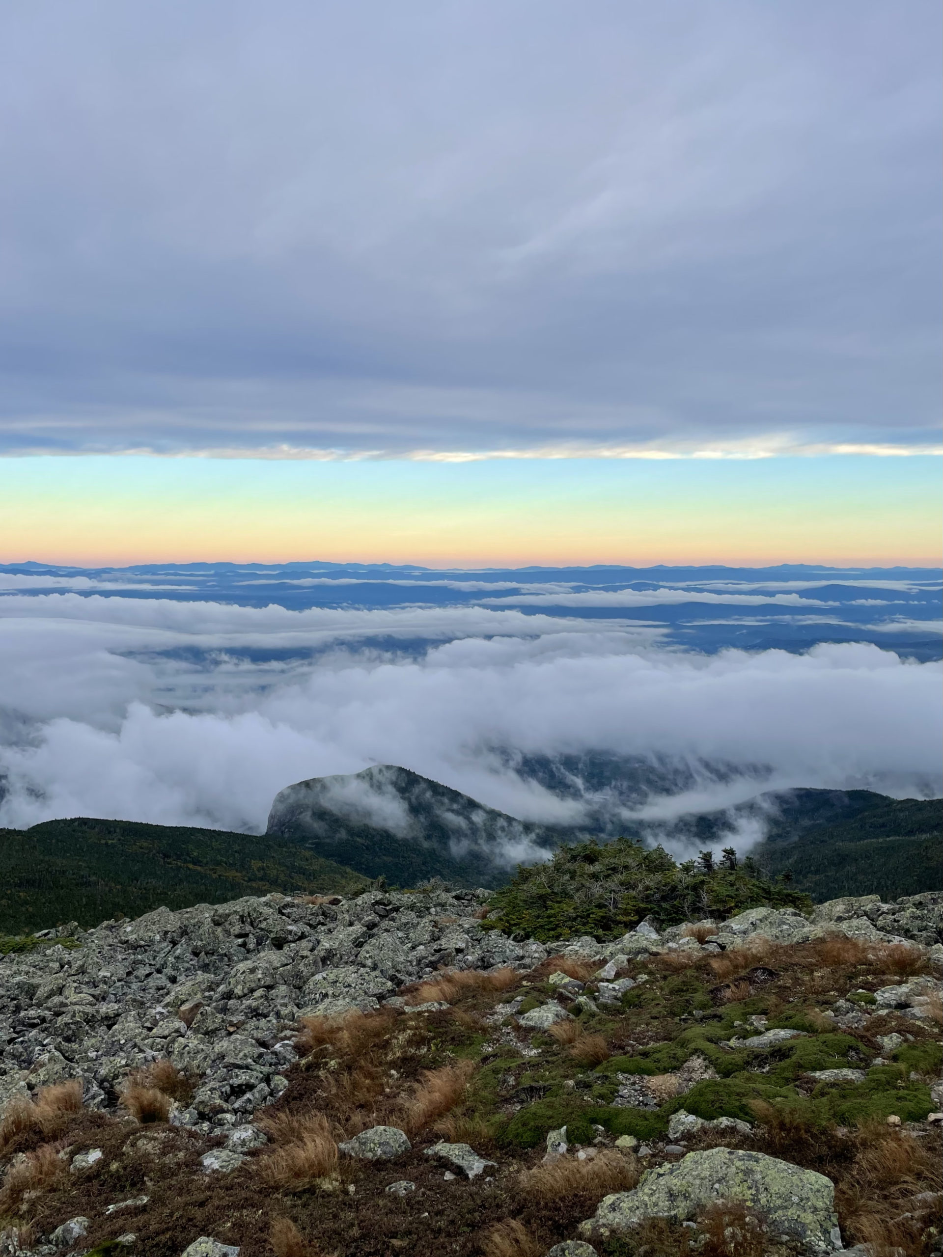
I didn’t realize it at the time, but undercasts are relatively rare in the Northeast (except on the tallest peaks like Mt. Washington). According to the Mount Washington Observatory, “When one finds themselves above the clouds, what they are seeing is referred to as undercast rather than overcast because the clouds are under or below them instead of over or above.”
In the case of the undercast on Franconia Ridge, the low level clouds were trapped in the valleys by what is called an inversion layer. This layer of the atmosphere happens when temperature increases with height, which is the opposite of what typically happens (hence the term: inversion). This phenomenon often occurs between storm systems, when moisture is trapped at a lower elevation.
Had I stayed in my tent, discouraged by the storm that created the undercast, I wouldn’t have experienced one of the most beautiful things I’ve ever seen.
Summit lesson: Nature has something incredible to show us every day. We just have to show up.
Franconia Ridge Trail Loop
| Total elevation: 5250 ft & 5089 ft | Elevation gain: 3822 ft |
| Mileage: 8.4 miles | Alpine exposure: significant |
| Terrain: woods, rough footing, ledge, scrambling | Challenges: steep, slippery, narrow ridge |
| View payoff: outstanding | Dogs: yes, on leash |
Recap: This loop can be done in either direction with about the same level of effort. The climb up to Franconia Ridge is tough; plan for steep, rough, and scrambly no matter the route you choose. If it’s particularly wet, ascending Falling Waters Trail is a safer choice. Once you reach the ridge, you’re in for some of the most phenomenal views in the Whites. Mt. Lafayette, Mt. Lincoln, and Little Haystack Mtn. are connected by a narrow trail, rough in spots but well defined, that should be avoided in any storm that might produce lightning. Don’t miss the remains of an old summit house at the top of Mt. Lafayette and stop into Greenleaf Hut if you need a snack (bring cash) or just a break with more fantastic views. If you’re hiking this loop in the summer, remember the trailhead parking lot at Lafayette Place is extremely popular and fills up fast, especially on weekends.
2 Comments
Phill mcraken
June 10, 2023 at 3:23 pmYou can’t park on the highway, never could. They now run a shuttle.
Sarah Holman
June 10, 2023 at 4:46 pmThanks, Phil. Updated info is now in the post.