Signal Ridge Trail
Mt. Carrigain 4700 ft
My trip to Mt. Carrigain was somewhat last minute. The weather was unseasonably hot and humid, and I’d canceled a hike two days prior because the conditions just seemed miserable. Quitter’s regret set in almost immediately because my summer hiking calendar didn’t have a ton of wiggle room if I was going to reach my goal, so I decided to embrace the inevitable sweaty discomfort and head to the mountains.
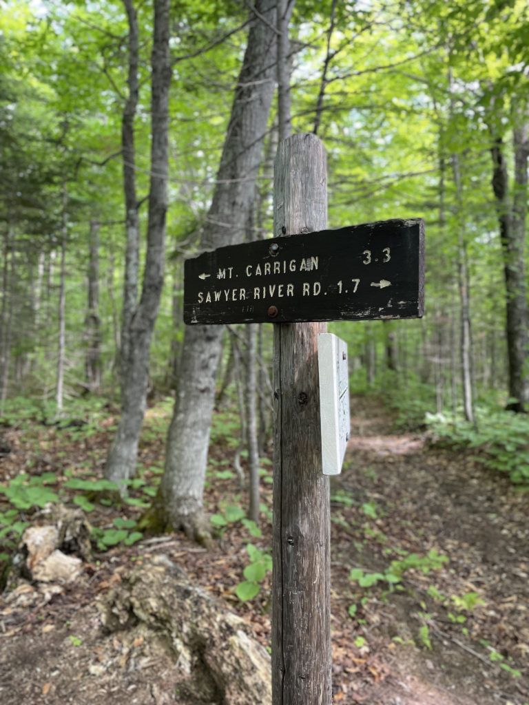
Signal Ridge Trail begins on Sawyer River Road, about 2 miles off Rt 302. The parking lot is on the left, just past the bridge over Whiteface Brook, and the trail begins on the right. According to the Appalachian Mountain Club White Mountain Guidebook, several relocations were made on the lower half of this trail in 2012, and in some places, ‘care is required’ to locate the trail, especially after stream crossings. I didn’t have trouble finding my way, but I did notice several places where the old trail had been blocked with logs.
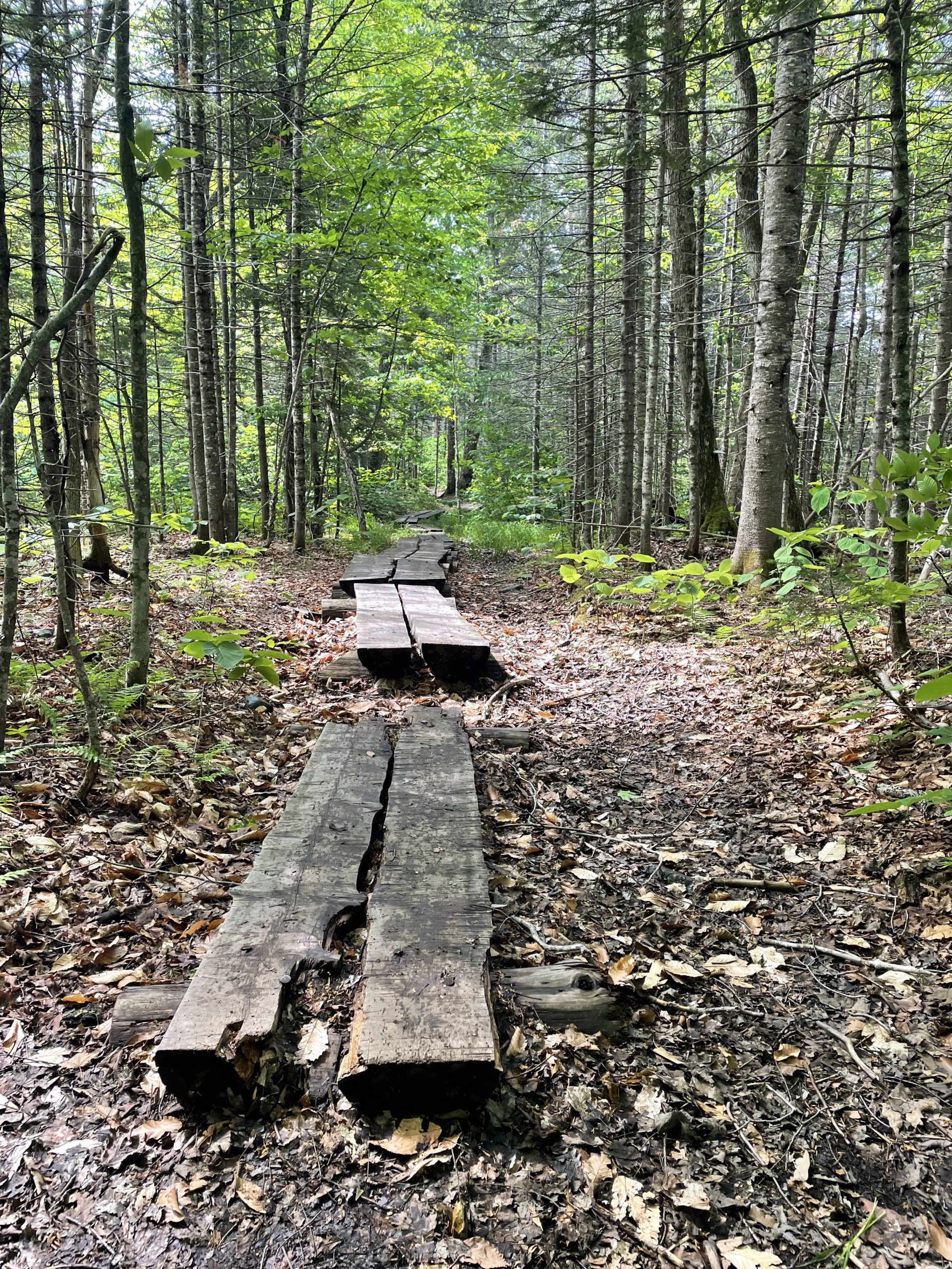
The first two miles of Signal Ridge Trail are almost entirely flat, utilizing old logging roads. The route travels along the edge of Whiteface Brook for about a mile and then crosses Carrigain Brook, which can be high after rain. Just before the crossing, there is an area of beaver activity on the left. I didn’t see any critters on the move, but the dams and teeth marks are there!
Another highlight along the way was a patch of pink lady’s slippers. Part of the orchid family, this hardy variety grows in cold climates and flowers in late spring. The flowers have a long history of popularity, both for their unique appearance and for medicinal trade. The US Forest Service writes, “Widespread collection, attempts at transplantation, and loss of habitat have drastically reduced their numbers. Wild lady’s slippers have special requirements that make them difficult to cultivate, and rarely survive transplanting from the wild.” Because of these variables, it is illegal to dig or pick lady’s slipper orchids on federal lands.

Seeing these flowers reminded me of my childhood home where they grew in the woods. My mother always told me not to pick them because they were (and still are) endangered. The truth is, almost all wildflowers are fragile and will wilt within hours of being picked. They also support entire ecosystems for pollinators, birds, and small animals on a micro scale, many of which (especially the pollinators) have a very small home range and limited mobility. While it may seem innocent enough to pick a flower, the repercussions reach far beyond one bloom. The US Forest Service has seen an increase in wildflower poaching, including endangered varieties. In some cases, entire populations of species have been stolen.
Hiker fact:
In National Forests, Parks, or Monuments, it is illegal to pick or collect any plants without a permit.
Happily, it is perfectly legal to photograph them!
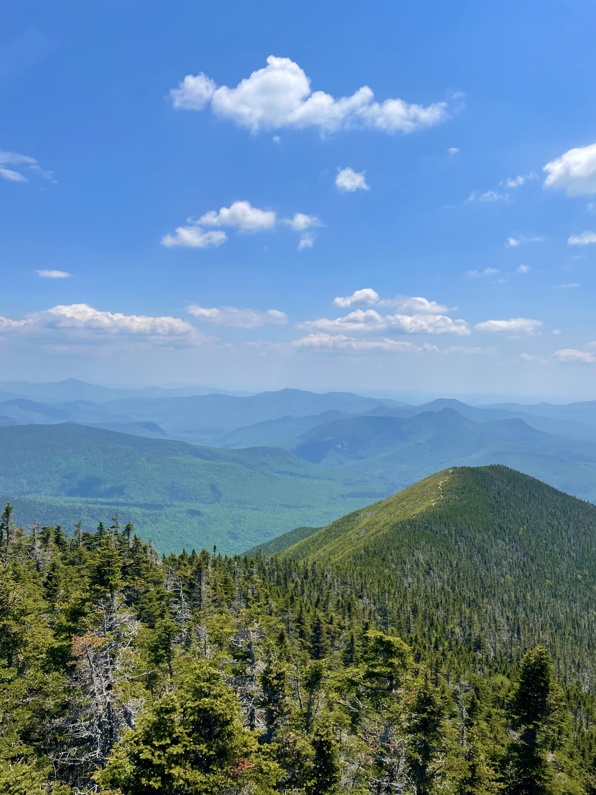
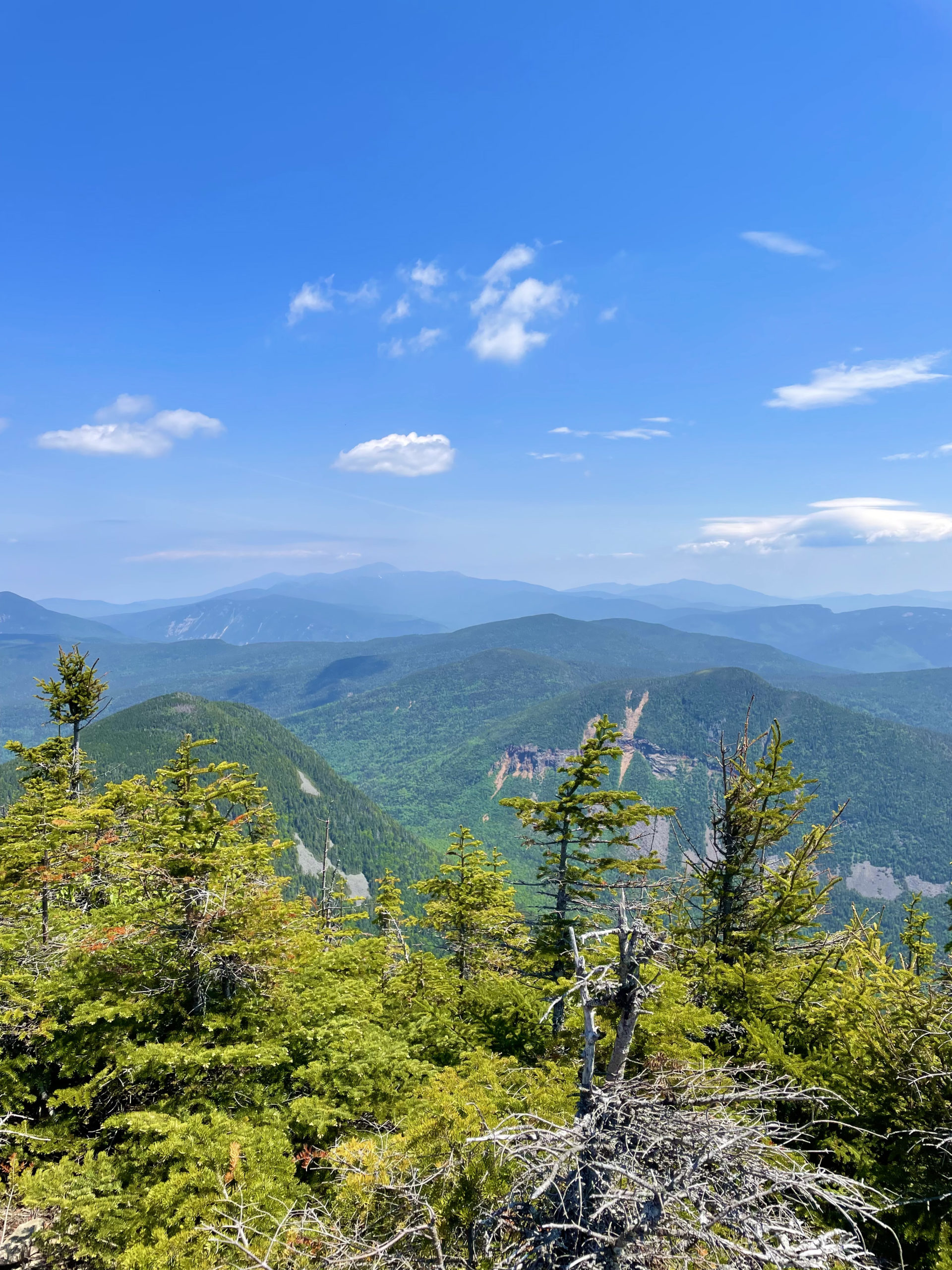
After taking pictures of orchids, I continued to the trail intersection at two miles where the grade of Signal Ridge Trail starts to ascend steadily and remains steep until opening onto the ridge. Multiple switchbacks make the climb more gradual, but the elevation gain is significant, especially during miles 3 and 4. The footing also changes from easy forest trail to loose, rocky, and rooty (a.k.a. miserable) and then transitions to larger rocks near the top. After a final, aggressive zig-zagging push, the bare crest of the ridge appears. There are amazing views from the open trail here, which is mostly gravel edged by low scrub. The tower atop Mt. Carrigain is easy to spot as well, about a half-mile away.
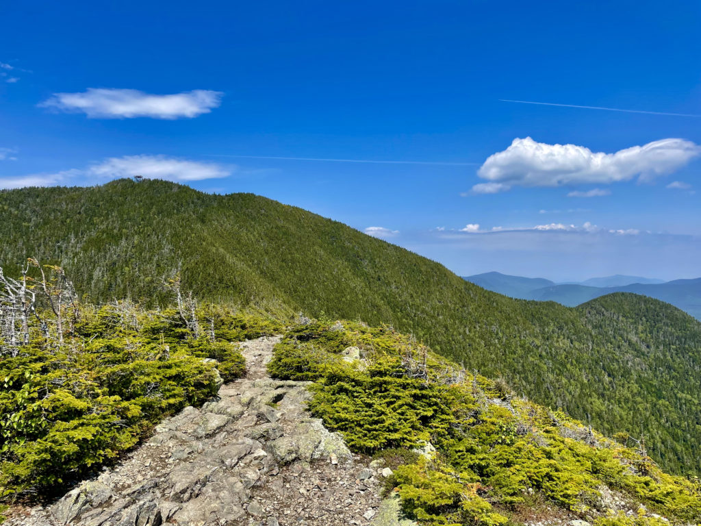
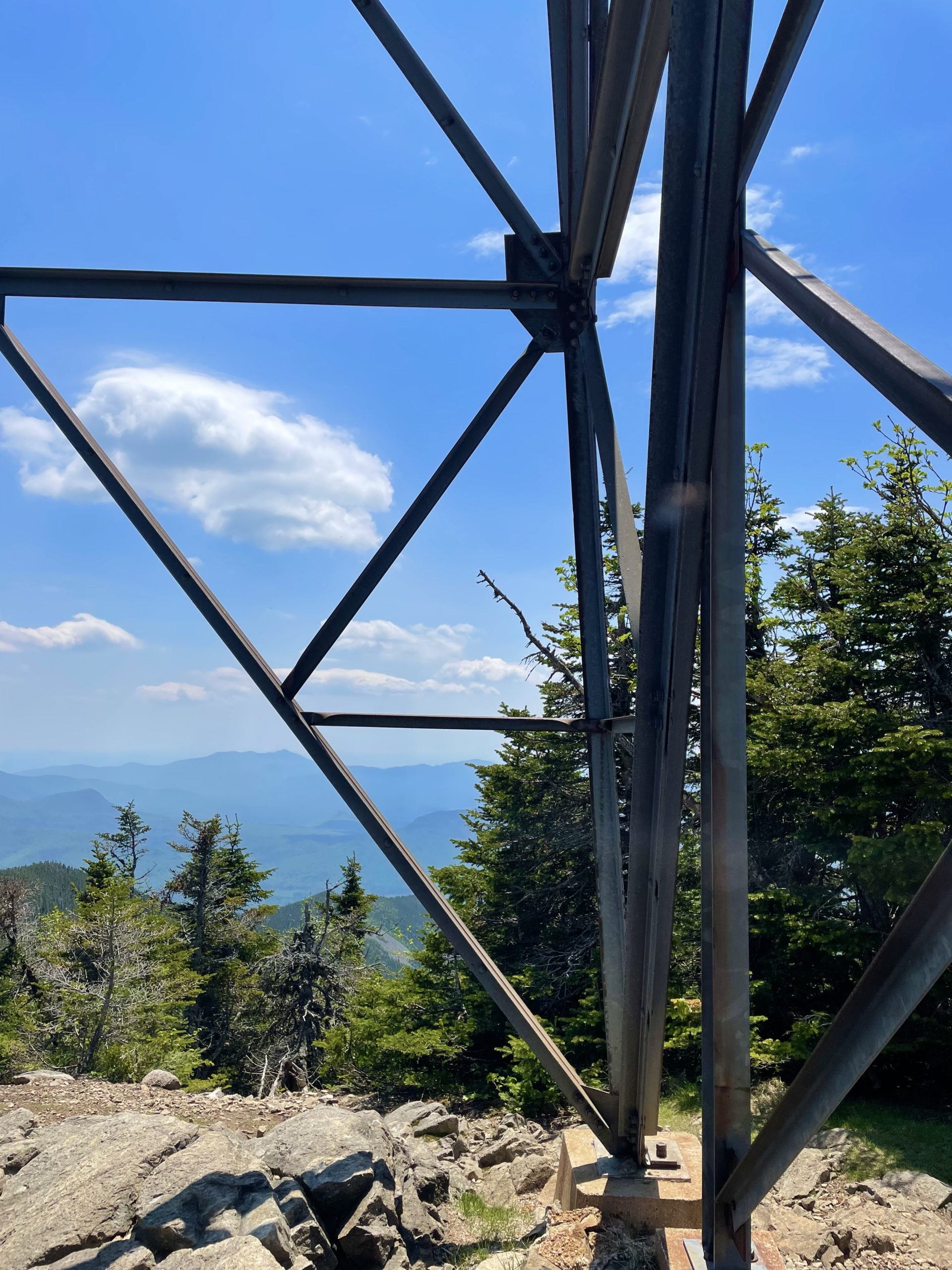
After crossing the ridge, the trail dips slightly and enters the woods before climbing the summit cone. An old well to the right of the trail marks the former location of a fire warden’s cabin. Water is still available but needs to be treated before drinking. After another steep section, the trail reaches the nearly-tree-covered summit of Mt. Carrigain and the impressive observation tower there, which occupies all the non-tree space. The tower has a large platform, and it was holding about a dozen other lunching hikers when I climbed up. Despite the heat and full sun, the breeze at the summit made for a pleasant lunch break. Several people had chosen to eat under the tower in the shade, also a great option.
Many guidebooks and reviewers say the views from Mt. Carrigain’s tower are the best in the White Mountains. You get a clear look at the Presidentials and the Pemigewasset Wilderness to the north and the Sandwich Range to the south. In fact, according to Gaia GSP, you can see 43 of the 48 4000 footers from the tower platform.
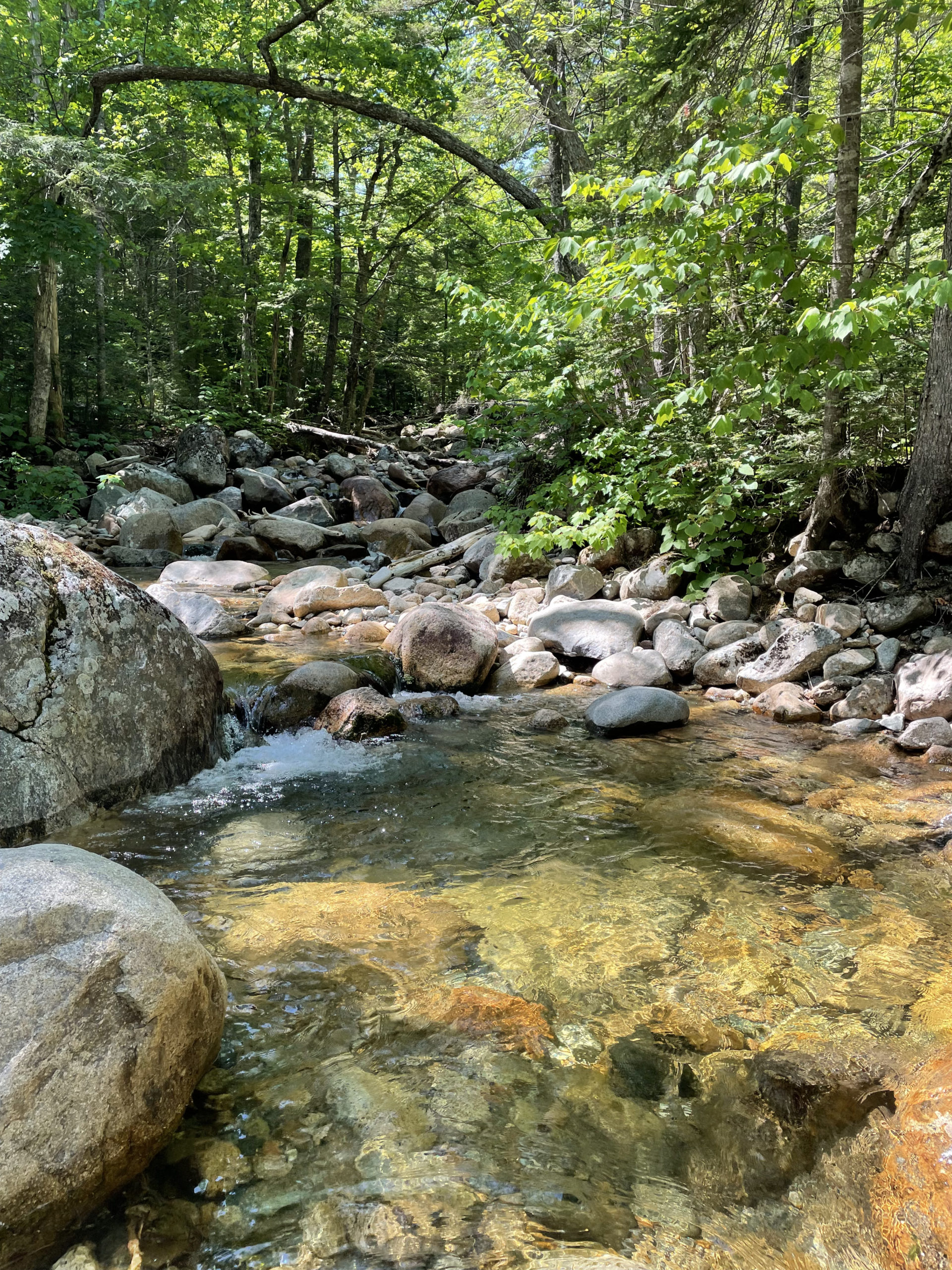
After trekking back across the exposed ridge and managing the steep descent, I was ready to cool off. I swam in one of the many pools along Whiteface Brook and was basically dry again by the time I reached my car, thanks to temperatures near 90 degrees. While it was definitely a hot, sweaty hike, it’s worth remembering most trails have significant tree cover, at least below the alpine zone. I tend to forget this fact, probably because anything above 80 degrees falls in my ‘too hot for comfortable exercise’ range, and I anticipate the worst. I did consume the full three-liters of water from my hydro-pack and would have refilled at the stream, had I packed a filter. But with adequate hydration, sunscreen, a hat, tree shade, and a dip in a really cold river, hiking on this scorcher of a day really wasn’t that bad.
Summit lesson: When we prepare for physical discomfort to the best of our ability by equipping ourselves with the right tools, resources, and gear, we can mitigate misery... and even enjoy an unexpectedly positive experience... like hiking in the heat.
Mt. Carrigain: Signal Ridge Trail
| Total elevation: 4,700 ft | Elevation gain: 3,448 ft |
| Mileage: 10.1 miles | Alpine exposure: some |
| Terrain: steep sections, wooded trail, ridge, switchbacks | Challenges: loose rock, very steep, water crossing |
| View payoff: one of the best in the Whites | Dogs: yes, great trail for pups |
Recap: The second half of Signal Ridge Trail is unrelentingly steep, but the easy first two miles warm you up for the push to the summit. Switchbacks alleviate some of the incline, and the views are arguably the best in the White Mountain National Forest. There are plenty of spots to cool off in streams or rest and watch the water during colder months. FYI for winter hikers, the Sawyer River Road is closed seasonally, and walking in from Rt 302 to the trailhead would add about 2 miles each way.

No Comments