Hunt Trail to Hamlin Ridge Trail to Chimney Pond Trail
Mt. Katahdin: Baxter & Hamlin Peaks 5269 ft
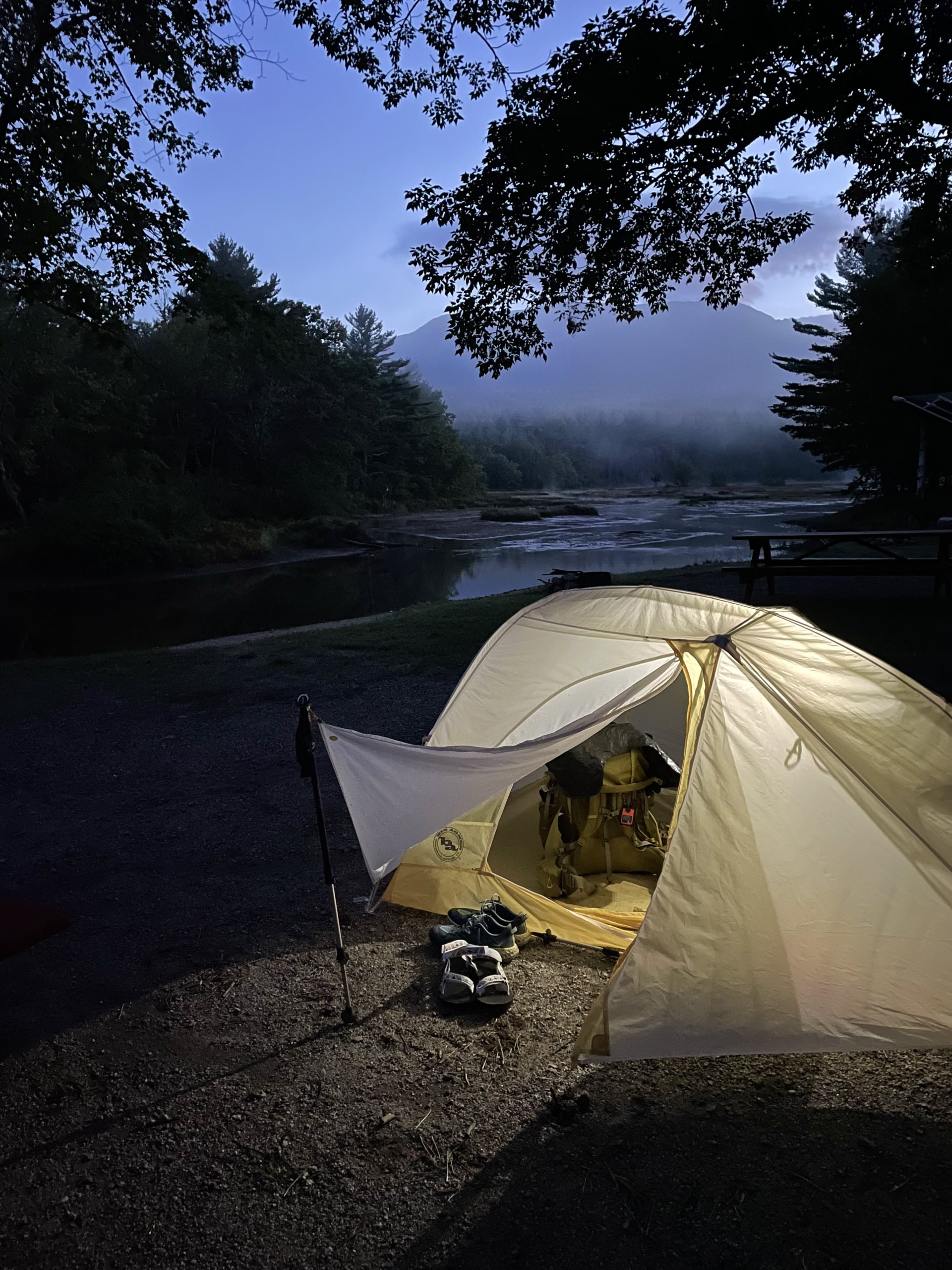
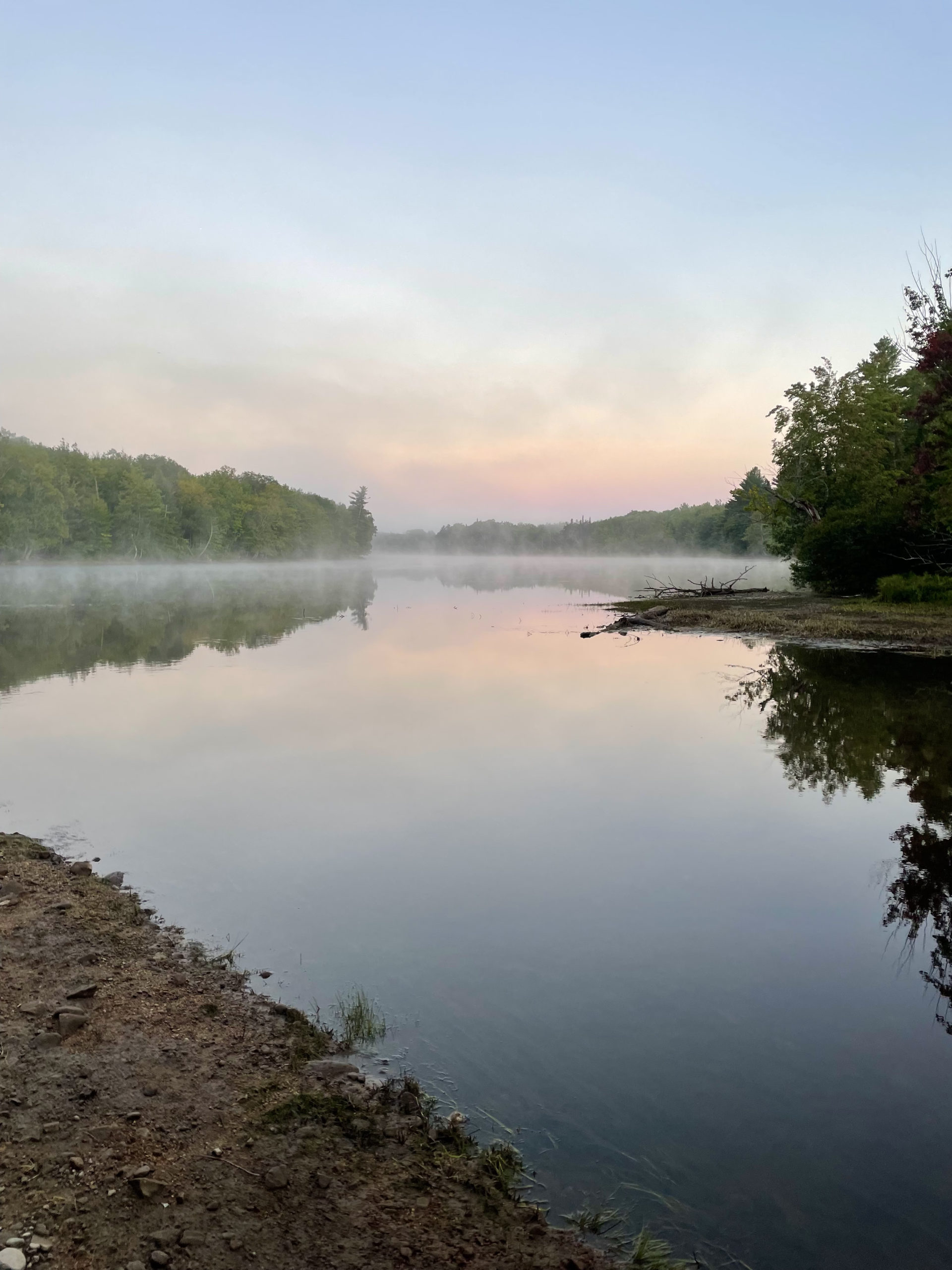
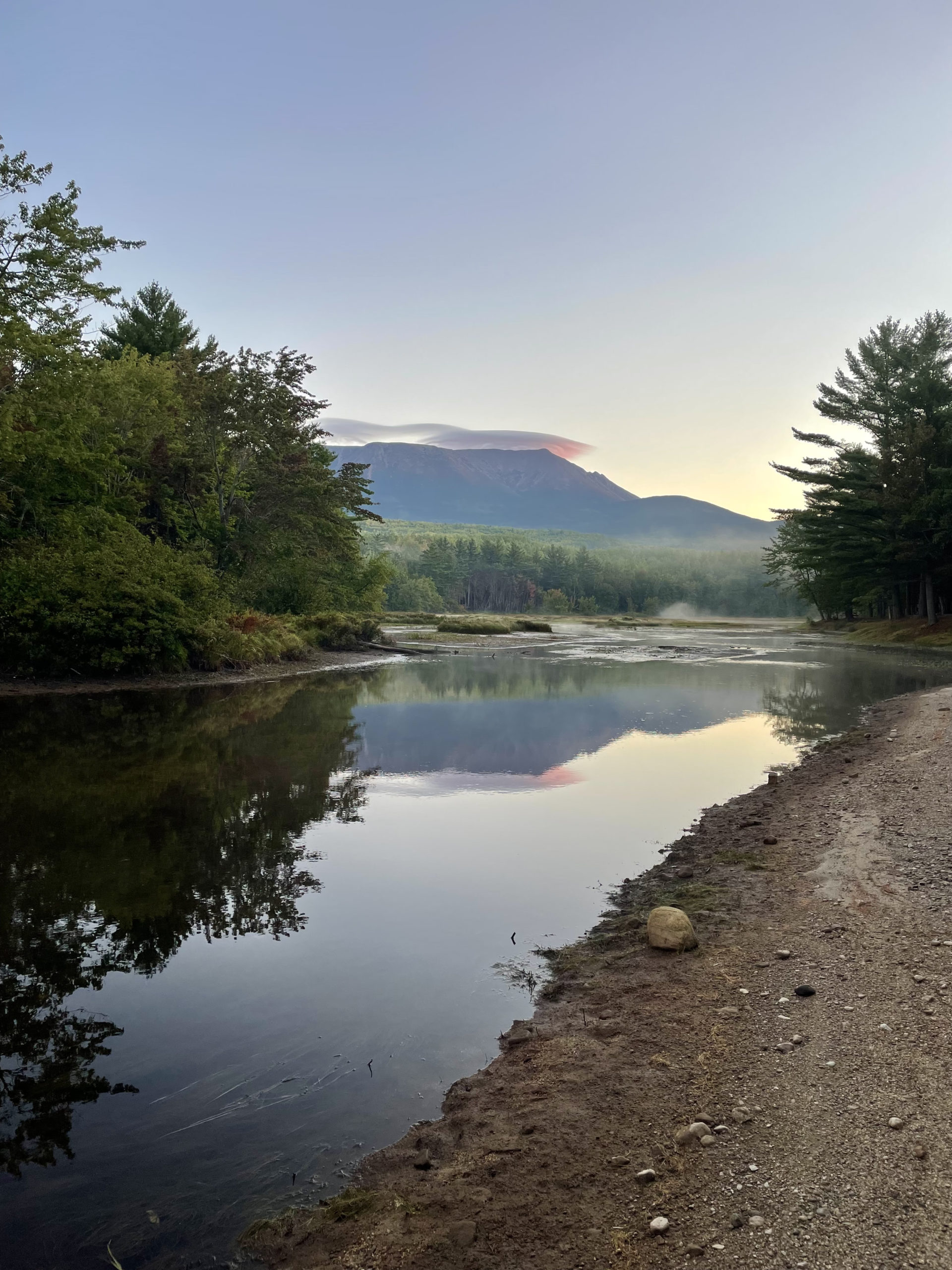
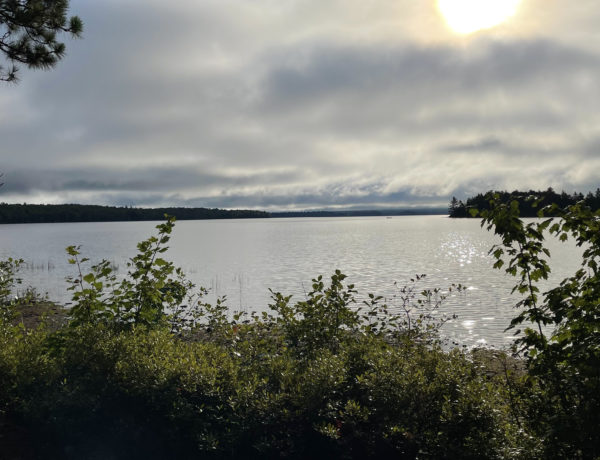
After spending an excited, restless night at Abol Bridge Campground, I was up before dawn to begin my last day of hiking. The rising sun lit up the wide expanse of Mt. Katahdin and cast its reflection onto Abol Stream. I was packed and ready to go by 6, when Grampa Fuzzy emerged from his tent to bid me good luck and goodbye.
The evening before, after completing six days in the 100 Mile Wilderness, I’d washed my clothes at Abol Bridge Campground and eaten bonus snacks from the general store. I ate dinner with Grampa Fuzzy, who would be summiting Katahdin a few days later with his daughter, and Big Tuna, who had left even earlier that morning to complete the 9.5 mile stretch of Appalachian Trail between Abol Bridge and the base of Katahdin. Both thru-hikers had been on the trail for about five months.
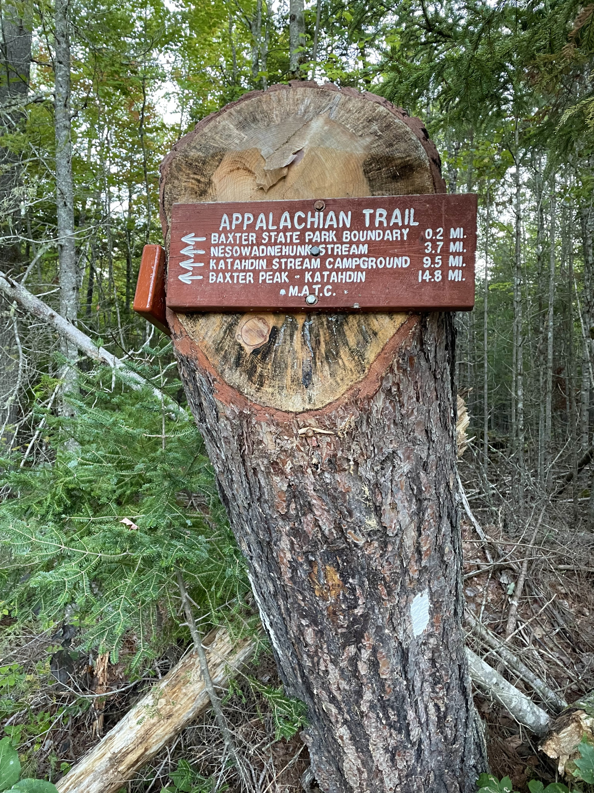
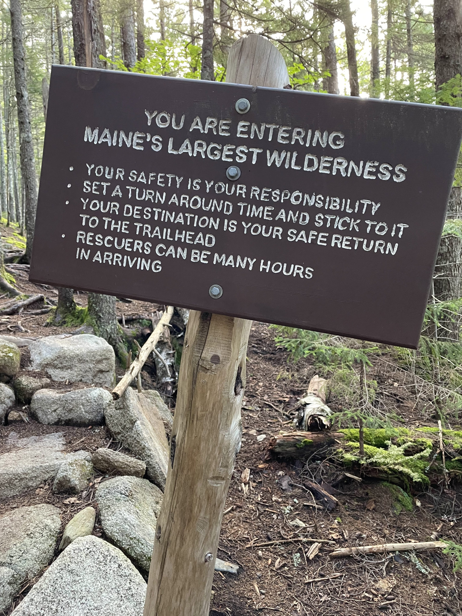
When I started the 100 Mile Wilderness, my intention was to hike the same 9.5 mile stretch Big Tuna was covering and stay in Baxter State Park the night before hiking Katahdin. Incoming rain had pushed up my plans, and I’d decided to take Blueberry Ledges Trail, a shortcut to reach the Hunt trailhead. It was 4.2 miles, and since I was already looking at a big hiking day (I had to tackle both Baxter and Hamlin peaks on Katahdin for my NE 67), I figured shaving a few miles was the right choice.
In retrospect, it definitely was. Katahdin is by far the toughest mountain I’ve ever hiked.
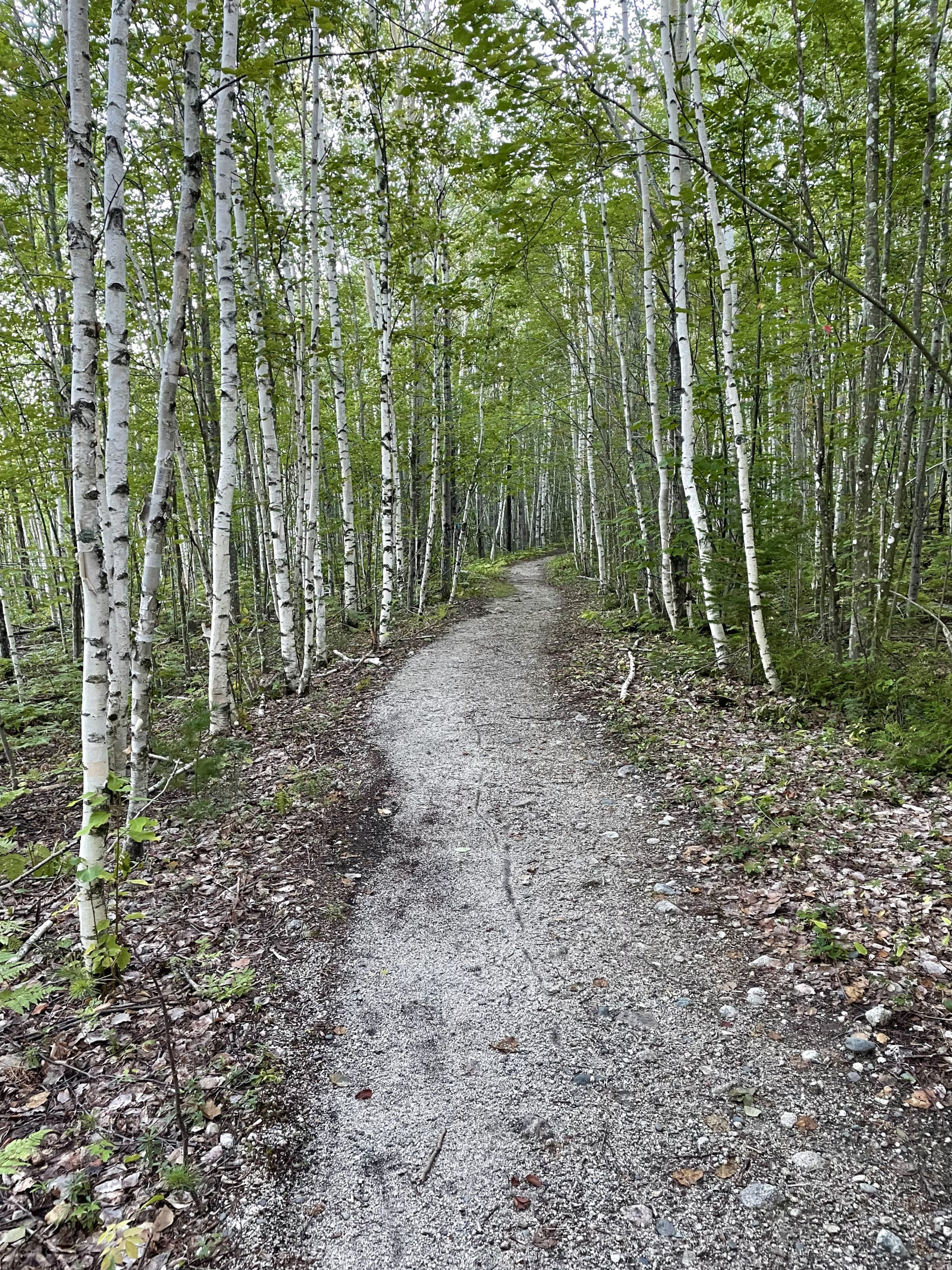
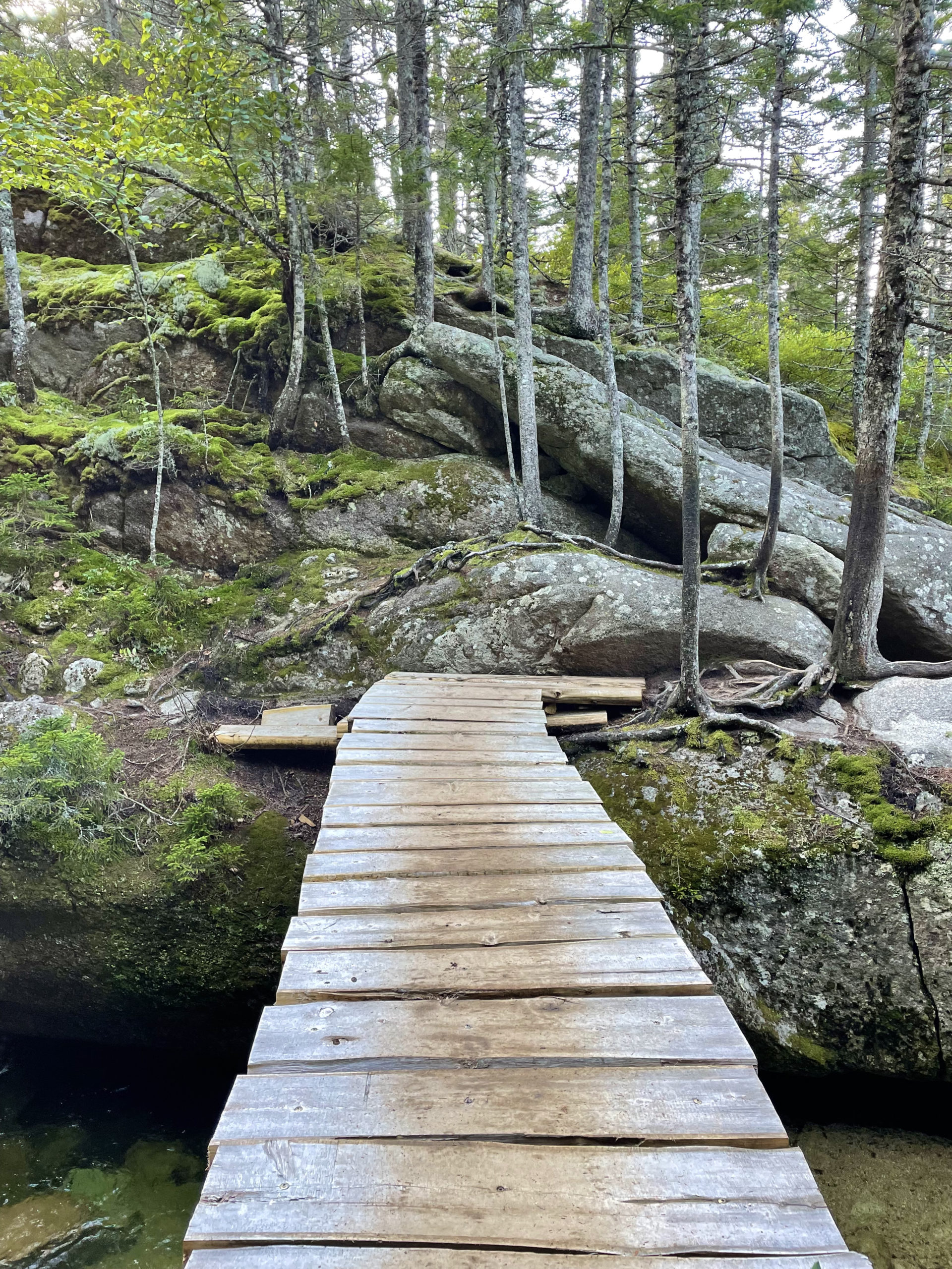
But I didn’t know that yet. I said goodbye to Grampa Fuzzy and headed to the trail. Blueberry Ledges Trail first travels across a boggy area with exceptional views of Katahdin and continues through a young birch forest. Signs warn that many trees in this area have been damaged by forest fire (in May 2020) and ‘may fall at any time.’
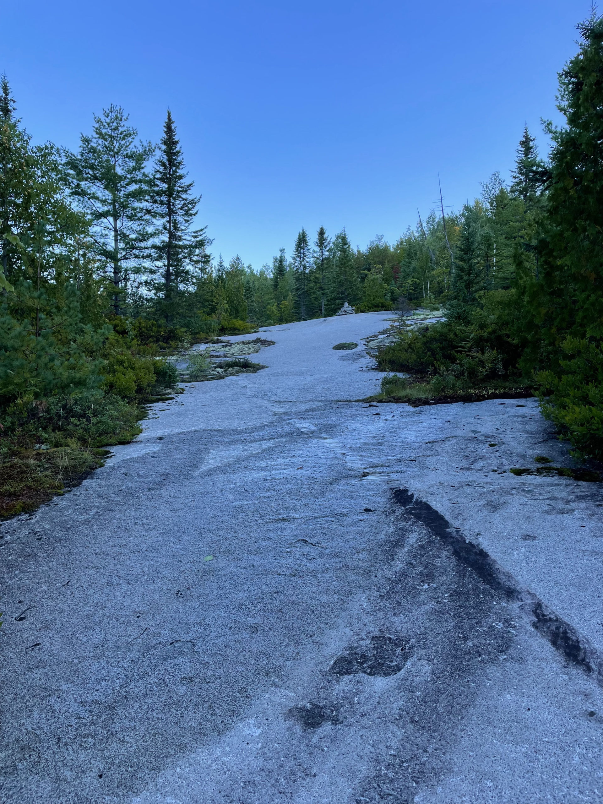
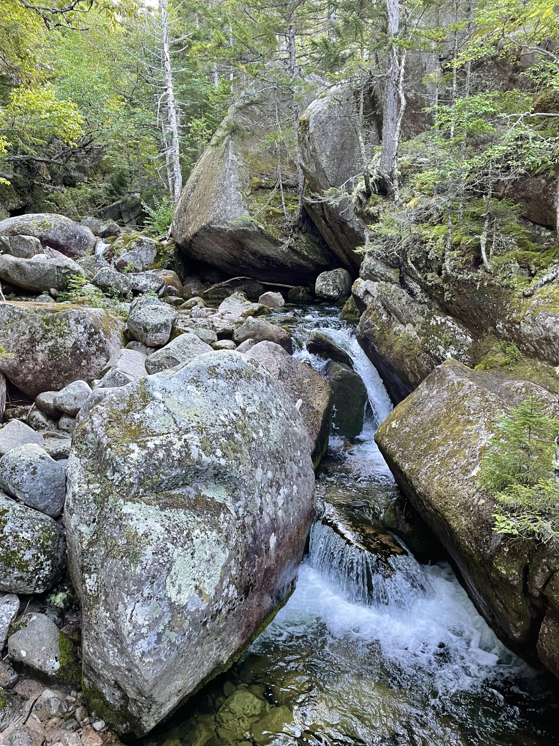
The trail soon reaches the ledges it’s named for, an expansive area of exposed granite bedrock. During summer months, this section is bordered by wild blueberry bushes. Several side paths lead to Katahdin Stream, said to have incredible cascades, sluice drops, and swimming holes. I didn’t have time to check out the scenery, but I could hear the water crashing nearby. It’s on my list for another time.
I passed The Birches, the campground reserved for thru-hikers (it was empty) and the lean-to holding dozens of large backpacks. Baxter provides smaller packs for thru-hikers to take up Katahdin so they don’t have to carry as much weight. Some, the ones who have never slackpacked and carried their bags almost 2200 miles, consider this cheating. Others are thrilled to ditch the extra weight. I don’t really have an opinion on the matter, but because I was ending my trek at a different trailhead, slackpacking wasn’t an option for me. My 25 pound pack was along for the ride, whether I liked it or not.
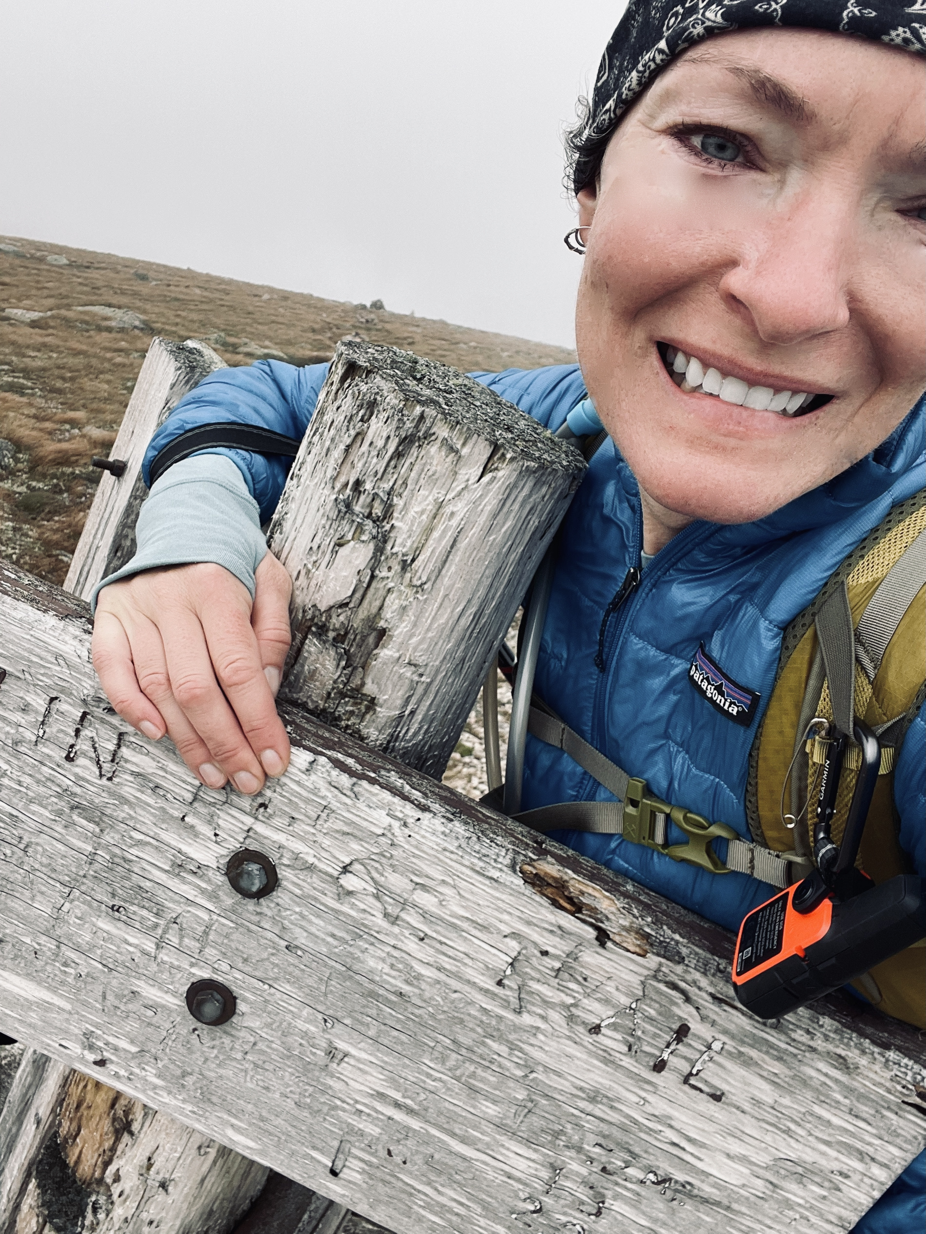
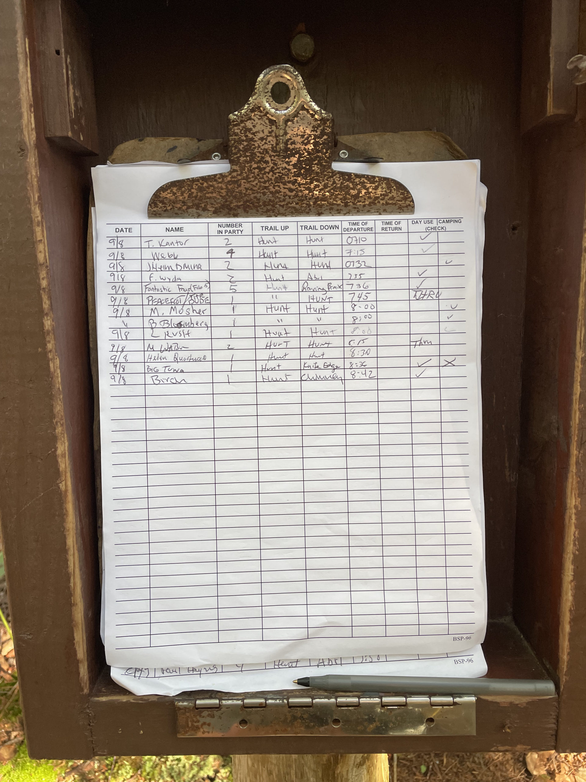
When I reached the Hunt Trail, a park ranger was waiting to register me. Big Tuna was there; despite taking different trails we’d reached the start of Katahdin at the same time. I gave my trail name, Birch, to the ranger and signed the log book. He handed me my hiking permit and reminded Big Tuna and me that ‘everyone enjoys the summit in their own way’ and to please save the boisterous celebrations for the bars in Millinocket later that evening. With that, he wished us luck and we were on our way.
Hunt Trail (also the Appalachian Trail) requires 4,169 feet of elevation gain to reach Baxter Peak, the most of any trail on Katahdin. According to the AMC Maine Mountain Guide, “…from treeline to the Tableland, the trail is long, steep, and rough.”
Truer words were never written.
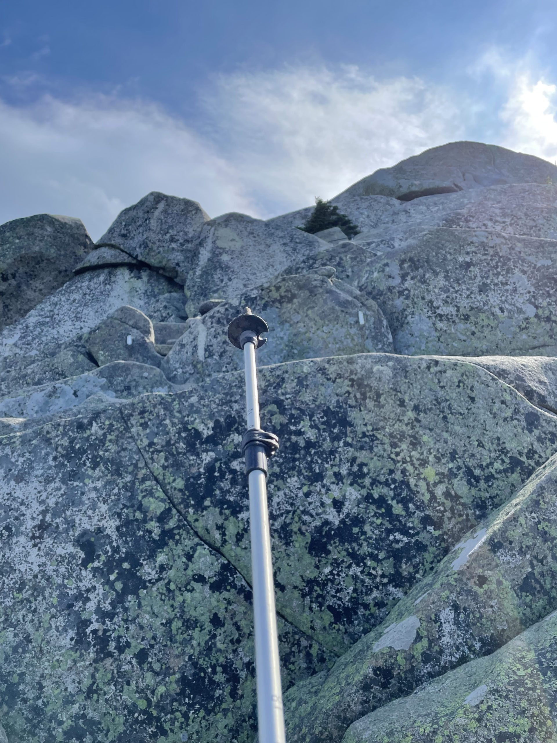
The trail initially passes through fir and spruce forests, crossing a cascade and climbing moderately. That doesn’t last long. At around three miles the Hunt Trail reaches Hunt Spur, the bare, steep crest on the southwest shoulder of the mountain. The path winds through massive boulders, many of which require climbing, sometimes aided by steel rungs. At one point I had to take off my pack and hoist it up ahead of me because it was too big to fit in the crevice I needed to pass through.
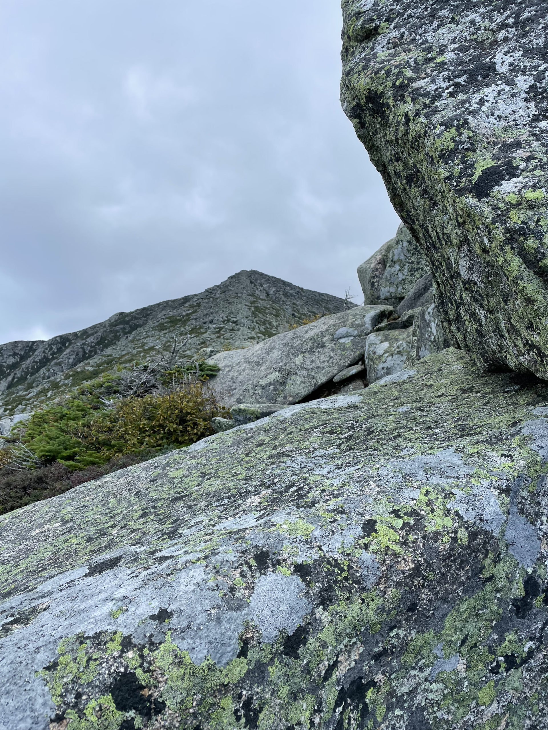
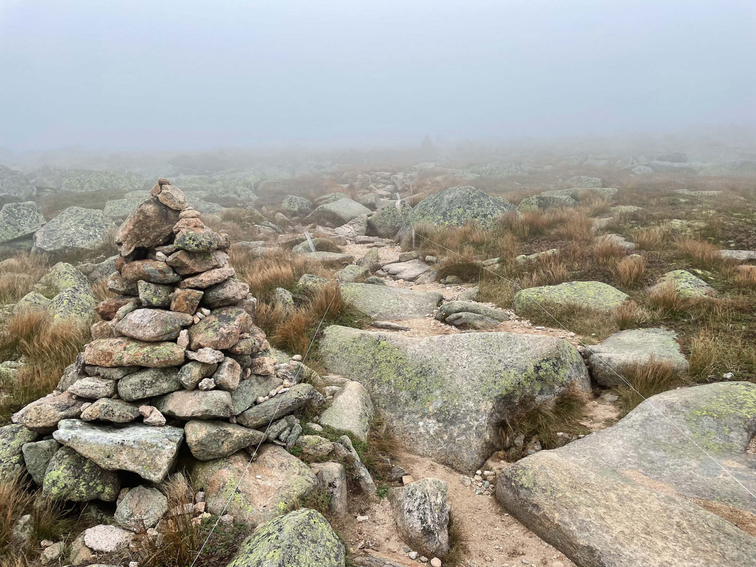
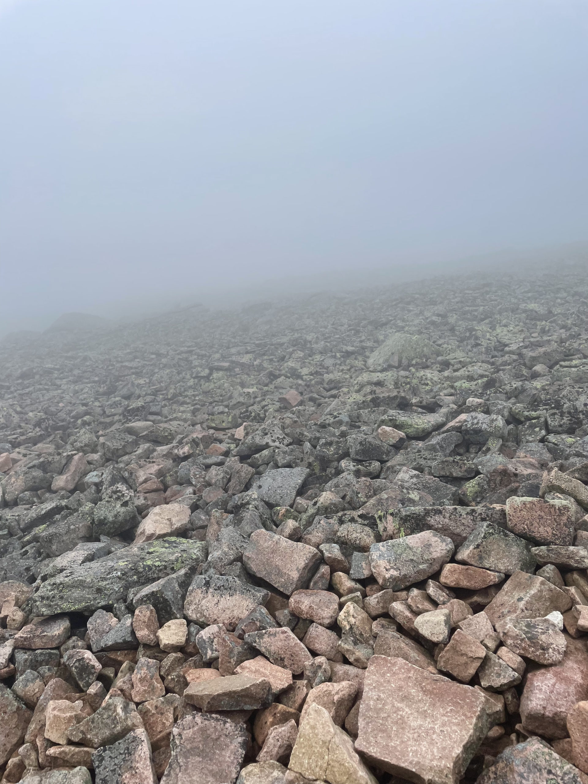
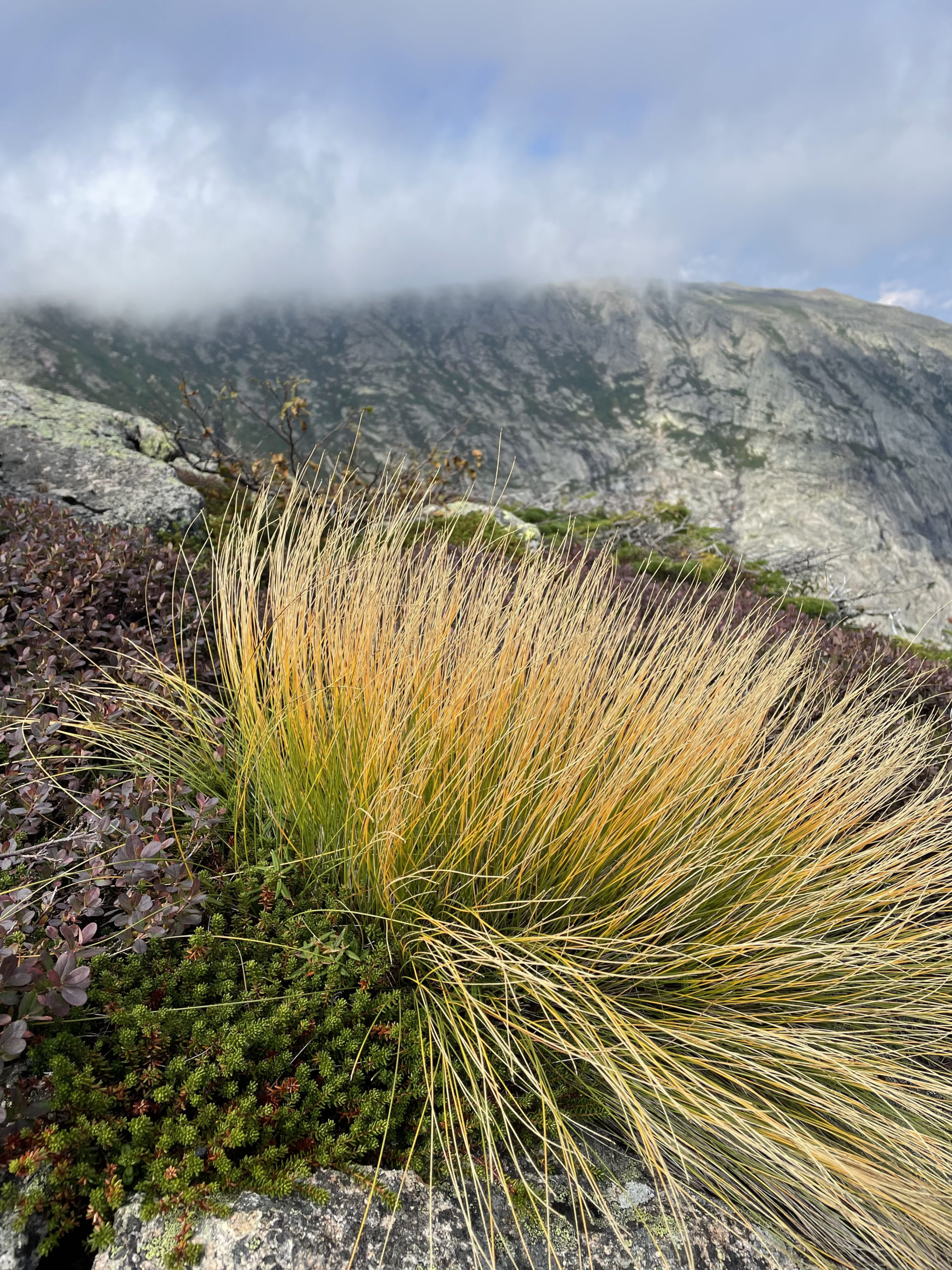
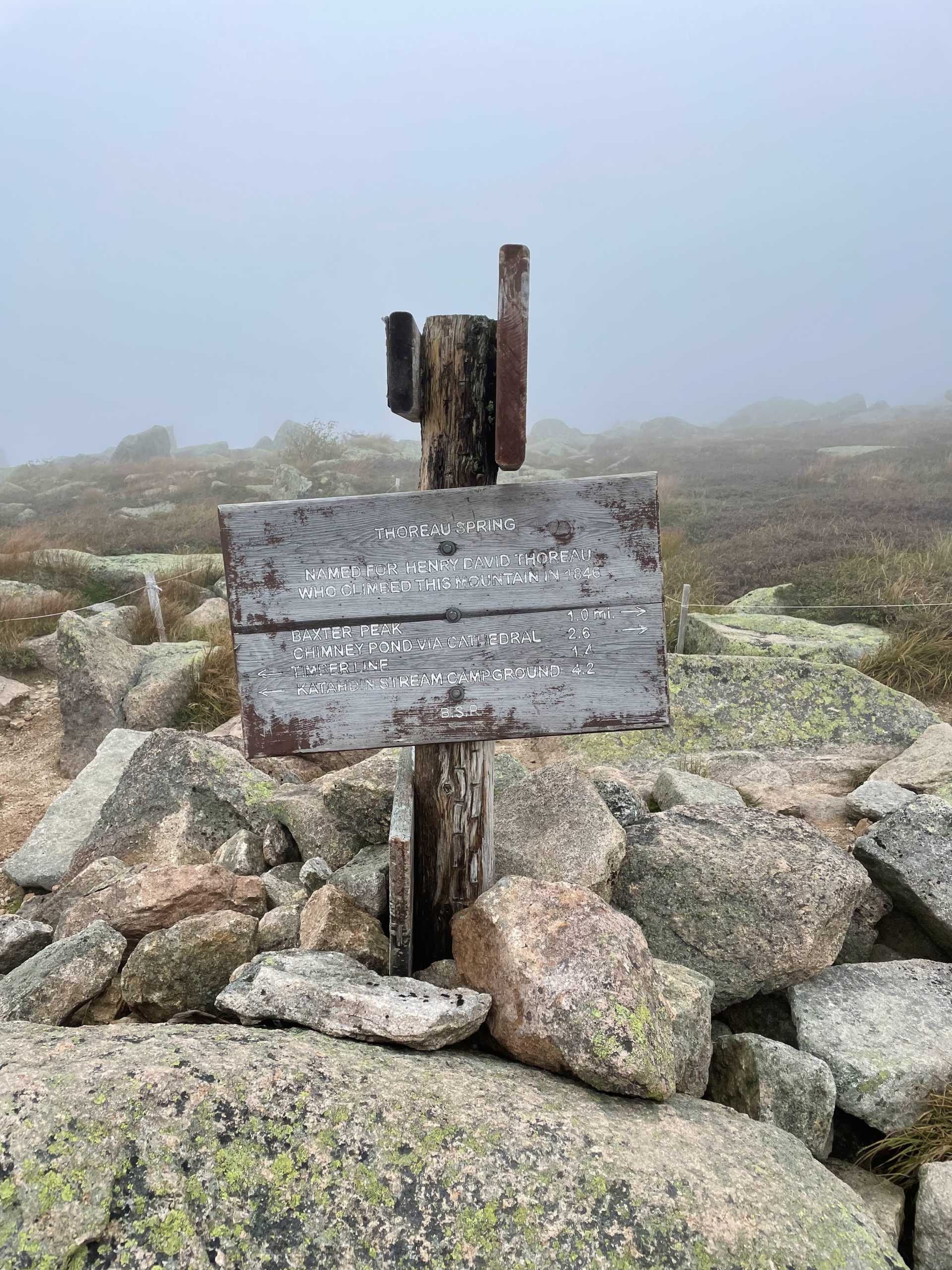
The aggressive boulder climb continues for about a half mile before reaching the Gateway, two large rocks marking the beginning of the Tableland. This next section of trail is like being on another planet, especially when it is fogged in, as it was when I reached it. The terrain is flat, rocky, and windswept. The temperature was dropping steadily, and a fine mist settled on my clothes. I put on my raincoat at Thoreau Spring, an unreliable water source marked by a plaque honoring Henry David Thoreau’s 1846 hike to Katahdin’s summit.
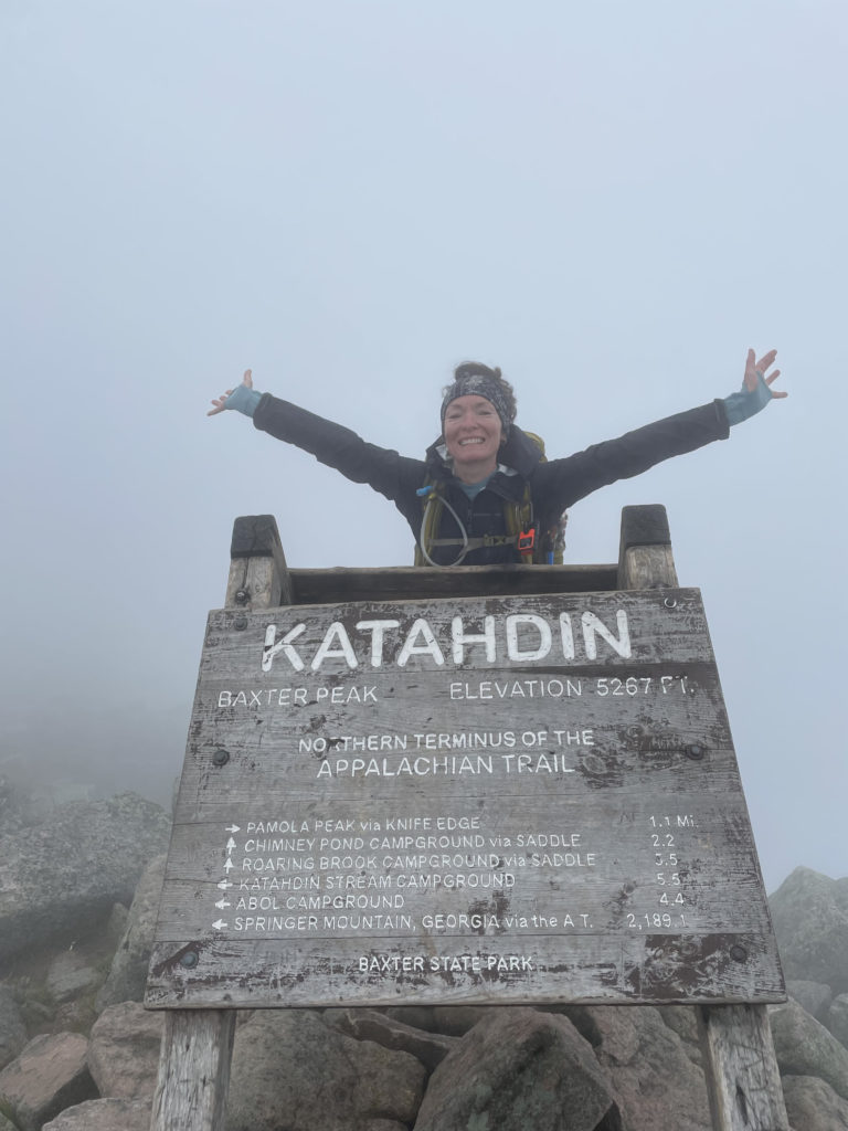
From the spring, the iconic Katahdin summit sign is about a mile away. At this point the hardest elevation is behind you, and it’s a moderate mile climb to reach the peak. When I got there, Big Tuna and several other familiar thru hikers had already arrived, and several more were right behind me. Watching a thru hiker finish the Appalachian Trail is a powerful experience. The emotional weight of such an incredible experience is difficult to describe and different for everyone. Relief, joy, accomplishment, but also disappointment, sadness, and a certain amount of dread about reentering normal society and leaving trail families behind.
I didn’t plan my trip up Katahdin to coincide with the AT end season, but I’m glad it happened that way. Witnessing triumph is inspiring and contagious.
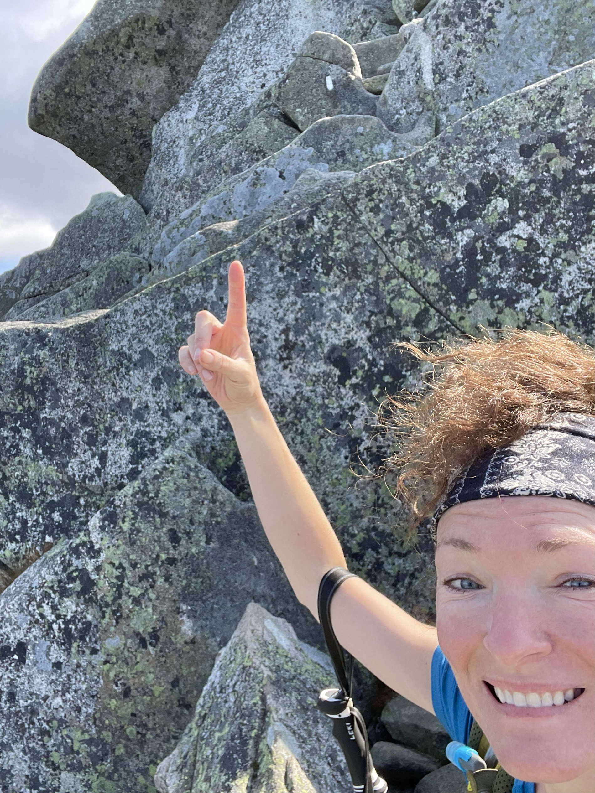
After having my picture taken and celebrating as long as I could before getting very cold, I took off across the Tablelands on Saddle Trail toward Hamlin Peak, the final summit of my New England 67.
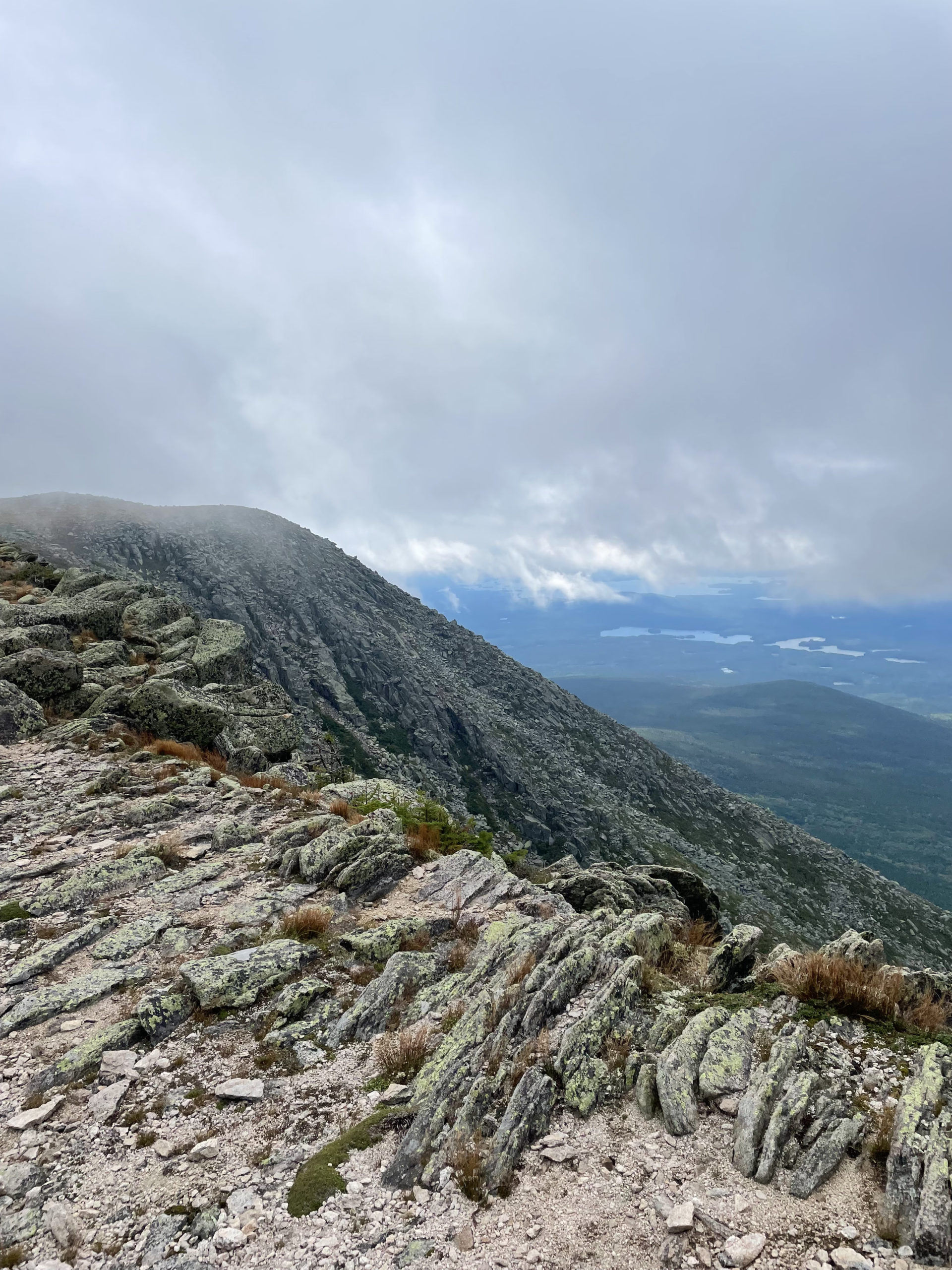
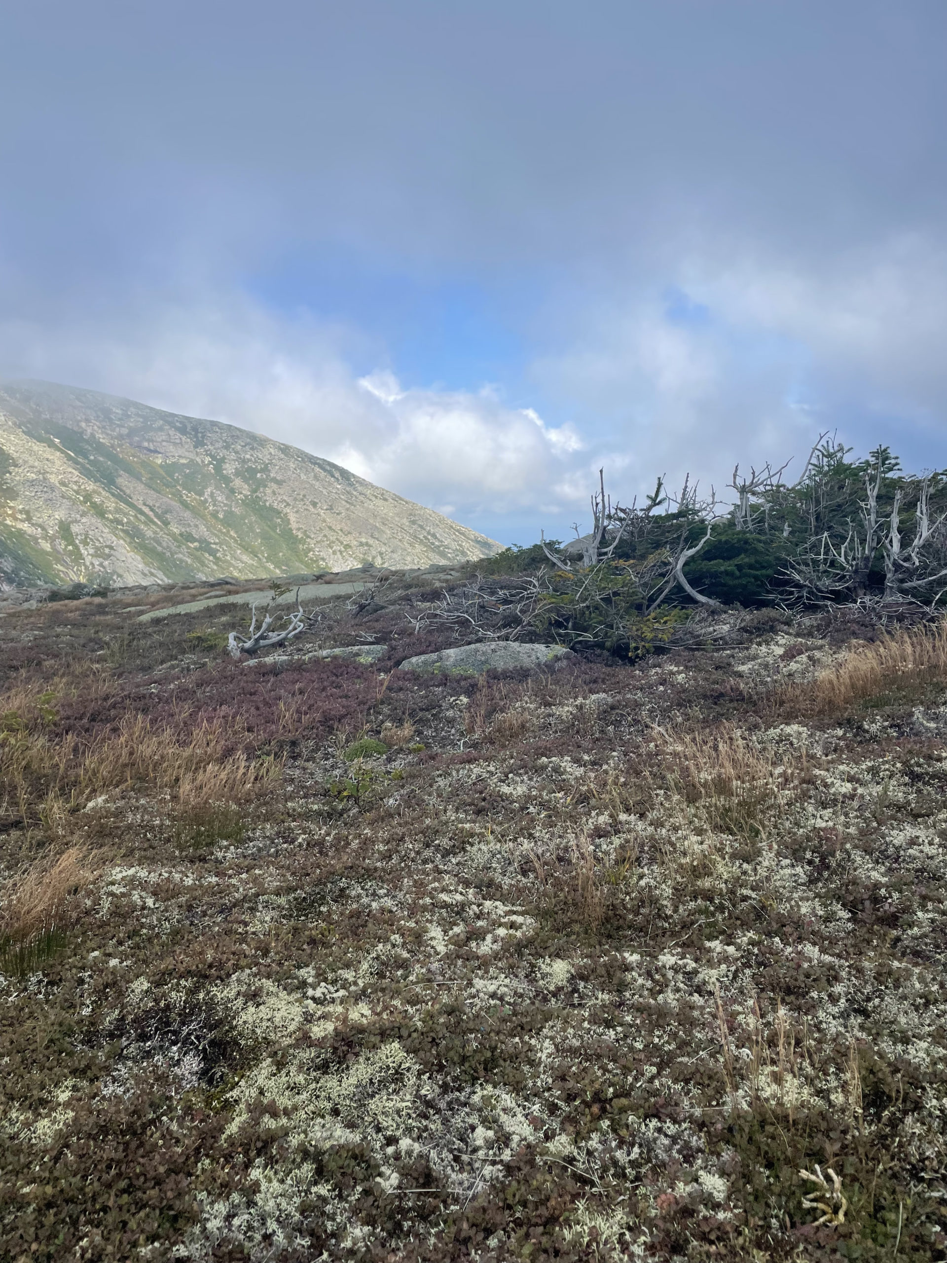
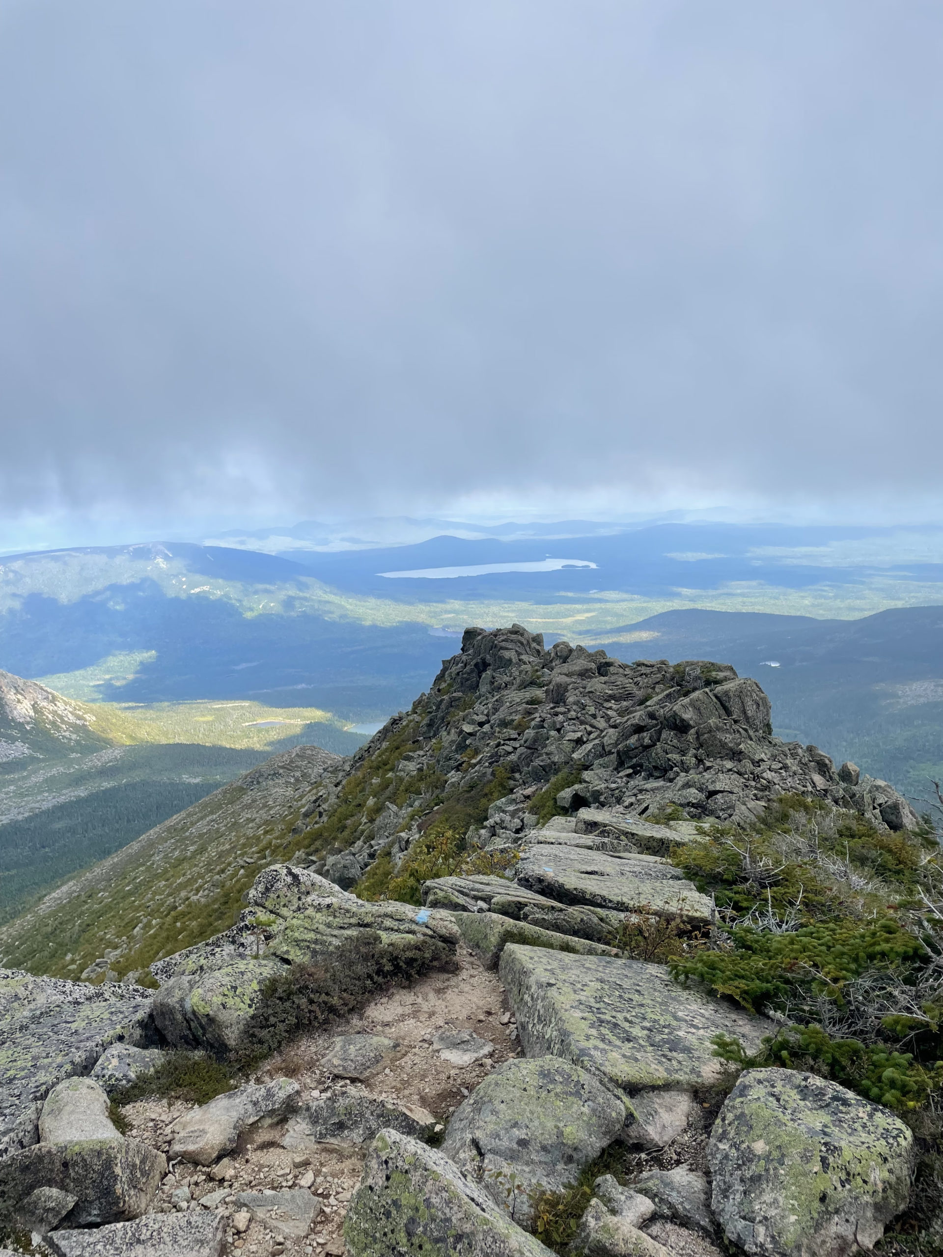
Saddle Trail gradually descends a ridge before veering off to the right to drop steeply toward Chimney Pond. I continued straight onto Northwest Basin Trail, which climbs steadily back up the long ridge toward Hamlin Peak. The terrain here is wild and otherworldly. Rocks, scrub, and lichen cover the ground, but in a way that is far more expansive than any peak in the White Mountains. The wind was howling, moving clouds and mist at high speeds across the alpine landscape. The Hamlin summit sign is a gray, weather-beaten stake at the top of a barren, flat plateau. I had to hang onto it to steady myself against the gusts and take a picture. There was no one else there; Hamlin is one of the less popular Katahdin peaks. It was perfect for me to end my 67 here, alone, the same way I began my journey on Mt. Adams almost exactly one year ago.
I left the summit and started down Hamlin Ridge Trail, a steep, narrow path over the rocky ridge. The AMC Maine Mountain Guide calls this trail’s descent ‘moderate’, but I would argue it is pretty aggressive. It didn’t help that at this point, my knee was killing me (it had been slowly acting up as my trip progressed, vestiges of an old injury), and my emotions were struggling to keep up with the fast-approaching trail terminus.
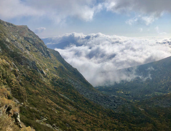
I was not too distraught to notice the views from this rocky slope, which are incredible in every direction. One of the most wonderful things about Katahdin, and Baxter State Park in general, is the distance one can see without interruption of human presence. Mt. Washington is taller, but it is also commercialized. Even from many of the more remote peaks in the Whites, you can see a distant road. From all of Vermont’s highest peaks, you can see houses. Not Katahdin. From the top of this beastly mountain, all you see is wilderness.
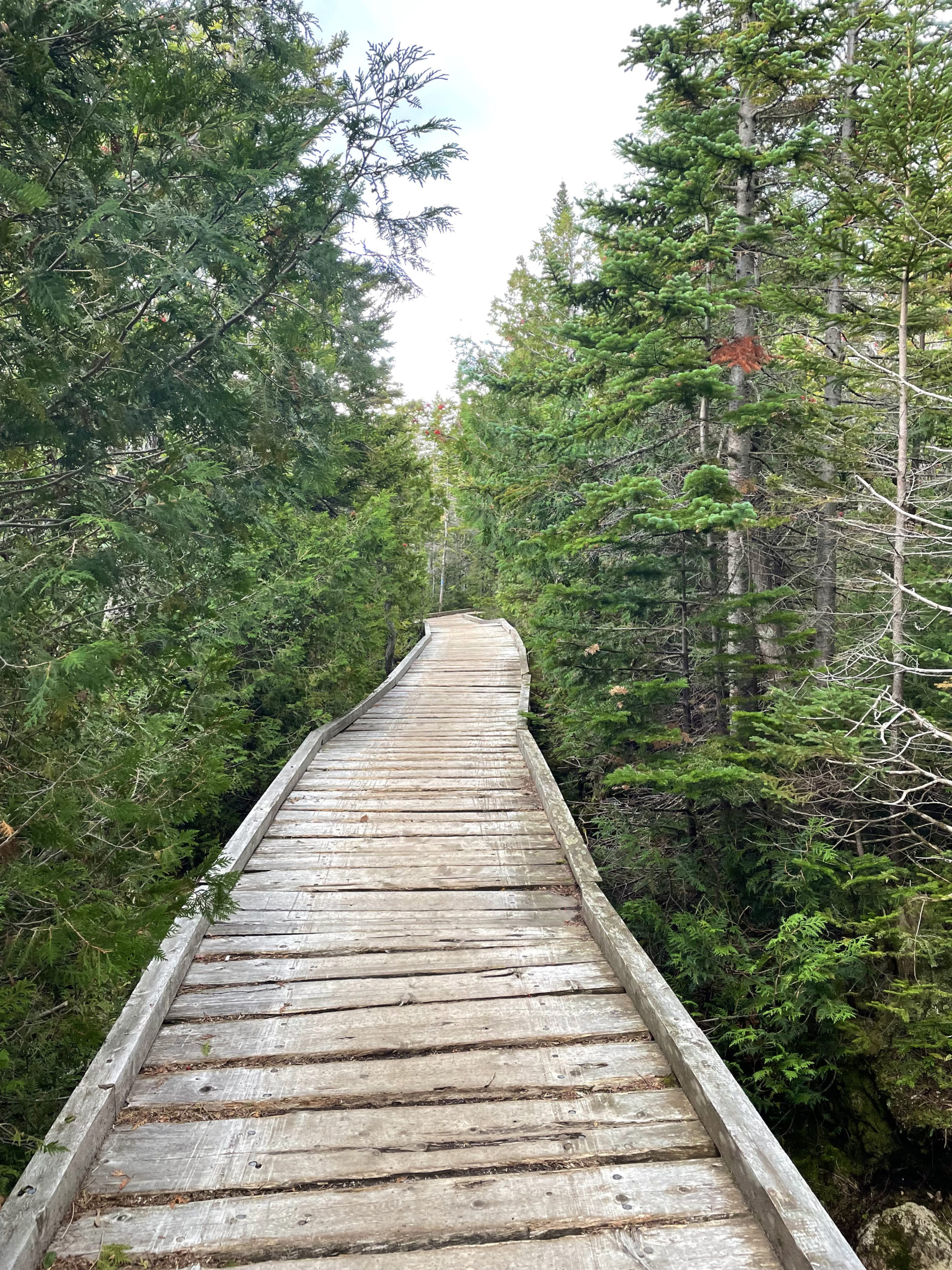
From Hamlin Ridge Trail, I connected to North Basin Trail, then North Basin Cut-Off, and finally Chimney Pond Trail to end my hike at Roaring Brook Trailhead. Big Tuna was already there, sitting on a boulder, drinking a beer someone had given him, waiting to hitch a ride to Portland. I joined him, reflecting silently on what we had each just completed. Him, a 2200 mile journey. Me, a much shorter journey that somehow carried a similar amount of emotional weight.
My family was on their way into the park to pick me up, and I realized the time it took to get from the main gate to where I was would add at least 40 minutes onto a 4 hour drive back to Portland. I asked a group of day hikers for a ride to the main gate and they generously obliged. We passed my family on the way and flagged them down (no cell service in Baxter). I hopped into the car, reunited and excited to share all about my journey.
Reflecting back over a year of hiking, I can easily say Katahdin was the hardest hike I’ve done. By the numbers, it should not have been. It’s not any longer, steeper, or higher than many other peaks included in the 67. But what it meant to me was bigger, bolder, and braver than any mountain I’d hiked before. It tested me in every way and rewarded me like no other summit had. Katahdin was the end of an amazing journey toward a goal that, at times, felt outrageous. That is the point of a goal, though. A dream that feels just out of reach.
Shortly after completing the NE67, I was interviewed on WBUR Radio Boston. I talked about my journey, why I started hiking, and what advice I had for others starting out. At the end of the interview, the host asked me, “What’s next?”
The obvious answer would have been the Appalachian Trail. It won’t be next, but it’s on the list for a few years from now.
My answer was, “What’s next is to keep hiking and to keep making it a priority.”
That’s why I started hiking. To find something I loved, something that brought me joy, peace, and clarity through hard work and determination, and to do it unapologetically.
The most profound summit lesson of them all is the one I learned on the barren summit of Katahdin: Carry less. Go farther. And I’m not talking about gear.
Hunt Trail to Hamlin Ridge Trail to Chimney Pond Trail
| Total elevation: 5269 ft & 4756 ft | Elevation gain: 4875 ft |
| Mileage: 11.75 miles (+4 w/ Blueberry Ledges) | Alpine exposure: extensive |
| Terrain: woods walk, rock climbing, ledge, scrambling | Challenges: very steep, exposure |
| View payoff: outstanding | Dogs: NO! Dogs are not allowed in Baxter State Park. |
Recap: Mt. Katahdin is a beast to hike and a beauty to summit. The views are unmatched anywhere in New England. The Hunt Trail is the hardest option and shouldn’t be attempted by anyone who doesn’t want to rock climb. The summit of Katahdin is unpredictable, often cold and blustery. Safety is always important, but even more so here because the location is so remote and so wild. That said, Katahdin should be on every hiker’s list! And the extra trek to Hamlin Peak is worth every step. This lower summit is just as lovely and much less crowded. Hamlin Ridge Trail offers amazing views, and once you pick up Chimney Pond Trail its smooth sailing through the woods. Remember to reserve a parking spot at the trailhead unless you’re entering Baxter State Park via the Appalachian Trail (i.e. on foot). Happy hiking!
No Comments