Lost Pond Trail – Wildcat Ridge Trail
U-turn at Ledge of Doom
I truly have no idea what possessed me to try this trail with Luna. I read the reviews on AllTrails. Not a single one suggested this would be an easy, breezy hike. Or even mildly moderate, for that matter. There was even a (hilariously clever) post that stated: “I felt like a hobbit needing to take the one ring up the mountain of despair to save Middle Earth.”
In retrospect I can say: Same, friend. Same.
The Wildcat Ridge Trail technically starts on the east side of Rt 16, opposite the parking area for Glen Ellis Falls. Both times I hiked it (yes, there’s another attempt coming) I was advised not to take that route because it requires you to cross the Ellis River, which seems to be discouraged at all times of the year for safety reasons. The preferred route is parking at the Pinkham Notch Visitor Center on the west side of Rt 16, crossing the road and then a nice bridge over the river (take note of beaver activity!), and traveling along Lost Pond Trail about a mile to intersect Wildcat Ridge Trail.
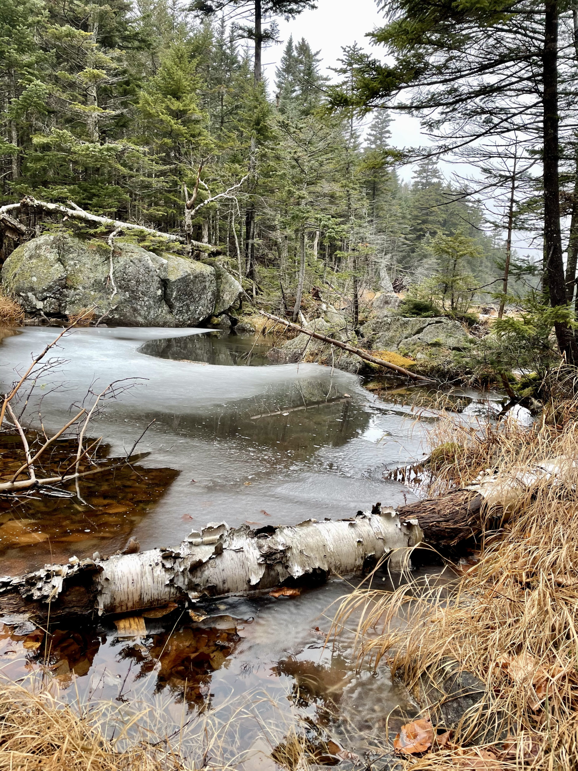
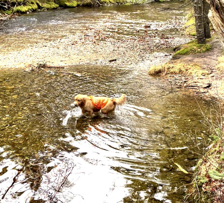
Lost Pond Trail follows the Ellis River in a beautiful woods setting with plenty of upward views, especially when you reach Lost Pond at the half-mile mark and look across to the Presidential Range. For a relatively flat stretch of trail, I wouldn’t call it easy. The path is rocky in parts with some wet footing. Luna loved it (not shocking) and got herself soaked and muddy in no time.
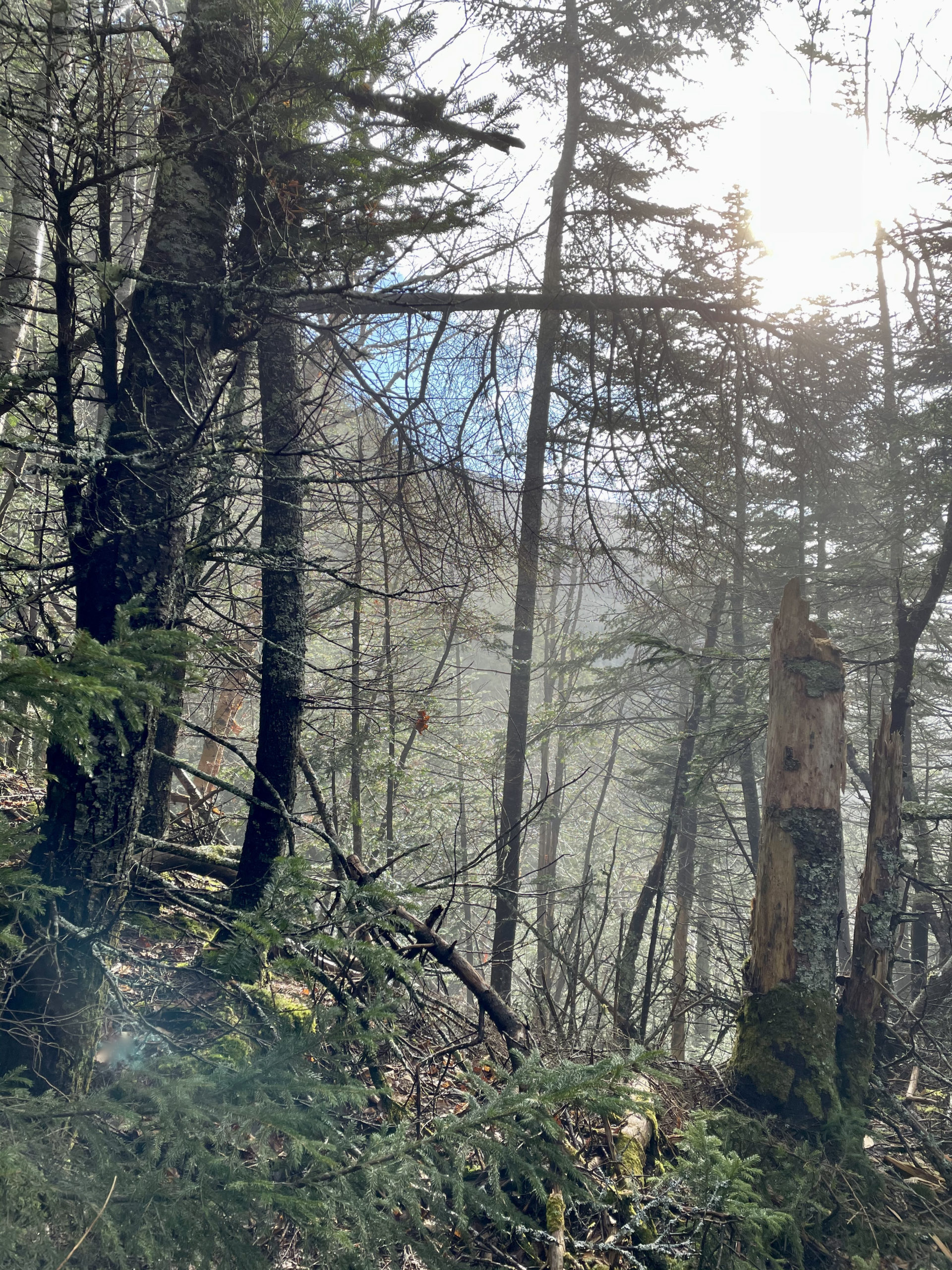
After a mile, we turned onto Wildcat Ridge Trail and started climbing. And climbing. And climbing. I’m not exaggerating when I write: This trail was harder than the steepest section of Tuckerman Ravine. And it was longer.
So. Damn. Steep.
I mean, to be fair, you’re climbing the side of a ridge. And had I owned the AMC White Mountain Guide before this trip, I would have read this sentence before setting out: “…rough sections along the rest of the trail make it more difficult and time-consuming than one might infer from a casual glance at the map or the distance summary.”
Ha! Well said, AMC. There is nothing casual about this trail. As my hiker-friend reported on AllTrails, it’s like a harrowing journey to Mount Doom, minus the cheerful hobbits along the way.


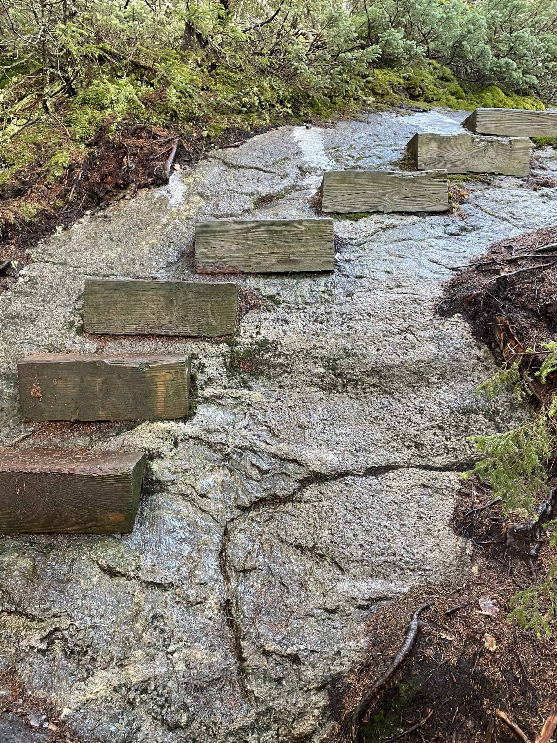
Now, look, I’m all for a challenge. Even a dangerous challenge, as long as I feel I can remain on the ‘stay alive and unbroken’ side of safety. What I’m not all for is worrying if my dog is going to fall to her death, or if we’re going to be able to get down after we’ve gotten up. Not only was the trail steep (not a huge issue for Luna), it was very icy in parts. Several times (three, actually) I had to lift 60lb Luna (lift, not butt-boost) over sections she couldn’t manage because she couldn’t find footing. She did well on the steps and ladders we encountered, but part of what makes this trail so tricky is the lack of side options. You can’t go around the hard parts by stepping off the trail and bushwacking alongside. The only option is up.
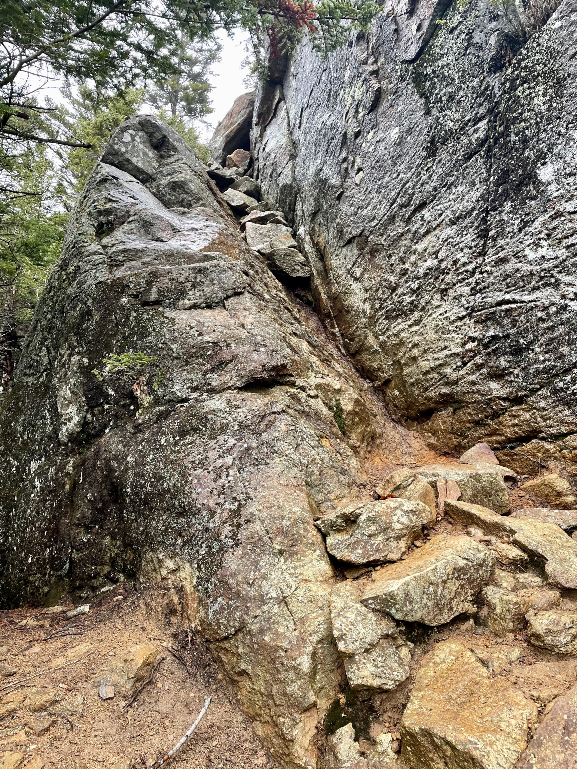
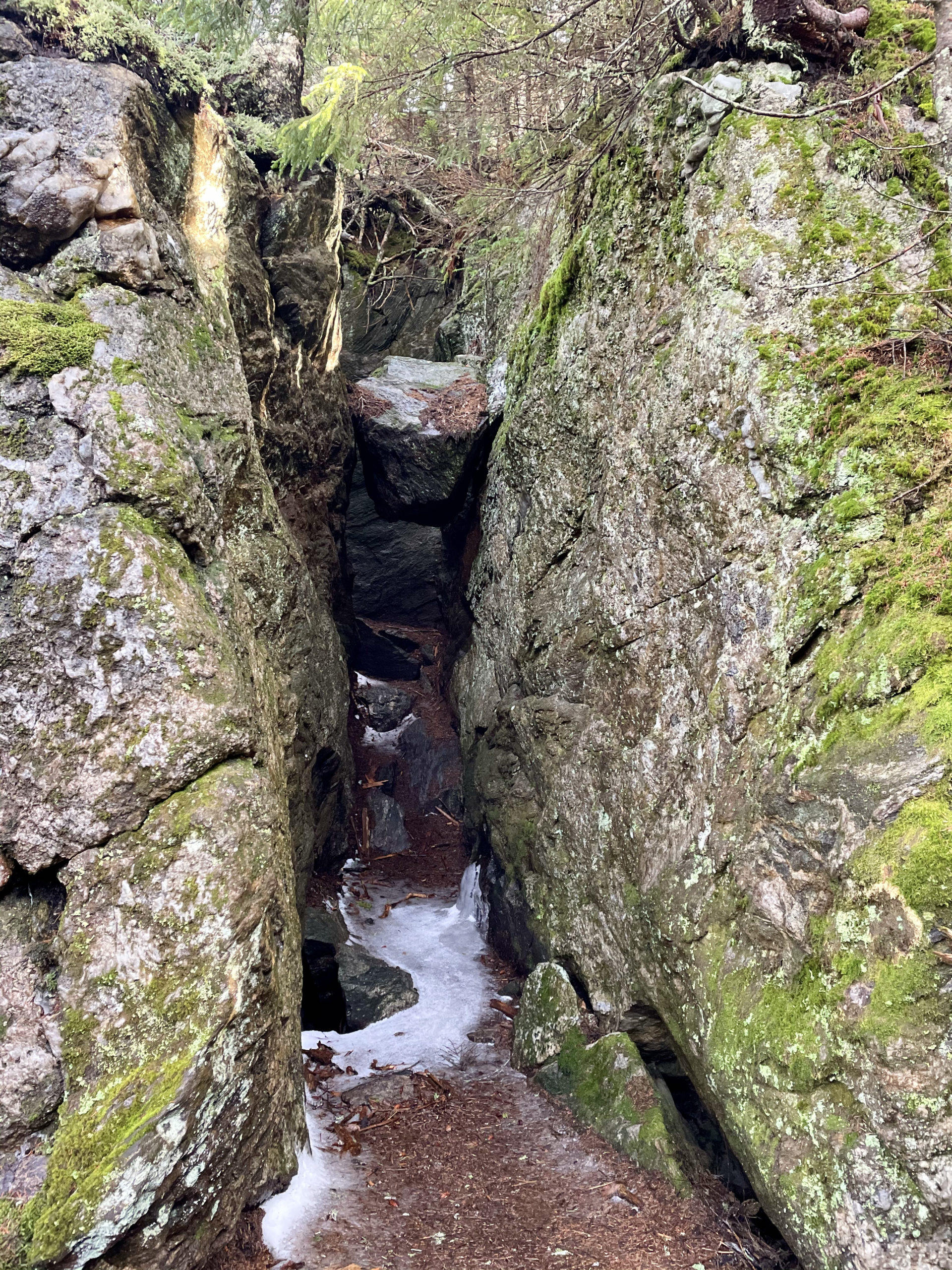
Hiker term: Rock chimney
A cleft in a rock, in this case filled with smaller rocks and debris.
I probably should have called it when we reached the rock chimney. It was two huge boulders (or maybe one with a crack), and the inbetween space was filled with smaller rocks. It was wildly steep. On the right, the rock face went up high. On the left, it pitched off to a steep slope. There was no way around. I knew the minute we got up that coming down was going to be a problem. At this point, I knew we weren’t going to finish the hike, but I figured we’d try for Wildcat Peak D, which was less than a quarter-mile away.
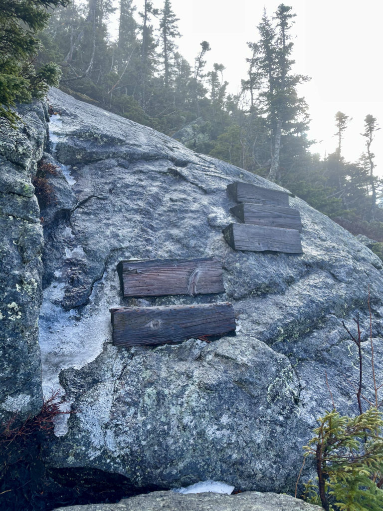
And then we got to the ledge.
There were five wooden steps bolted to the stone, wrapping around the rock face and leading left to a section of serious scramble on a 40-45 degree pitch of ledge. Oh, and throw in a thin coat of ice on all of it. To the right, a stunning view of the ravines for the eyes, and for the feet… nothing. Lose your footing here and you get to see the bottom of the ravine up close and personal.
Could I have made it? Probably. Was I willing to risk my dog’s life to tag a peak? 100% no.
We U-turned.
Frankly, at this point the two miles we’d hiked felt more like ten miles. I was already dreading the chimney on descent, and for good reason. Luna refused to go down it. She whined. She sat. She sniffed the edge of the trail and determined, as I already had, there was no other way. I couldn’t carry her down. Her weight and the pitch would have made it dangerous for both of us. I needed a way to lower her without holding her full weight.
Because it was hunting season, she was wearing a blaze vest. I slid it around so the bulk of the fabric was under her belly, like a sling. I sat on my butt, holding her in the jerry-rigged sling, and inched down the slope. It was enough to make her feel secure until she found her footing, and butt-sliding kept my weight low so I didn’t topple. With four firmly on the floor and her vest readjusted, there was lots of tail-wagging and butt-wiggling and face-licking thanks.
The remaining descent was steep and rough, just as it had been on the way up, but Luna managed it on her own. We made our way back to Rt 16, where Luna decided to really turn things up a notch by darting out into the road to chase a truck. Rt. 16, btw, is a very fast road that cuts through the mountains, not a scenic byway like the Kanc. And so, the journey ended with me shrieking my head off, certain she was going to become roadkill, while she sprinted blissfully into the arms of a stranger who, alerted by my screaming, was waiting to catch her in the Pinkham Notch Visitor Parking lot.
Luna is hereby grounded from hiking until she learns to make better choices.
Okay, not really, but I did learn a valuable lesson about bringing her along. Most importantly, that elevation often has little to do with trail difficulty. The fact that Luna can hike some 8-10 mile trails on a 4000-footer doesn’t mean she can hike all the trails.
This adventure was a good reminder that the objective of any hike should not be to reach the summit at all costs. The real goal, the one that matters most, is always to make it back to the trailhead or to the terminus point in one piece.
By those standards, our hike today was a smashing success.
Summit lesson: When hiking with special furry friends, be prepared to turn back for their safety as well as yours.
Wildcat Ridge: Lost Pond Trail to Wildcat Ridge Trail
| Total elevation: 4,422 ft (Wildcat), 4,050 ft (Wildcat D) | Elevation gain: 3,540 ft |
| Mileage: incomplete | Alpine exposure: N/A |
| Terrain: rock steps, scrambles, boulders | Challenges: insanely steep, rough footing, ledges, rock chimney |
| View payoff: N/A | Dogs: On leash… I don’t recommend it |
Recap: The first section of trail to Lost Pond is a lovely woods walk with some rough footing. Wildcat Ridge Trail is immediately steep and does not let up. There are many technical challenges in this hike, including ledges, steep rock steps, and a chimney. I had to turn back before the first summit for the safety of my pup.
1 Comment
East Osceola | 4156 ft | NH - She Hikes Mountains
April 17, 2021 at 9:30 am[…] with Mt. Osceola Trail. This would have been about a 7.5 mile round trip. I also knew there was a rock chimney between the two peaks, but the reviews on AllTrails reported it could be avoided by a detour. I […]