Edmands Path – Crawford Path
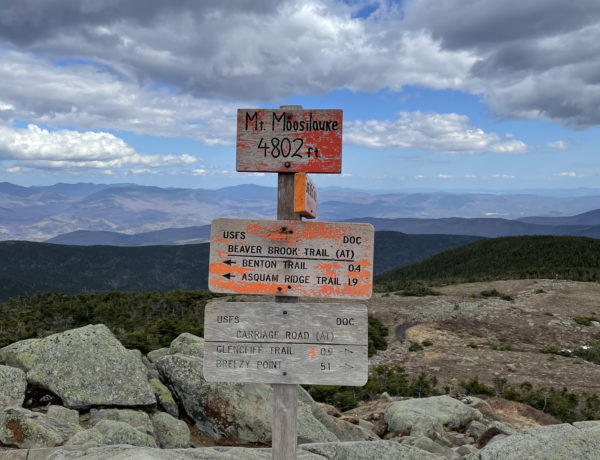
Mt. Monroe 5384 ft | Mt. Washington 6288 ft
Third time is a charm! That’s what I told myself when I headed out, again, for Edmands Path. I was on the trail at 7:45am and by God, I was prepared for anything. Not only did I have multiple layers (including a nano puff jacket and waterproof pants), I also had borrowed trekking poles, ski goggles, a fleece buff, and my new EXOspikes. Boom! I wasn’t about to let the weather stop me this time. My goal was to summit Mt. Monroe and reach Lakes of the Clouds just beyond it (because, um, that sounded like something I needed to see).
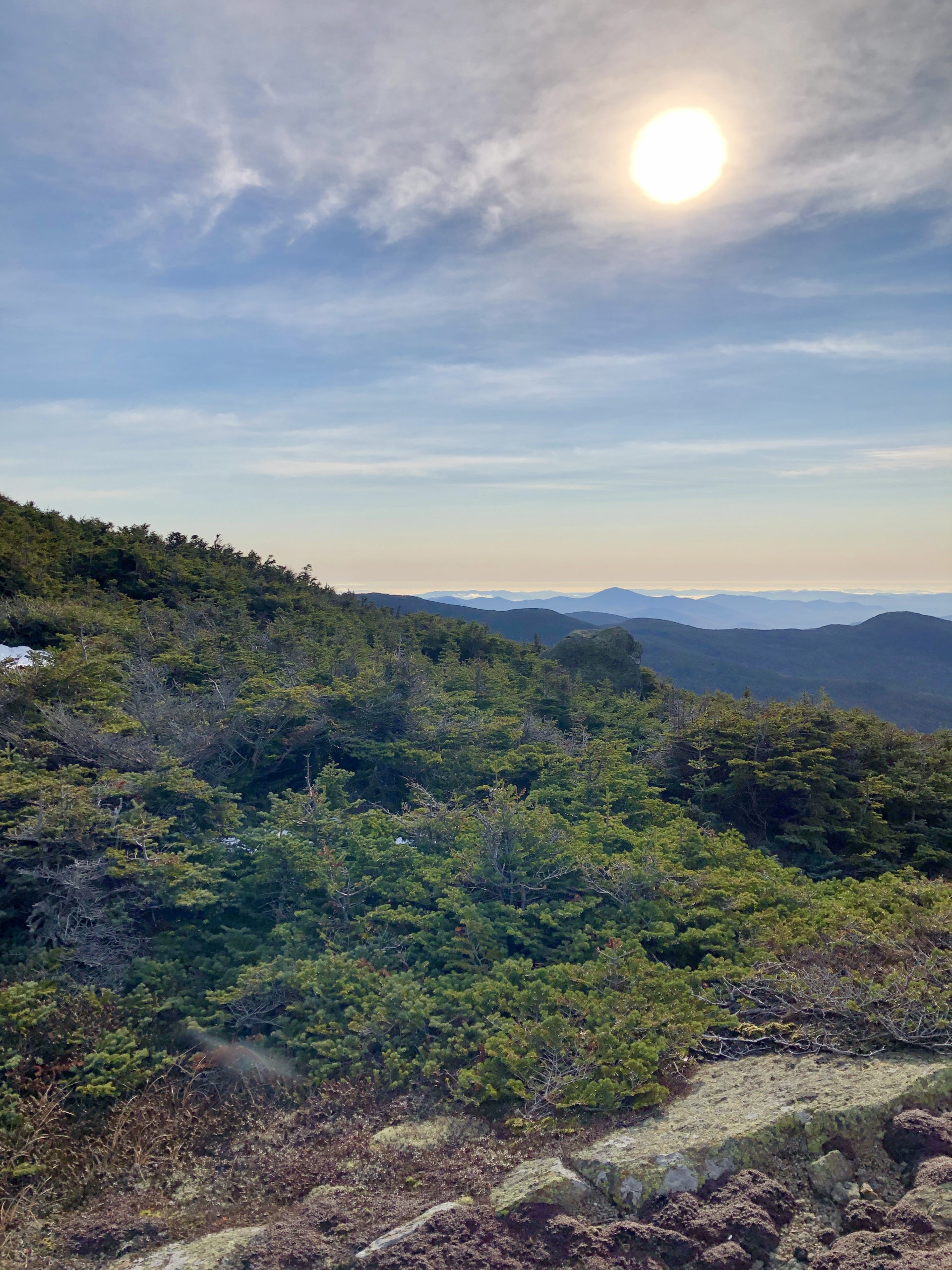
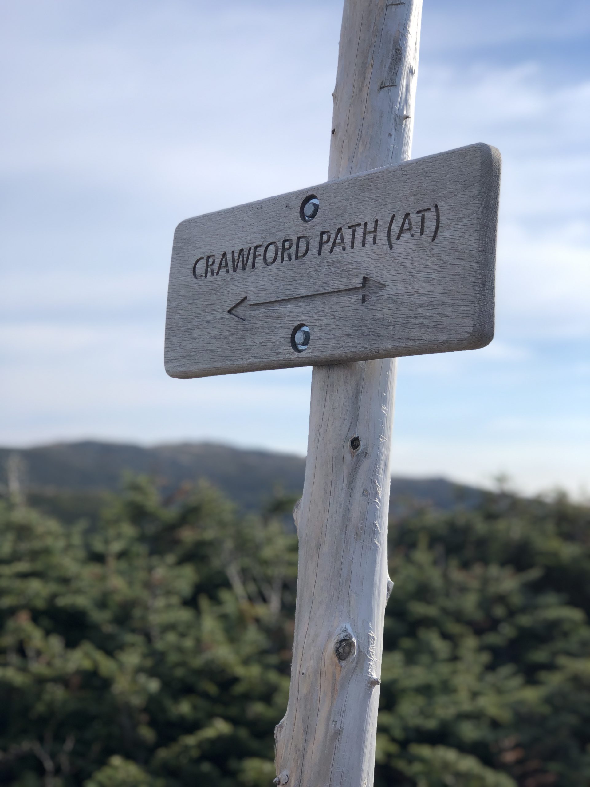
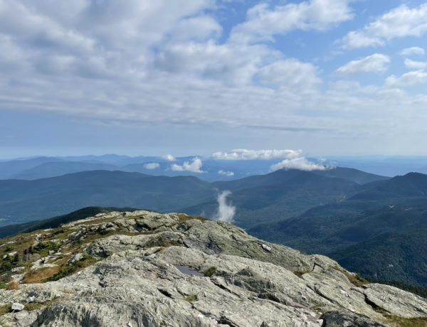
Well, apparently when you prepare for arctic conditions, Mother Nature pats you on the back with a glorious, warm, sun-shiney day. I was at the alpine zone in an hour and a half, taking in the stunning (now snowless) peaks of Washington and his neighbors. I was practically skipping when I intersected Crawford Path, also the Appalachian Trail in this section.

Fun fact from the AMC White Mountain Guide: Crawford Path is considered the oldest continually maintained footpath in the United States. The first section, leading up to Mt. Pierce, was cut in 1819.
Less fun fact: This trail—particularly the part between Mt. Eisenhower and Mt. Washington—is extremely dangerous in bad weather (I didn’t know this when I attempted it the first time). The ridge connecting these peaks is entirely exposed to the full force of all storms that blow over the Presidential Range. People die here, in most cases due to becoming lost in poor visibility. Also worth knowing—the AMC recommends, if you do become lost, to follow your compass (and you better be carrying a compass) due west, descending into the woods and following streams downhill to the roads. The southeast side of the ridge is a more treacherous descent, with potentially dangerous river crossings and a much farther distance to the nearest road. So, yeah. Forging ahead on Crawford during a storm isn’t a badass power move. It’s a deathwish.
Lucky for me, the day was glorious and I felt confident I could reach the summit of Mt. Monroe, just over a mile away. It was windy on the ridge, but it was a steady wind, not the blustery kind that throws you around. Another idea was brewing in my mind for this hike, but I hadn’t fully acknowledged it yet. Stay tuned.
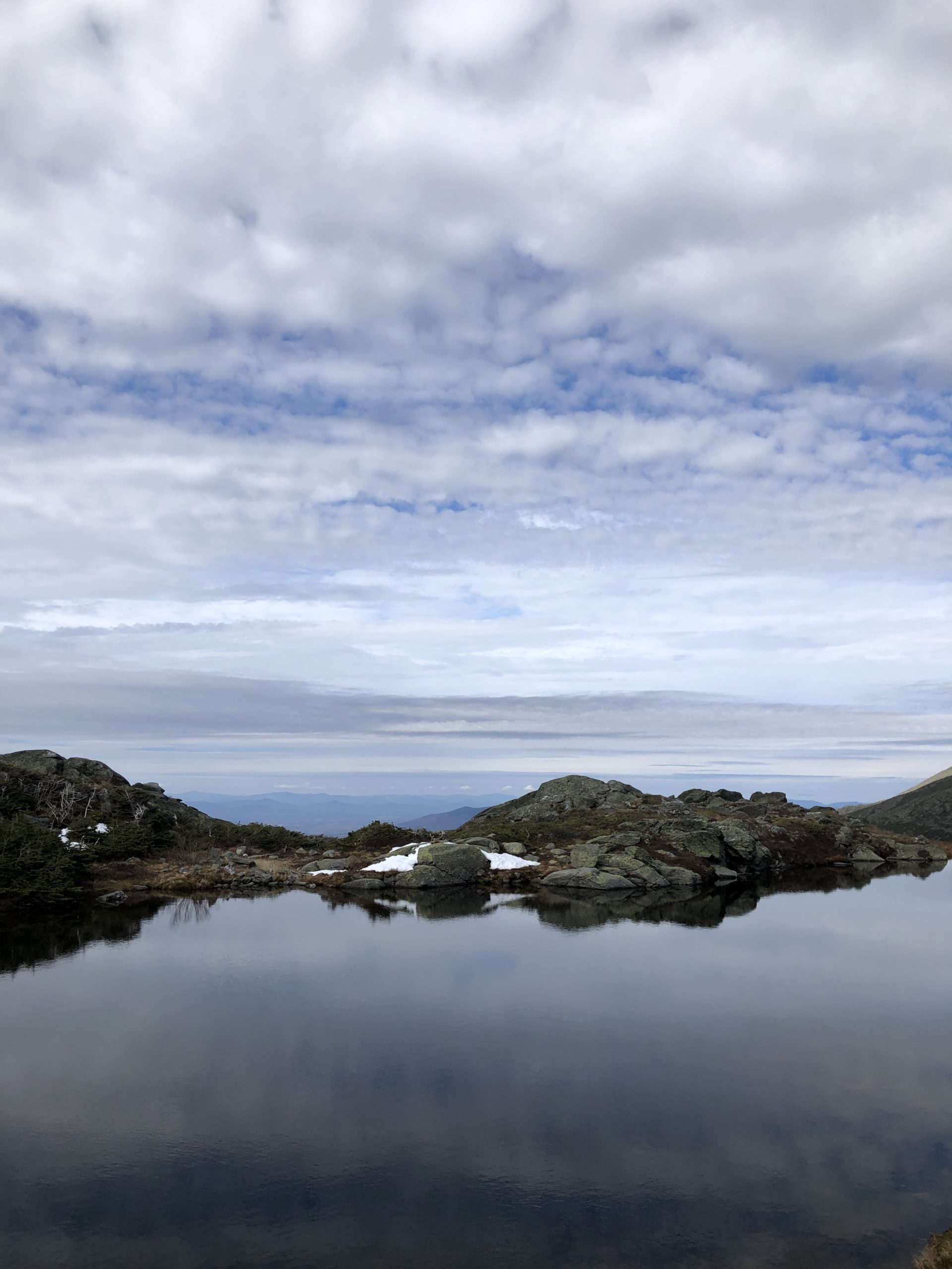
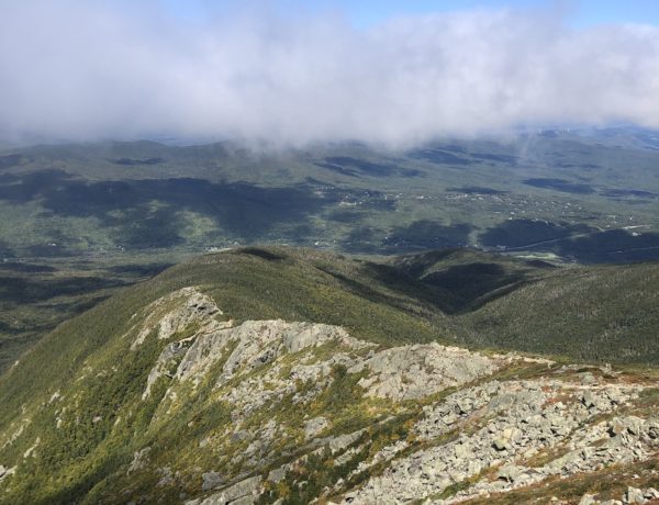
Crawford Path climbs the shoulder of Mt. Franklin, which is 5000 feet but doesn’t make the 4000s list (remember the prominence requirement). Although you’re hiking at a high elevation, the trail is pretty moderate at this point, mostly rolling up and down. At about a mile, Mt. Monroe Loop breaks off to the left. This path takes you over the Monroe summit (apparently there are two Monroe summits, Little Monroe and Mt. Monroe, a fact that was lost on me at the time). Regardless, the Loop is rough. It’s hand-and-foot contact climbing over a boulder field to reach the very exposed summit. The way down also drops sharply, but it’s short and before you know it you’re back on Crawford Path, looking out at Lakes of the Clouds and accompanying AMC hut.
Oh, and you’re staring at Mt. Washington. And it looks… So. Damn. Close.
I was now prepared to acknowledge my well-brewed idea. I was going to reach Mt. Washington. Right now.
I give myself some credit for allowing this idea to brew on the backburner before I let it boil over. I knew the weather was predicted to be good the day of my hike, but I also knew it could change in a second. Let’s not forget that ‘Mt. Washington’s winter conditions rival those of Mount Everest and the Polar regions’… and winter begins in October here. I was committed to assessing the option to continue to the Big Peak after I’d safely made it to Monroe, taking into consideration not only weather, but time, distance, and how tired I was. Remember that whole thing about flexible thinking? Well, here it was, in action.
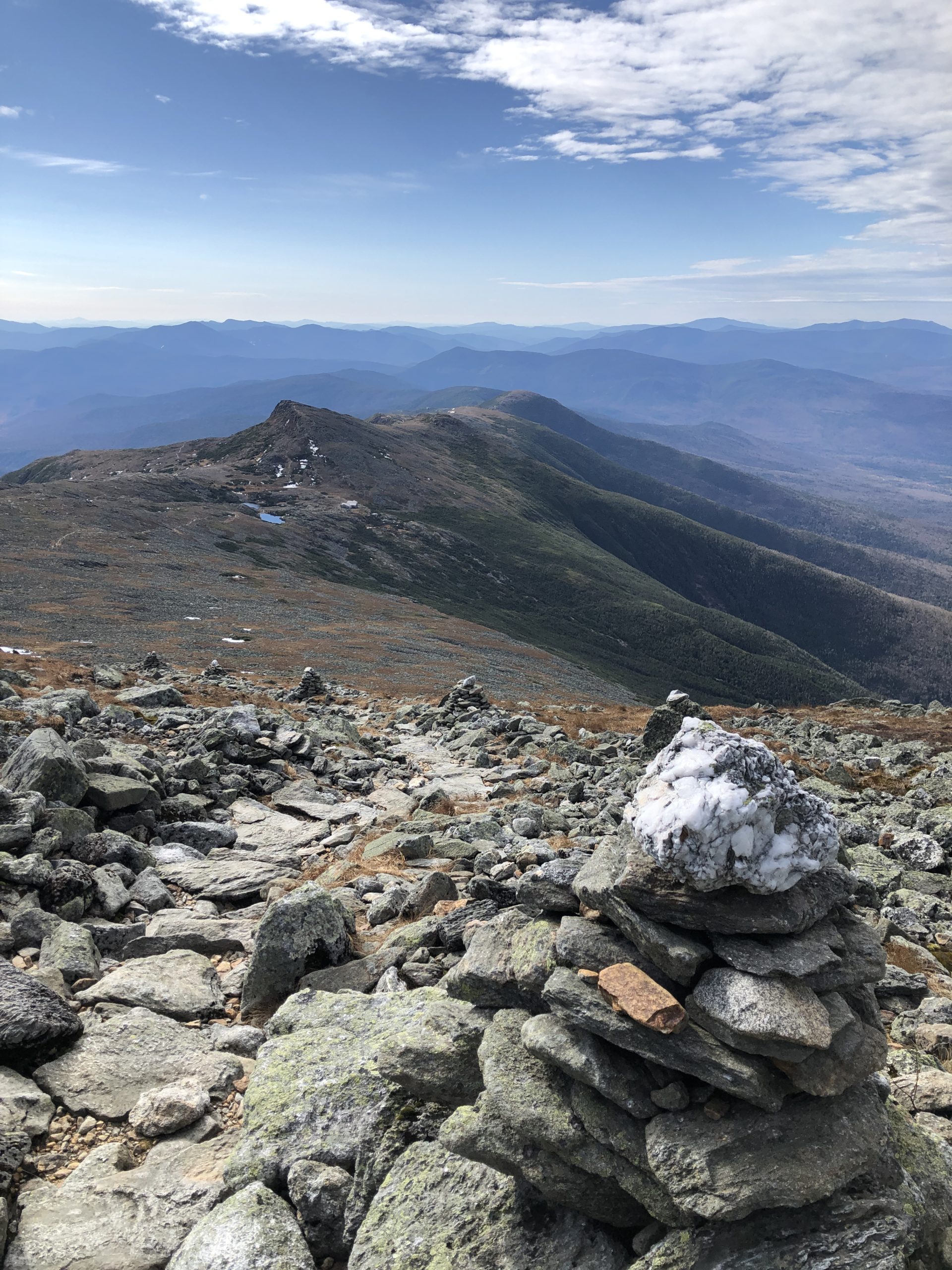
At this point it was only 10:15 in the morning. The summit of Washington was 1.4 miles away. If I did it, it would bring the entire distance of my hike to almost 13 miles, which was longer than the Carter hike I hated. But… this was Mt. Washington. The sky was so clear and the views would be phenomenal. Also, Crawford Path is one of the best-maintained trails I’ve ever seen. It is well defined and sturdy underfoot. I knew it would be an intense push to the top; Washington’s summit is nearly 1000 feet higher than Monroe’s…
I sent an update text to the fam and off I went.

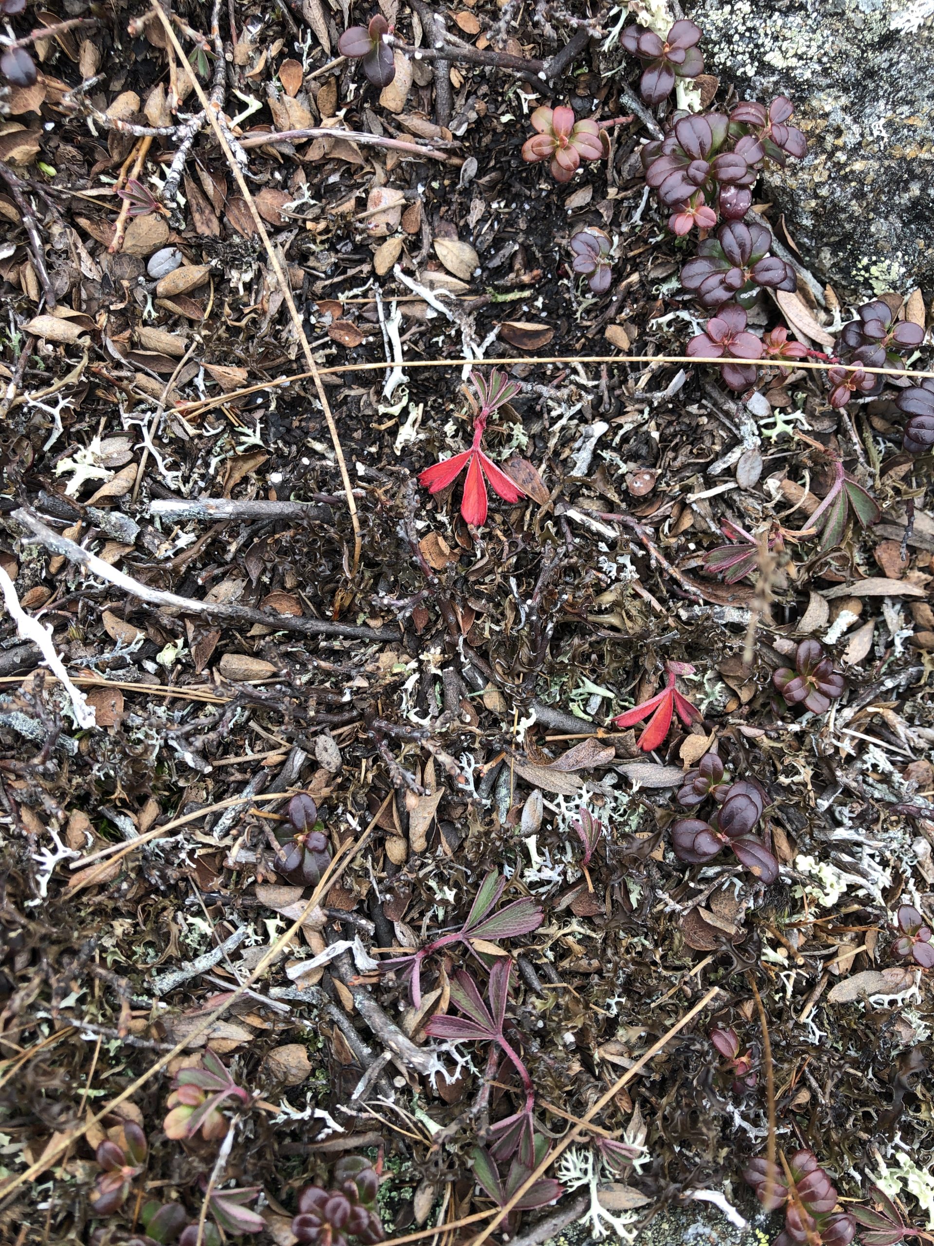
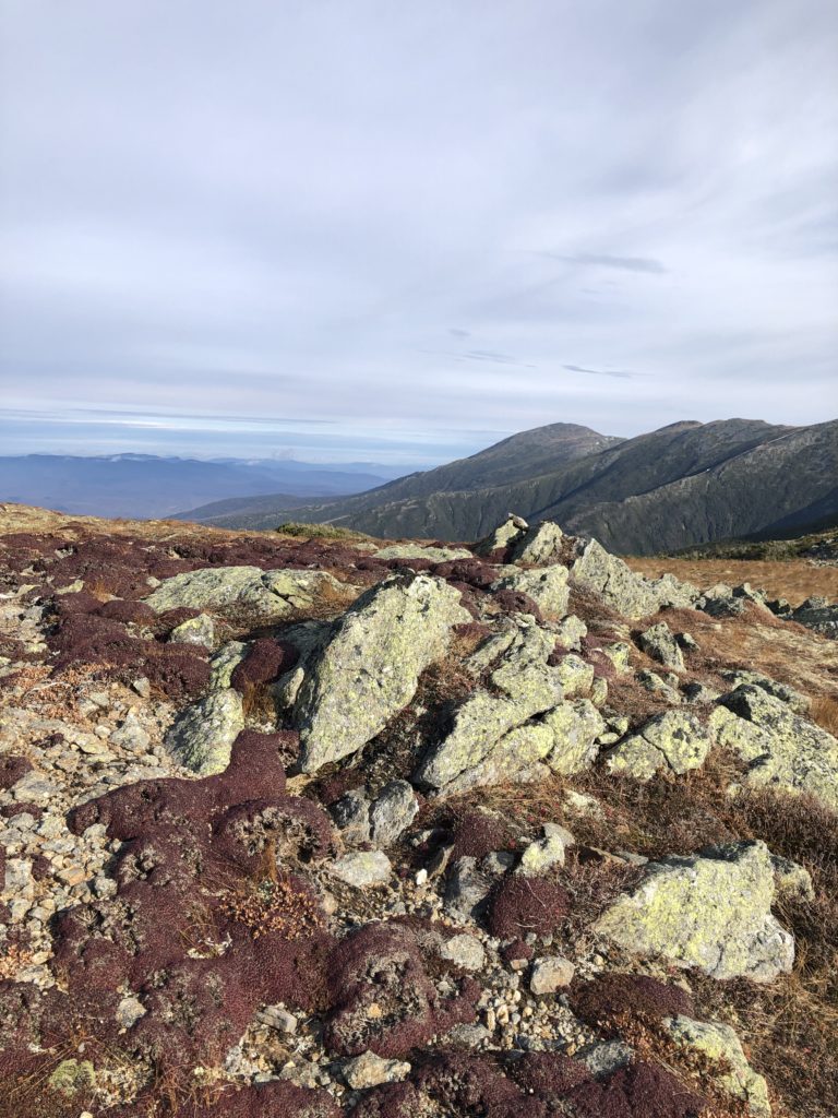
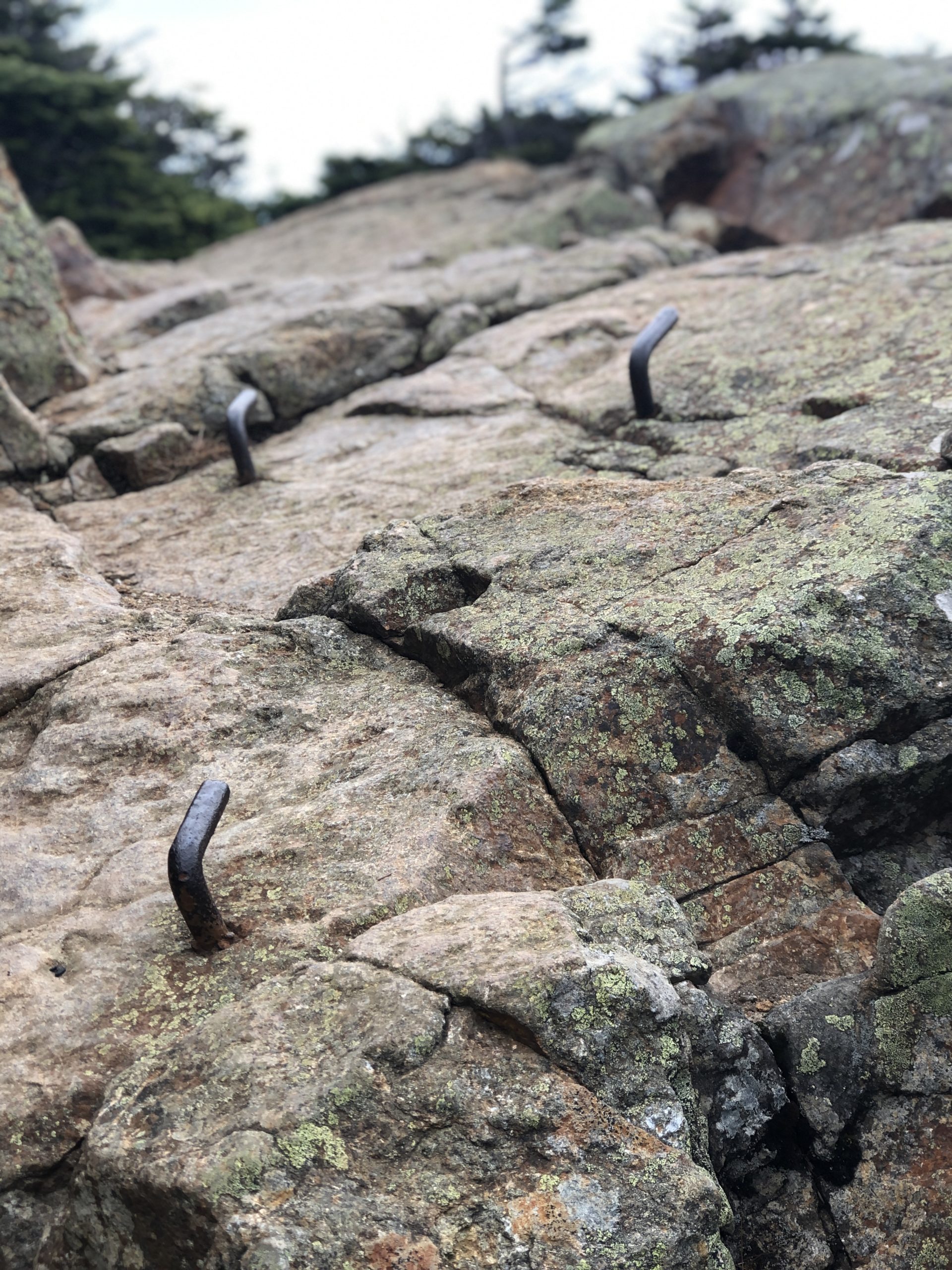
After noting (and photo-ing) how well-marked the trail is here, I learned (again, via the AMC Guidebook, giver of both life-saving and life-enhancing information) that on either side of the trail grows ‘probably the most significant tract of rare vegetation in the entire White Mountain region.’ No wonder they want hikers to stay between the trail curbs. Plainly put, don’t go wandering off to snap a selfie (or even a legit photograph) from a better angle, because you may be trampling a botanically significant plant!
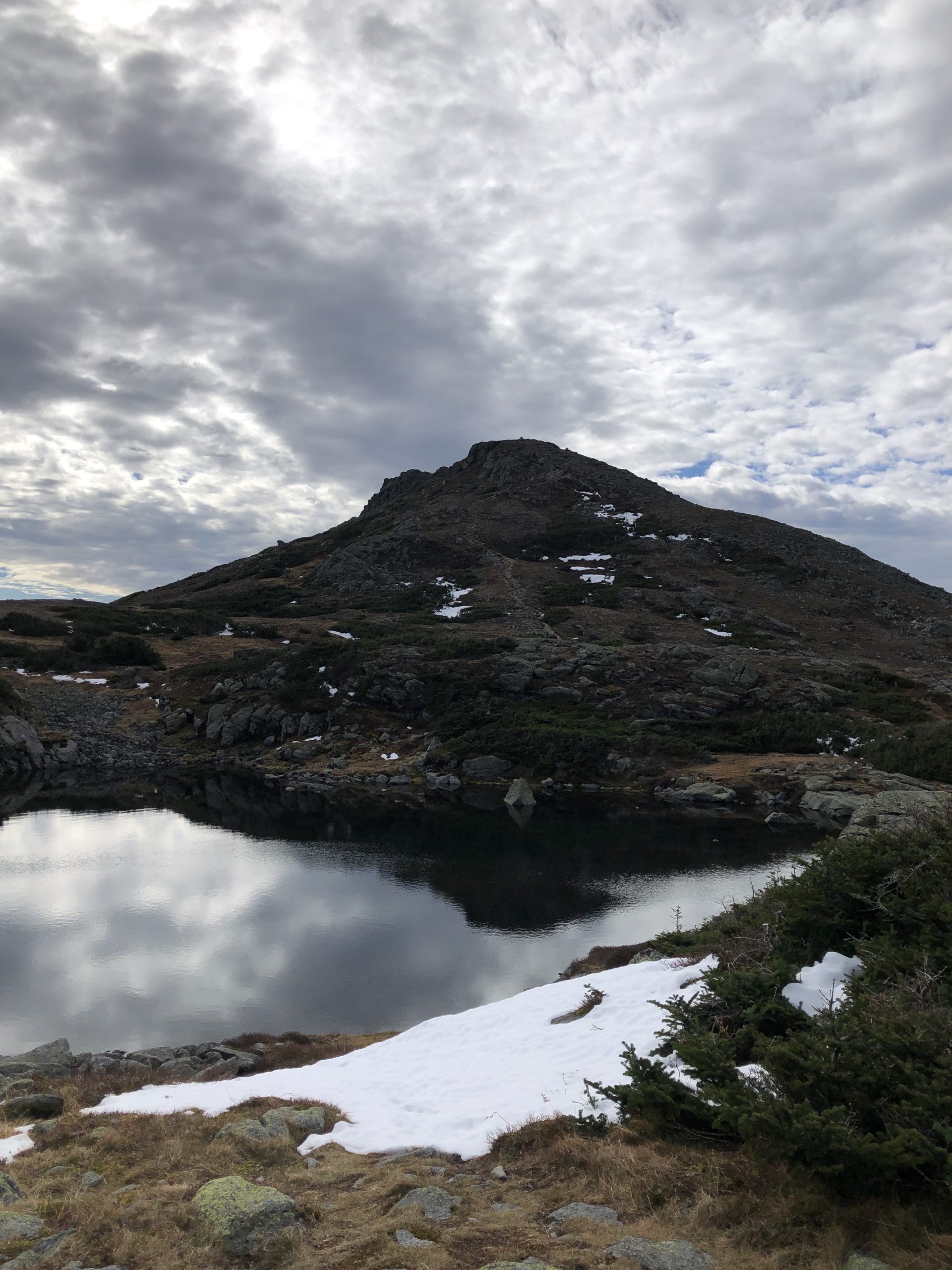
I was happy to stay on the trail, which led to past the AMC Lakes of the Clouds Hut (not opened, thanks to COVID) and in between the two lakes here. The lakes are technically tarns, formed in a cirque excavated by a glacier (thank you, Wikipedia). However you name them, they’re spectacular to look at, these lakes at the top of the world. After this brief flat stretch, Crawford Trail turns up the intensity, leading you north over a steep stairs and switchbacks built in a trench of rock. Although I was absolutely huffing and puffing, I found this to be not easier, but far more straightforward than my Tuckerman’s ascent (and many other previous ascents, for that matter). The path was so thoughtfully laid out and intentionally set, it was just a matter of putting one foot in front of the other… or rather, lifting one foot above the other.
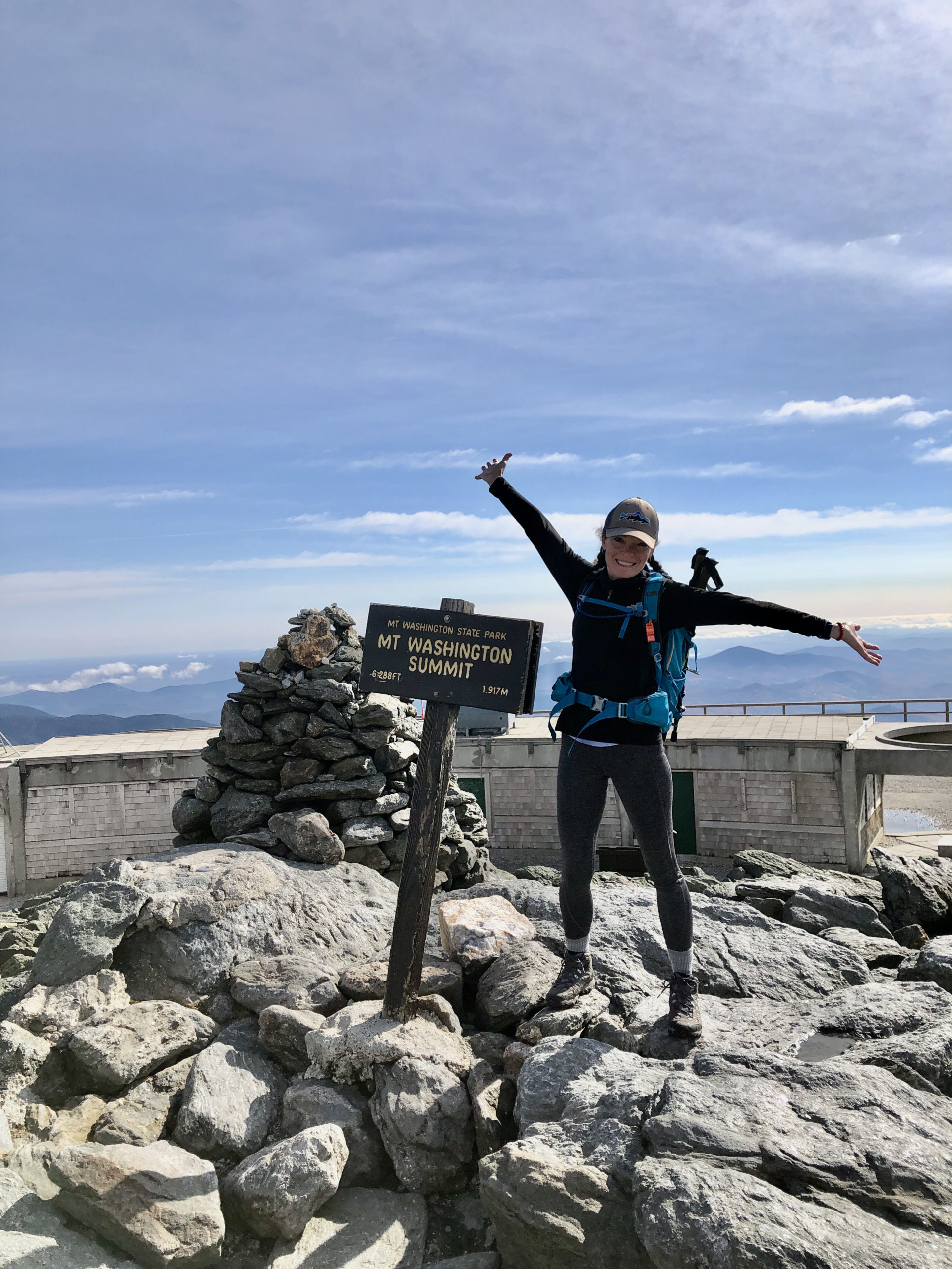
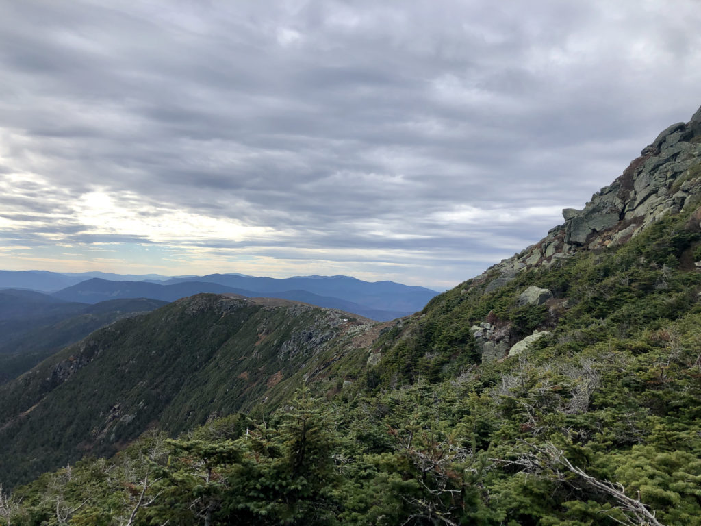
I reached the top of Mt. Washington at 11:40, just shy of four hours total hiking time and plenty of time to get back before dusk. Reaching the top before Noon (and in good weather) allowed me to wander around and sightsee, something I didn’t do on my previous visit. There is no bad view from the top of Mt. Washington. It is breathtaking from every vantage point, the kind of view that is difficult to describe in words because it is just so expansive and overwhelming. In all directions, as far as you can see, there are mountains. Crisscrossing ranges of peaks in every shade of blue and gray and purple and brown, and the only thing beyond them is sky.
Hiker fact:
A quarter of a million people from all over the world visit Mt. Washington’s summit every year.
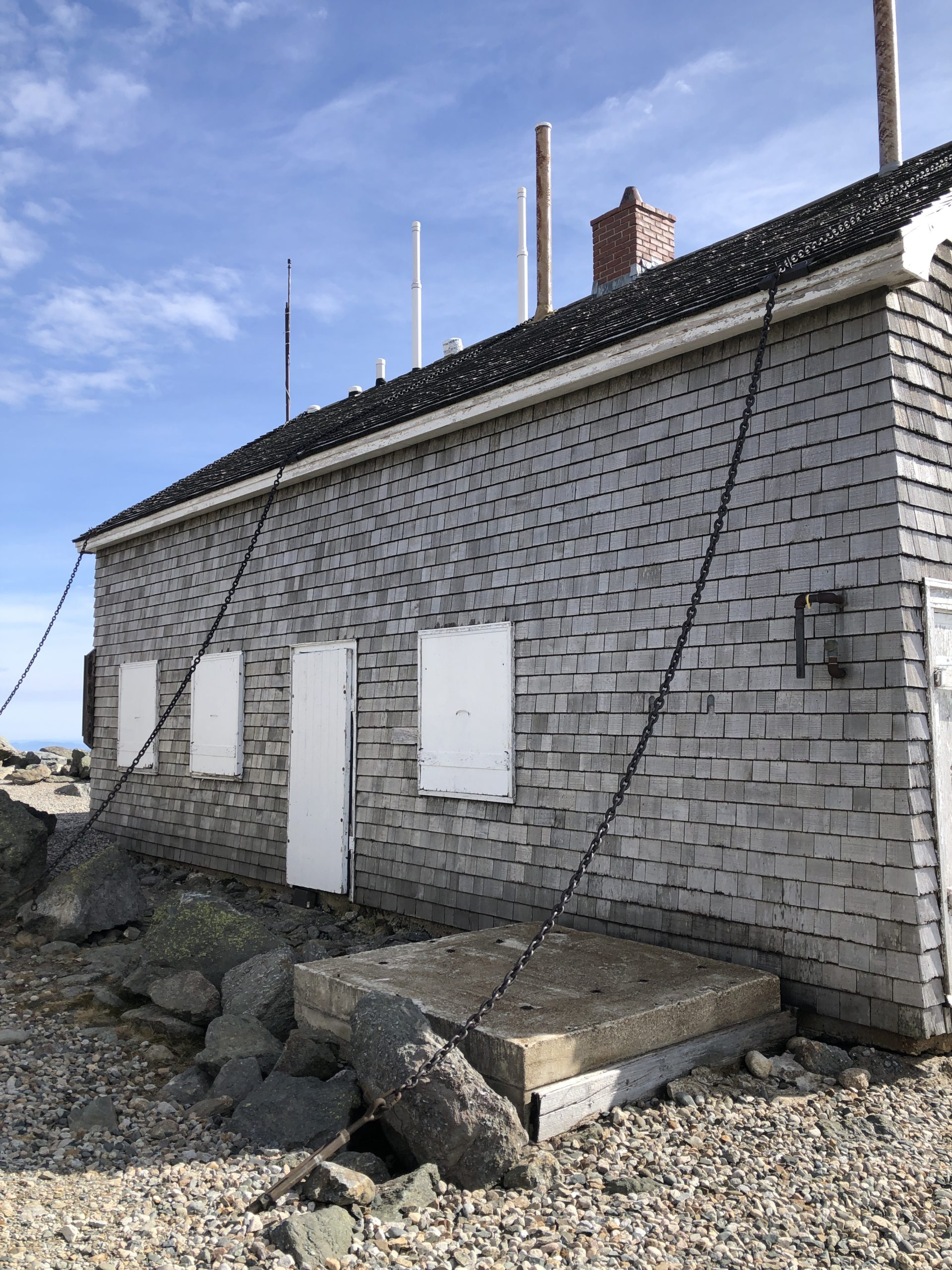
The summit of Mt. Washington is a state park, though most of the facilities are closed because of COVID. I was able to duck into the gift shop to poke around, and outside I found a portapotty. I imagine there is a lot of history to be learned up there, and I’m looking forward to returning when more buildings are open. The gift shop (which I’m sure wasn’t always a gift shop) is chained down so it doesn’t blow away, and there were once two competing hotels at the summit.

I will stop myself from doing a deep dive into the history books… but only so I can come back to it another day with full attention.
I spent about a half hour at the summit, eating and wandering and taking pictures, before heading back down Crawford Path. The only thing I did differently from my ascent was bearing left at the Mt. Monroe Loop to hug the base instead of climbing up and over again. This resulted in a much easier descent and a fantastic view of the southern presidential ridge from a different angle. Oh, and the incredible drop into the Oakes Gulf on the left. Don’t fall really sums it up.
I reached the Edmands Path parking lot just after 4 o’clock… about 8 hours of hiking if you subtract my lunch break. It was the hardest hike I’d done by far but one of the most enjoyable and rewarding. The view was obviously at the top of the rewards list, but so was the sense of accomplishment that came from climbing Washington when I’d only come for Monroe. It was another notch of flexible thinking in my belt. Now I had experienced turning back in unsafe conditions and adding peaks when the conditions were opportune. Both felt like important skills. Both require the separation of emotion from reality. The will of nature is infinitely stronger than the will of humankind, and accepting this truth is both humbling and freeing. Perhaps the hardest work in outdoor adventuring is knowing when to give in to its whims.
Summit lesson: Nothing is more powerful than nature.
Mt. Monroe & Mt. Washington: Edmands Path to Crawford Path
| Total elevation: 5,384 ft | 6,288 ft | Elevation gain: 4,273 ft |
| Mileage: 12.8 miles | Alpine exposure: extensive, unsheltered |
| Terrain: woods walk, alpine trail, scrambles, bouldering, rock stairs, very steep | Challenges: wind, cold temps, prolonged exposure, distance |
| View payoff: the best in New England | Dogs: on leash, very difficult |
Recap: This is a wonderful hike for a good weather day. High winds would make the Crawford Path stretch (which is entirely exposed) miserable and potentially dangerous. Both trails on this hike are very well maintained. The Lakes of the Clouds is worth hiking to, even if you don’t continue on to Mt. Washington. Even if you’re going in July and it’s 90 degrees at the trailhead, you need warm layers.

1 Comment
Old Speck | 4170 ft | ME - She Hikes Mountains
April 17, 2021 at 10:58 am[…] my epic adventure up Monroe and Big W, I chose a shorter hike up Old Speck for the first week of November. Luna would be joining me, and […]