Edmands Path – Mt. Eisenhower Loop
Mt. Eisenhower 4780 ft
This was a crazy damn hike.
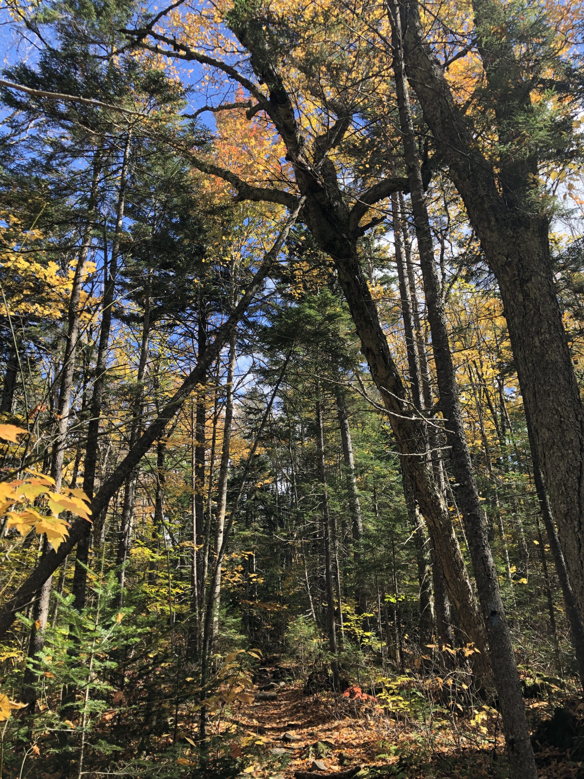
The adventure started when I turned off Rt 302 onto Mt Clinton Road, a gated, seasonal dirt road that is pretty rough, even in the dry months. It was a long two-and-a-half-miles of bouncing and bumping to reach the parking for Edmands Path.
I knew this day would be chilly, but after my experience atop Mt. Adams I thought I could handle it. I arrived at the trailhead at 8 am and it was 30 degrees. Cold, but not brutal, and I figured once I got moving I’d be fine. This trail is considered one of the easiest for accessing the middle of Crawford Path (which is part of the Appalachian Trail) and the Southern Presidential Mountains. The trailmaker who created the path, J. Rayner Edmands, made great efforts to build a trail with consistent, comfortable grades in otherwise treacherous terrain. Wear and tear has taken a toll since it’s completion in 1909, yet the AMC White Mountains guidebook still calls this one of the most moderate of any comparable trail in the Presidential Range.
Noted… but moderate was not my experience.
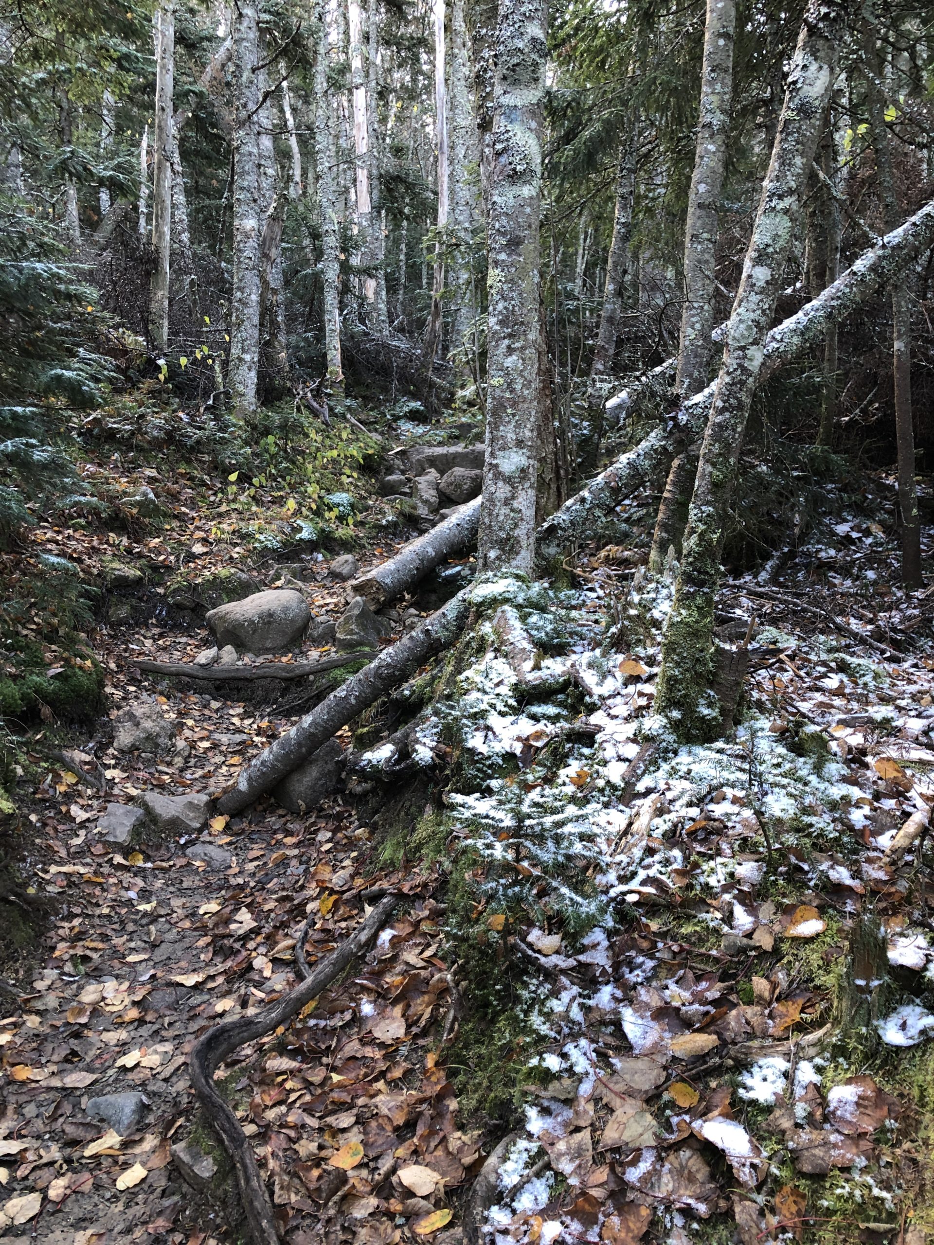
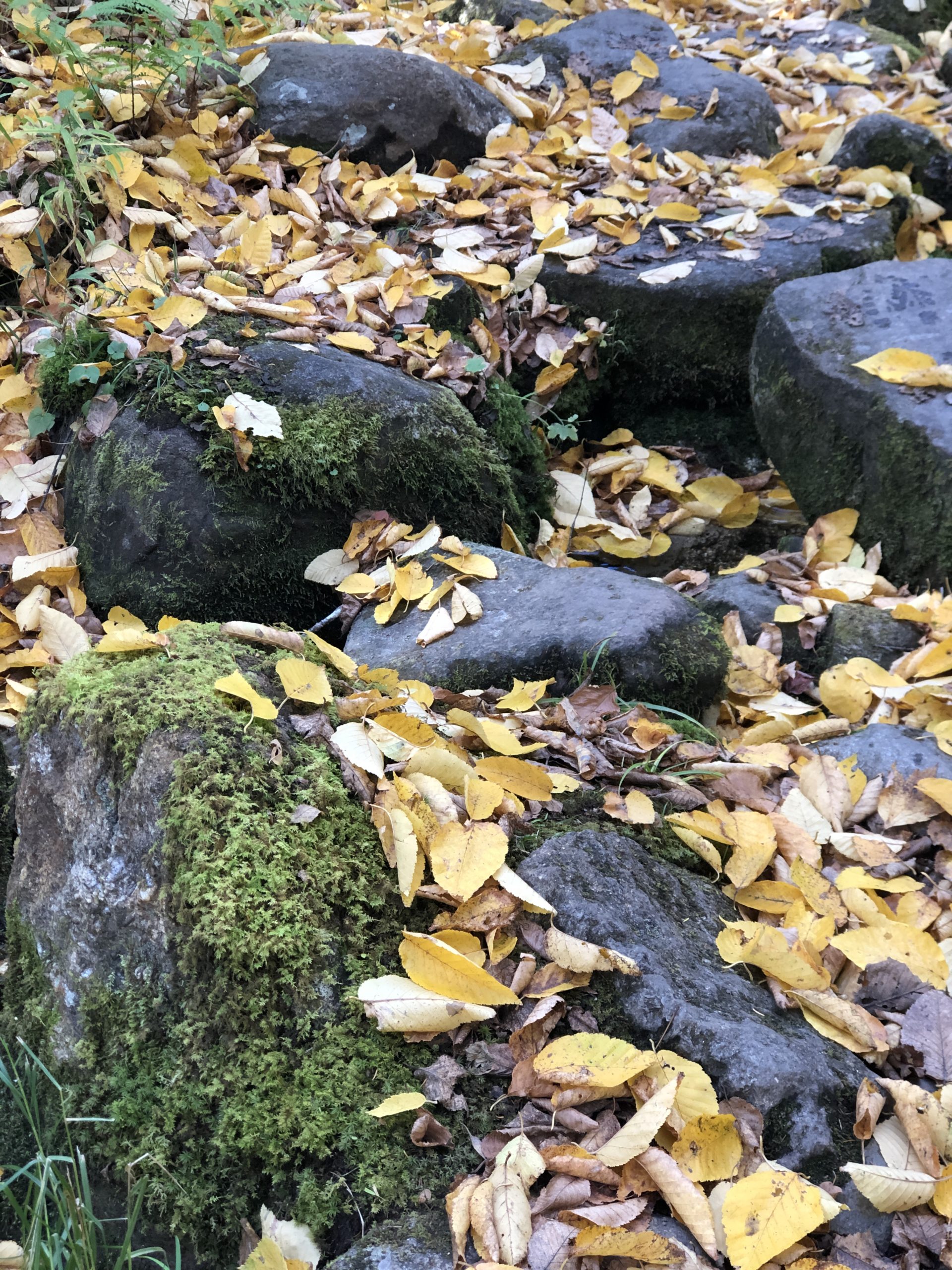

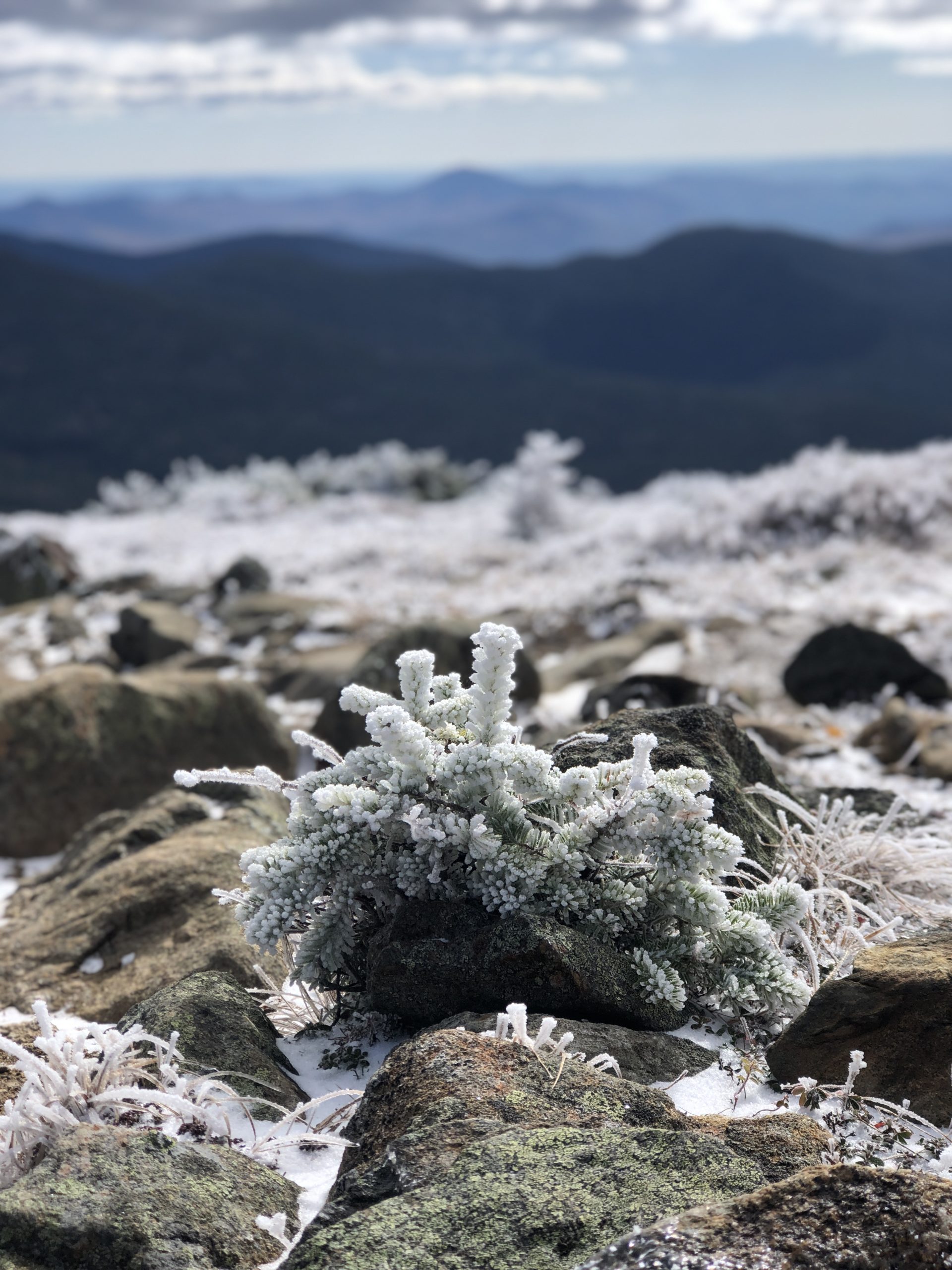
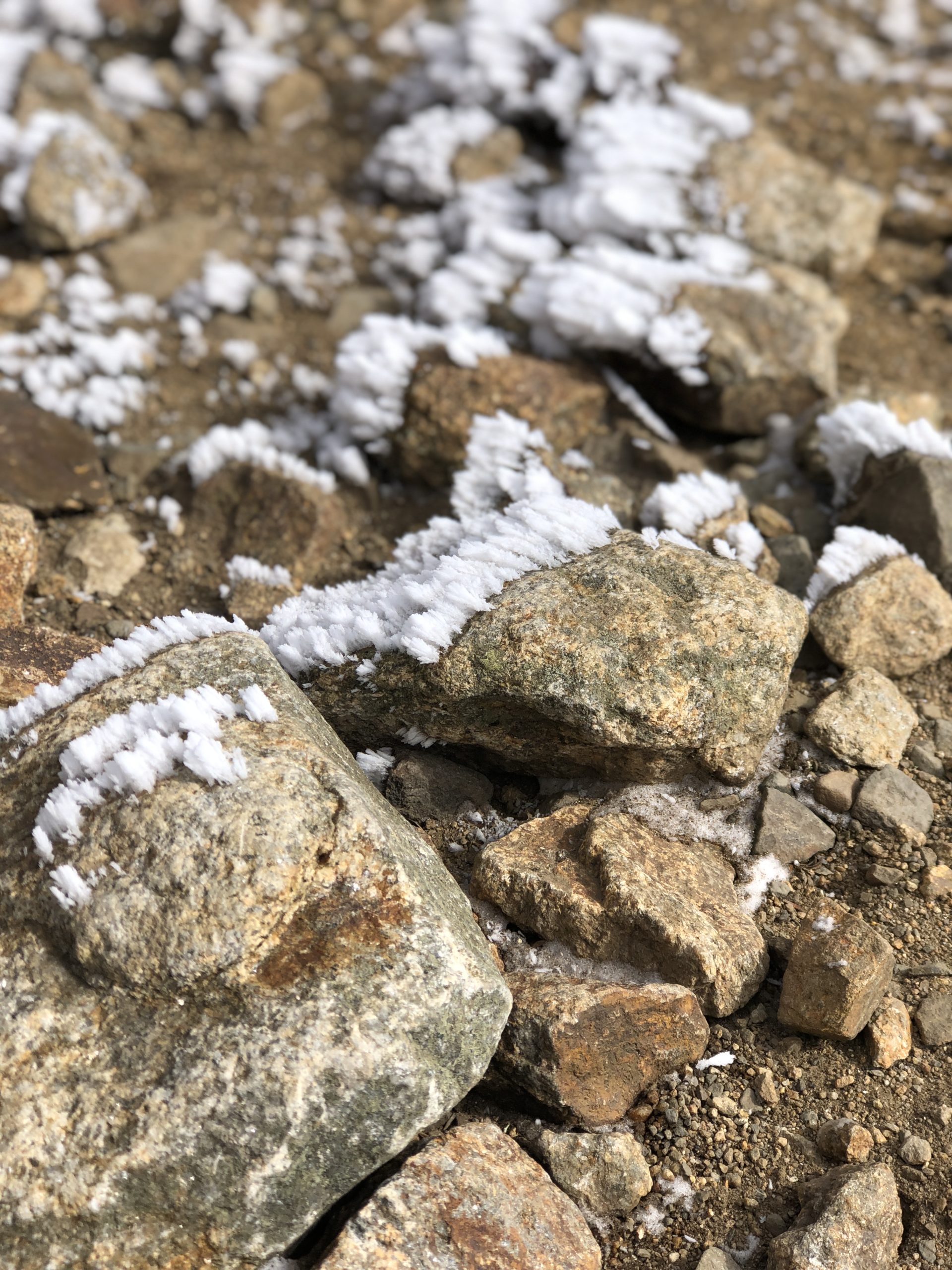
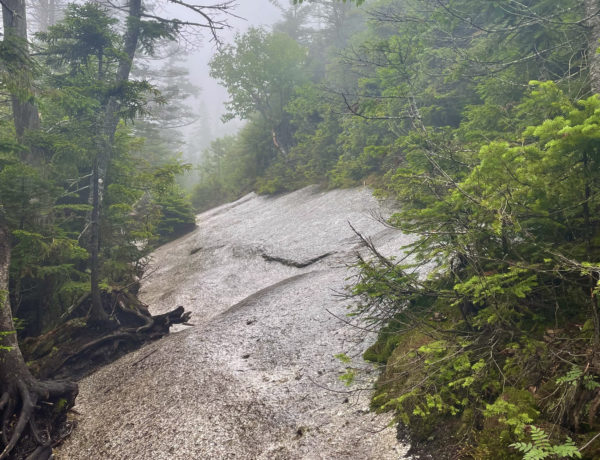
To be fair, that’s not the fault of the trail. It was mostly due to weather and somewhat due to unpreparedness on my part. The moderate nature of the trail may have worked against me too, because I never got very warm. My fingers were cold from the beginning. I was wearing waterproof gloves, but they weren’t insulated. The result was dry-but-freezing fingers. There was snow on the trail after less than a mile (the first time I’d encountered snow on a hike) and the brooks were already dripping into icicles and frosty pools. Several minor water crossings were made difficult by the icy footing, while two, more significant crossings were forded by log bridges.
I reached the alpine zone a few minutes before 10 o’clock. At this point the rocks were consistently icy, so I paused to put on YakTrax (the Pro version). After crossing a ledgy waterfall, the trail became very steep and rocky for a short section before leveling off and curving around the north slope of Mt. Eisenhower. Through the treetops, there is an amazing view of Mt. Washington and the neighboring peaks, all of which had a dusting of snow. This moment of “wow” didn’t last long; two steps later one of my YakTrax broke. The rubber band across the sole snapped, freeing the metal coil meant to provide traction and rendering them useless. I took them off (not awesome with already frozen fingers) and plodded onward.
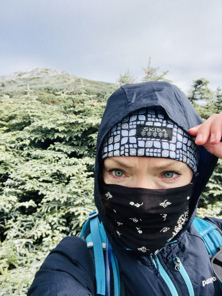
Just before three miles, Edmands Path breaks into the open and climbs a rough slope toward Crawford Path. This is the point at which I began to worry. The wind was insane. It dropped the temps toward the teens. I was prepared for conditions similar to those I encountered on Mt. Adams (42 degrees and blowing at the summit), not full-on arctic winter at 5000 feet. I was wearing every layer I’d packed, including a bandana I intended to use as a sweatband wrapped around my face to shield it from the wind. I sent a text to my family that said, “Made it to alpine, too cold to text.”
My original plan for this hike was to reach Mt. Monroe at 5,372 feet. I headed that way, making a left on Crawford Path. I struggled against the wind for about a third of a mile before accepting that this was a horrible idea. I couldn’t keep my balance when the wind gusted and I could barely see out of my left eye, which was taking the force of the wind from the north. I turned back and found a sheltered place between the rocks to squat down and reassess. The only two options I saw were to hike back down or try to reach Mt. Eisenhower. It was less than a half mile away, and I could see two hikers at the top. If I summited it, I could salvage this hike as a successful 4000 footer day and come back for Mt. Monroe.
I decided to salvage and headed up the Eisenhower Loop, crossing paths with two female hikers descending.
“How is it up there?” I asked.
“It’s gnarly!” one of them said. “But you can totally make it!”
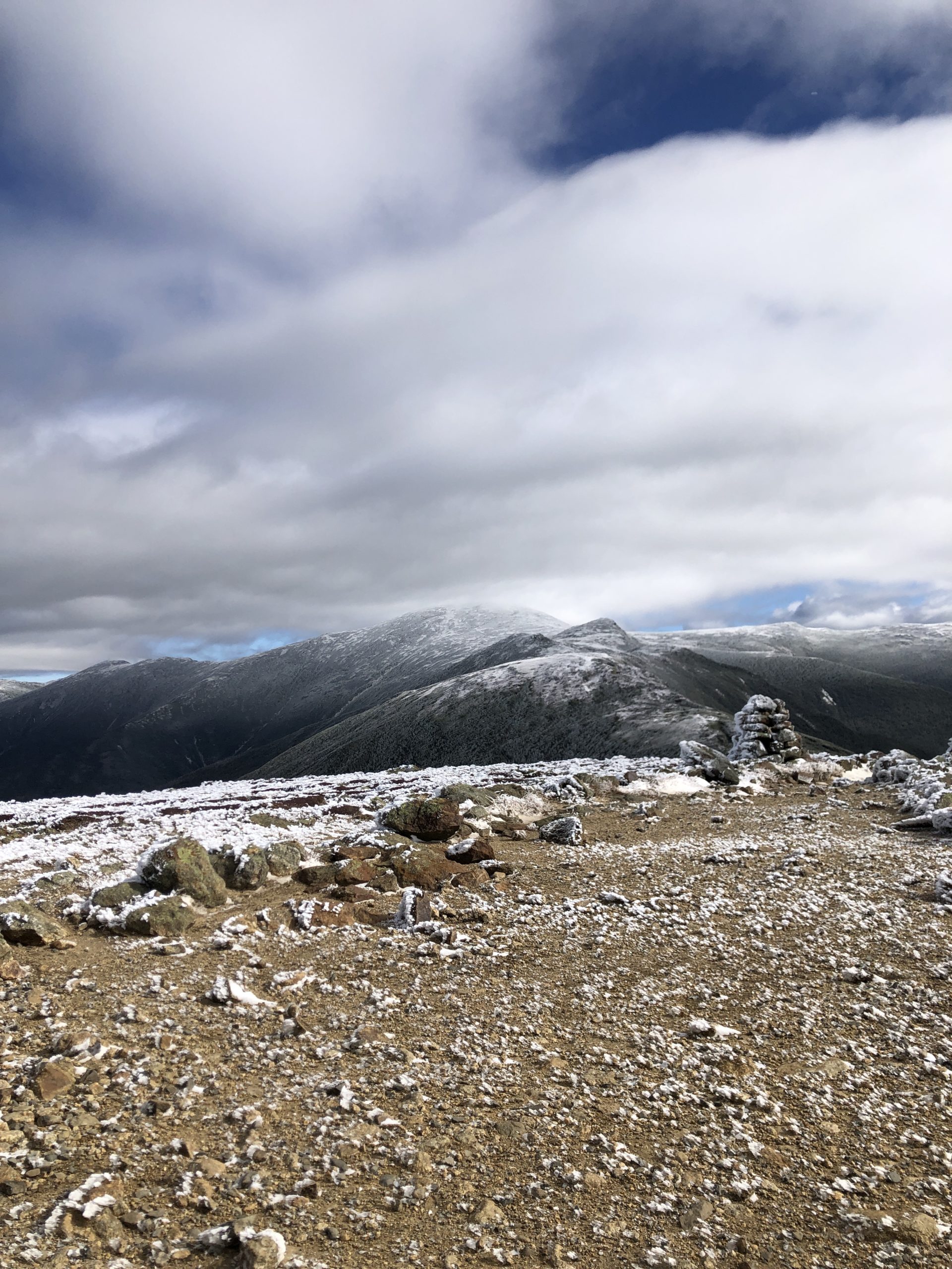
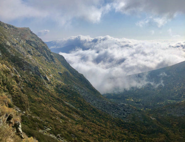
I pushed ahead, ascending a section of steep switchbacks and bracing against the cold gusts to reach a large cairn at the summit of Mt. Eisenhower. I immediately hunkered down behind it, facing south so I was sheltered from the wind. The view was spectacular but far too frigid to enjoy for long. I snapped a few photos and headed back.
Hiker fact:
Over 200 people have died while hiking, climbing, or backcountry skiing in the White Mountains. Most deaths were due to oversight or poor decision making and could have been avoided.
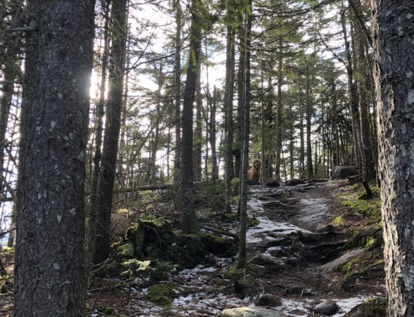
The descent, after crossing the treeline, was relatively easy going, thanks to J. Rayner Edmands efforts to create a moderate trail. I got back to my car about two hours after leaving the Eisenhower summit. I blasted the heat and immediately headed to REI in North Conway to mitigate some of my gear issues. There was a bit of defeat hanging over my head, even though I knew turning back was absolutely the right choice.
At REI I returned the waterproof gloves and purchased a pair of thickly lined leather mittens. Big thanks to the employee who listened to my icy finger woes and spent a half hour with me in the mitten and glove section. I learned that leather mittens, although not as waterproof as Gore-Tex, are superior at keeping out cold and wind. The same employee also steered me to a better foot traction option, confirming the assessment I was already making about YakTrax: while they’re fine for walking your dog on a slick sidewalk, they aren’t made for backcountry sports. I picked out EXOspikes (for ice) and MICROspikes (for ice, snow, and rugged trails) by Kahtoola.
While I was checking out, I bemoaned my failed attempt at Mt Monroe to the cashier, who was planning to hike the presi with his girlfriend the next day and was curious about the conditions.
“It’s hard to turn back,” he agreed. “But you know what almost all the stories I’ve heard about real disasters out there have in common?”
“What?” I asked. I was pretty sure I knew the answer.
“At some point, every survivor had a moment where they thought, ‘I should probably turn back.’ But they didn’t.”
“Yeah,” I said, nodding. “Yeah, you’re right.”
“The mountains aren’t going anywhere,” he said with a smile. “You’ll get it next time.”
Summit lesson: Knowing when to turn back is success, not failure.
Mt. Eisenhower: Edmands Path to Eisenhower Loop
| Total elevation: 4,780 ft | Elevation gain: 2,694 ft |
| Mileage: 6.25 miles | Alpine exposure: fully exposed at summit |
| Terrain: steep woods walk, consistent footing, scrambling, boulders, very steep rock steps | Challenges: wind, cold temps, uneven rocks |
| View payoff: amazing | Dogs: on leash |
Recap: This trail offers consistent, comfortable grades with some scrambling before the treeline. The alpine zone here is very exposed and steep to the summit, but it’s a short last push to the peak and the views are incredible.

2 Comments
East Osceola | 4156 ft | NH - She Hikes Mountains
April 17, 2021 at 9:32 am[…] we’ve established, it’s hard to turn back. And it’s doubly hard when you know you can reach the peak but others in your party (four-legged […]
Mt. Monroe | 5384 ft | NH - She Hikes Mountains
April 17, 2021 at 10:58 am[…] time is a charm! That’s what I told myself when I headed out, again, for Edmands Path. I was on the trail at 7:45am and by God, I was prepared for anything. Not only […]