Grafton Loop Trail
Baldpate Mtn 3576 ft, Long Mtn 3012 ft, Puzzle Mtn 3125 ft
Grafton Loop Trail and I have history. This 38.6 mile loop in Newry, Maine was the site of my very first backpacking trip in May 2021. I had never spent a night alone in the woods, and I was lucky to have a seasoned hiking buddy (a AT thru hiker) who was willing to show me the ropes. When I became a guide, I knew I wanted this trail to be one of the trips I offered. It’s a fantastic trail to backpack because there are so many different types of terrain along the way. A portion of the loop coincides with the Appalachian Trail (that section can be busy), but other parts are extremely remote and solitary. And, the loop is bisected by Rt. 26, which means if you’re really having a bad time, you can bail half way through. Or, as my seasoned hiking buddy did, drop a resupply in a bear proof Yeti cooler so you can carry less food!
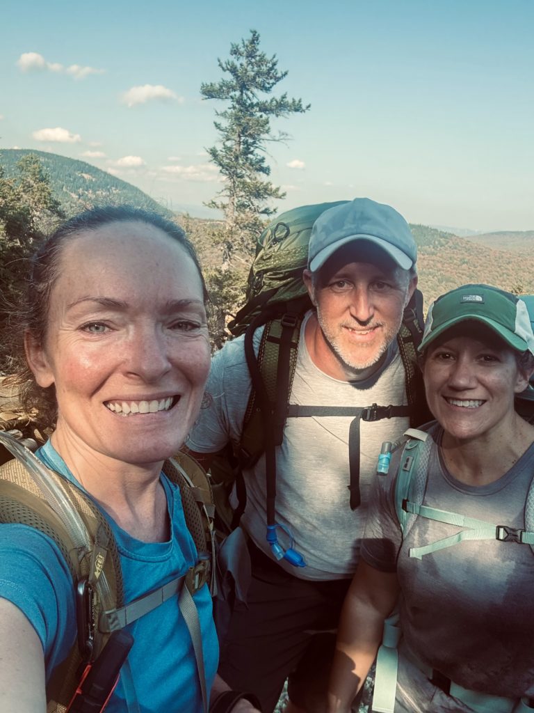
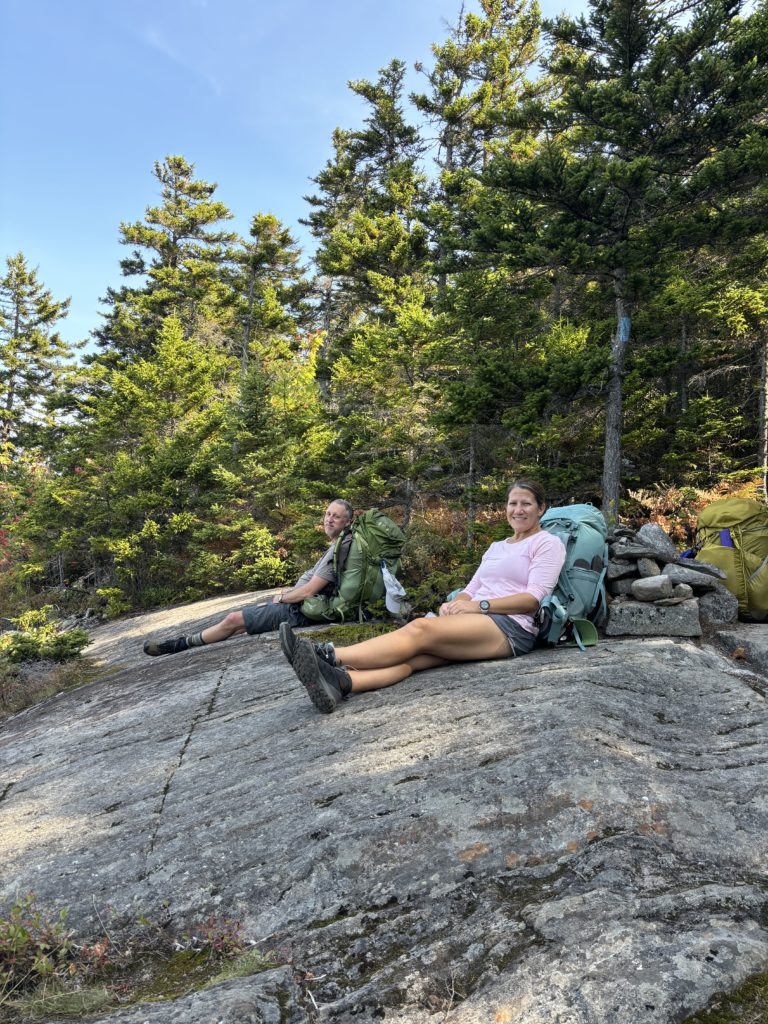
On my guide services page, I decided to offer this loop in three ways. A one-night intro to backpacking trip to the Stewart Campsite, a two-night 1/2 loop on either the east of west side of Rt 26, or a three-night full loop. When I was contacted by a couple from Michigan who wanted to backpack in Maine for a few days, I suggested the east side half loop. Tammi and Jason had never been to Maine, and I wanted them to see the view from Baldpate, which is why I chose the east versus west side.
We planned our 3 day, 2 night hike for mid-September. Tammi and Jason were bringing all their hiking and sleeping gear, and I would carry cooking gear, first aid, and emergency supplies. We spoke extensively about weather, food, and daily mileage and elevation. I was excited to share this experience with them, but as the trip got closer, I realized it had been awhile since I’d been on this trail. I had been up the north section to Baldpate and the south section to Puzzle Mountain, but the middle section was a bit of a blur in my memory. I knew one of the tentsites had closed due to an issue with the privy and the water table, but I couldn’t remember which one. I wanted to see the trail for myself before bringing Tammi and Jason out into the woods.
Alas… it was already mid-August… and the height of guide season… which meant I definitely didn’t have an extra three days and two nights in my schedule. So, I decided to hike the 19 mile half loop in one day. I love long distance hiking, especially when I don’t have to carry a backpacking-sized bag full of overnight gear. The longest day hike I’d done prior to this was Owl’s Head (17.5 miles), but I’ve done longer milage days during backpacking trips, so I knew I could do it. Still, I packed my bivy, extra food, and warm layers in case something unplanned happened and I had to spend a night in the woods.
I decided to start the hike at 6am, which meant leaving Portland around 4am. I absolutely hate early morning commitments. I hate early morning flights, early morning plans, early morning drives… because I cannot sleep the night before. I would have been better off driving to the trailhead the night before and sleeping in my car. As it was, I got about two hours of sleep the night before this hike. I was miserable in the morning, and I even napped in my car while I waited for my car spot to arrive.
One of the logistical challenges of the Grafton Loop, if you’re only hiking half of it, is that the trailheads are 7.5 miles apart on Rt 26. It’s a rural, windy, fast-moving road without a shoulder, so walking it isn’t ideal. Hitchhiking is an option, or car spotting if you have two hikers (or a helpful friend). There are also shuttles that pick up AT hikers at the Appalachian Trail crossing on Rt 26 (at the northern start of the loop), so I imagine a shuttle ride could be arranged to get from one trailhead to the other.
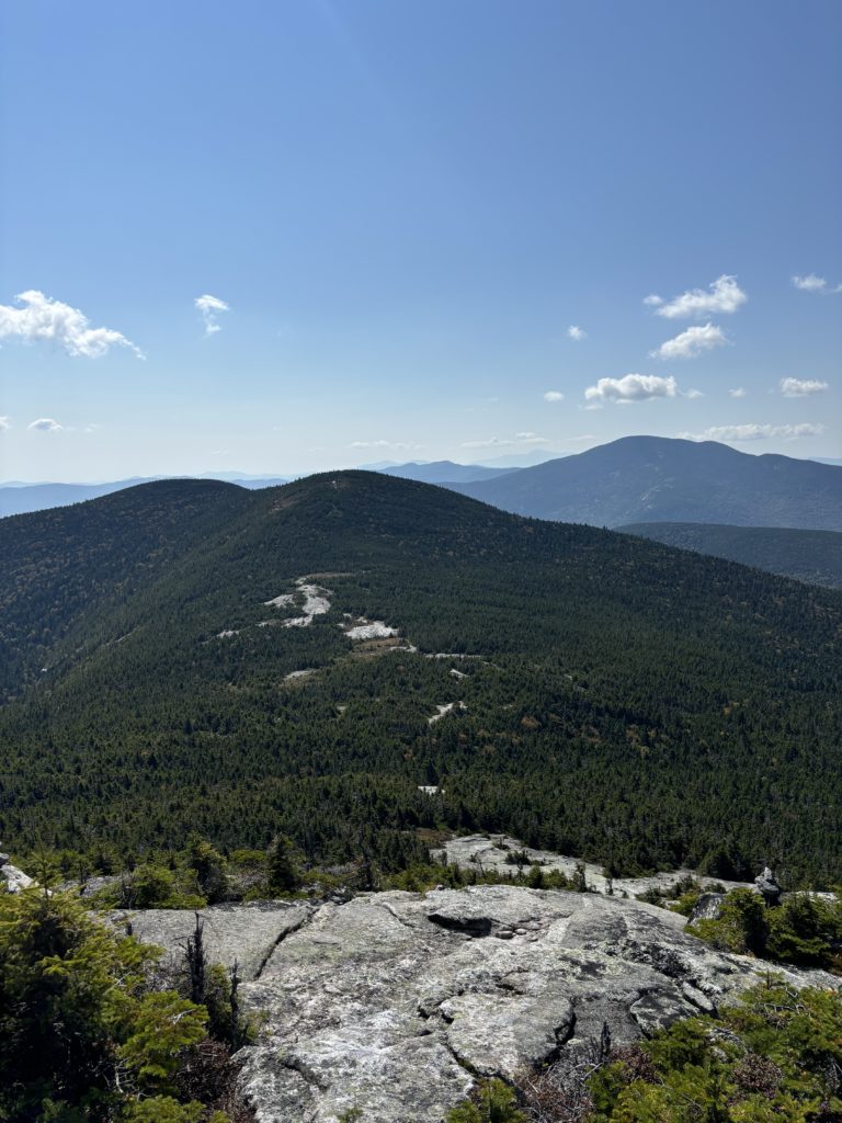
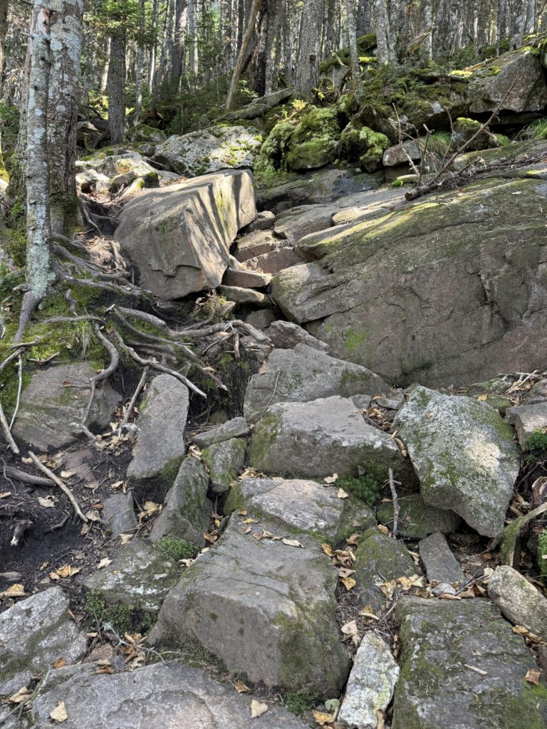
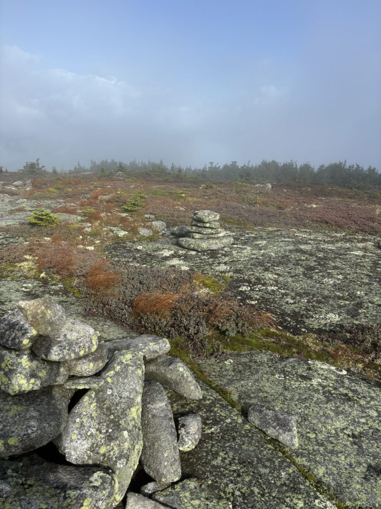
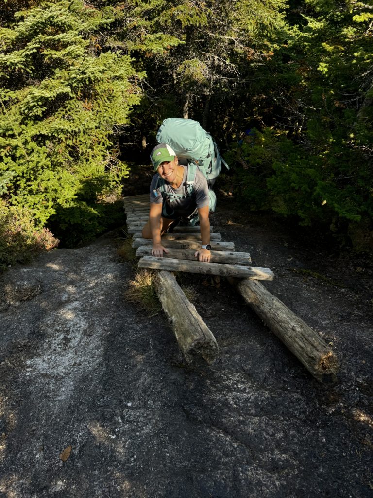
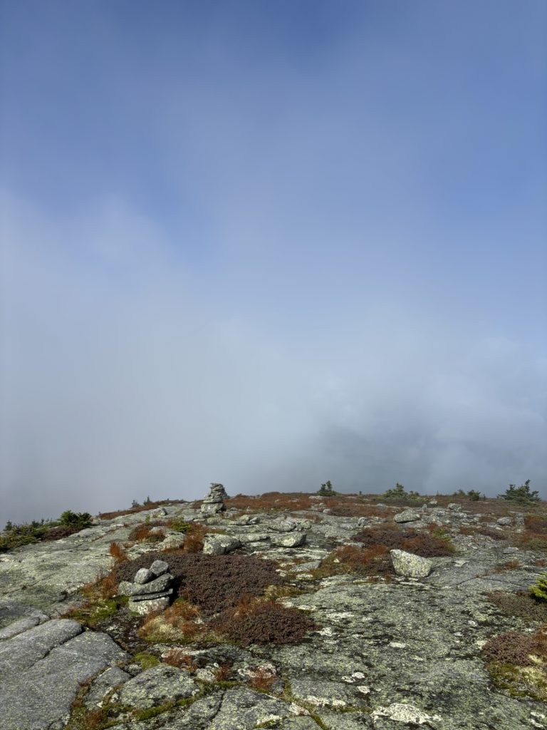
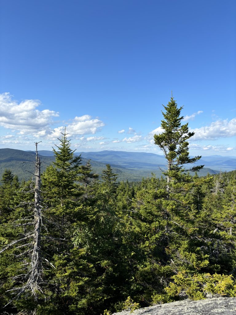
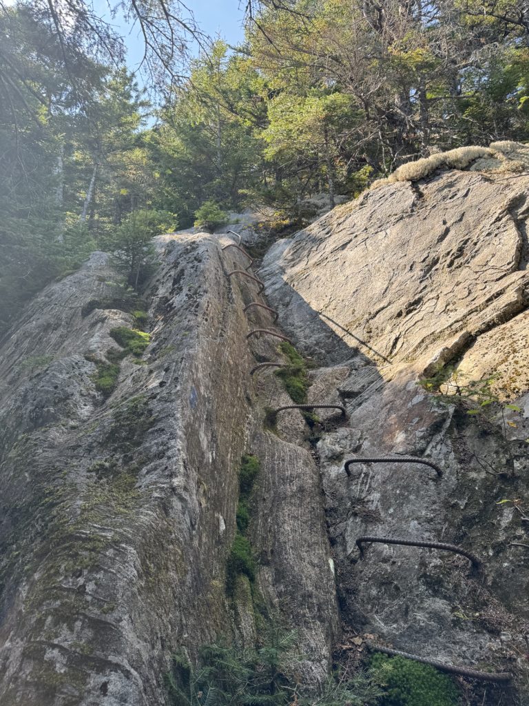
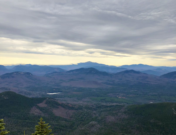
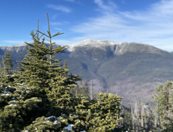
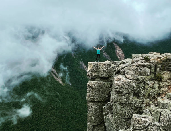
At the northern trailhead (also the trailhead for Old Speck), there is ample parking, picnic tables, and outhouses, so it’s a good place to start a backpacking trip. The Grafton Loop east starts here on the AT, which heads east and doesn’t waste any time beginning to climb up toward Baldpate West and East peaks. The elevation gain is about 2000 feet in four miles, and it’s classic AT terrain: roots, rocks, more roots, more rocks. West Baldpate is wooded, but East Baldpate is wide open and the view is stunning. The climb up can also be scary for anyone who gets nervous about heights. The trail travels over wide open, exposed ledges. It can feel like if you straighten up, you’re going to fall backward and just keep falling forever. I encouraged Tammi and Jason to stay low and keep a hand on the rock while they climbed. The terrain levels out and offers views in all directions, crossing a rocky plateau to reach the official summit of East Peak, marked by a tall cairn.
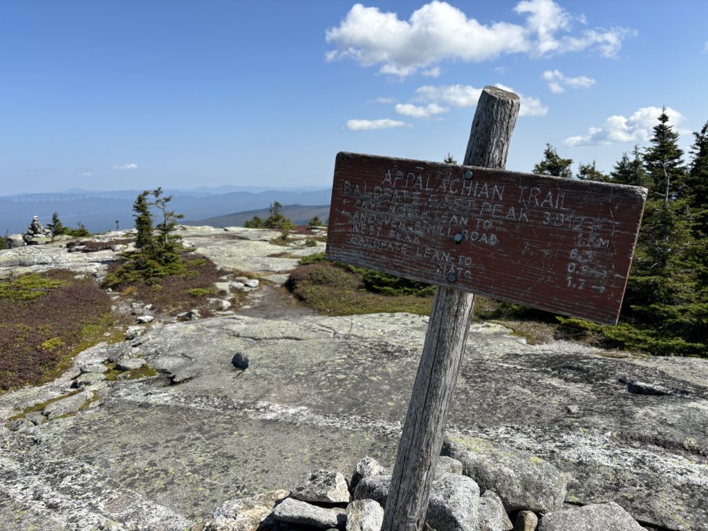
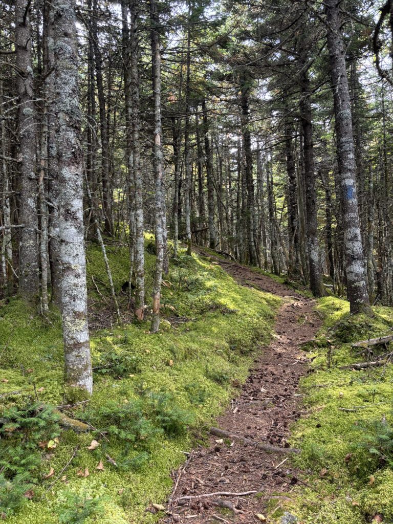
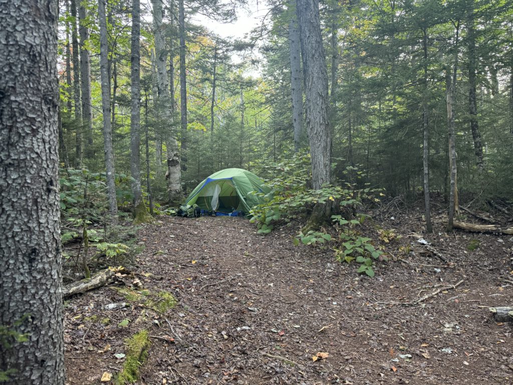
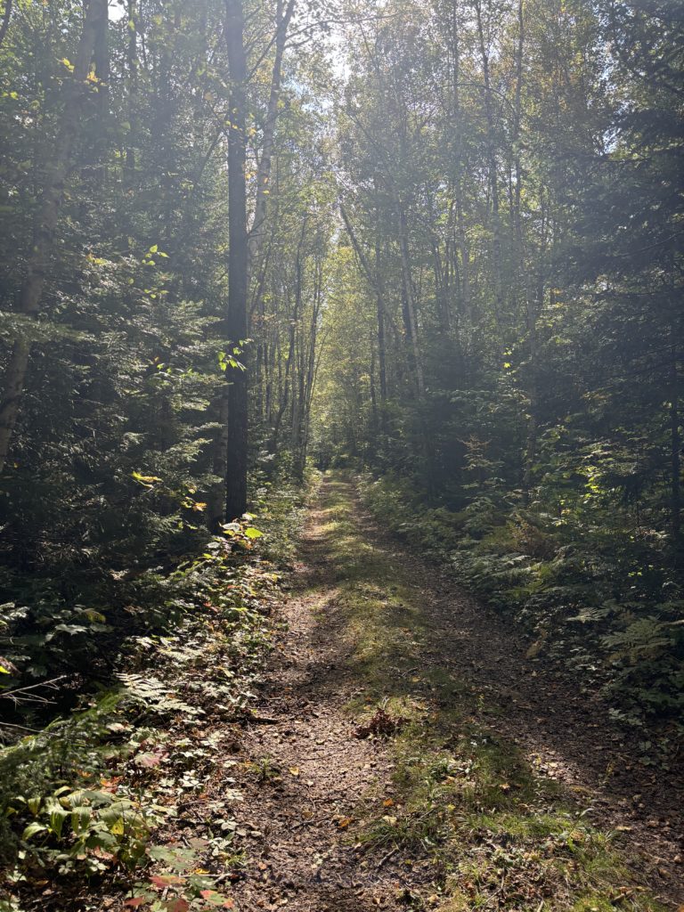
At the Baldpate East summit, the AT continues north while Grafton Loop Trail heads east… and becomes markedly more overgrown and remote. The next four miles are a steady descent, passing a ladder, several streams, the East Baldpate Campsite, and Lightning Ledge. We reached the East Baldpate tent site around 4, and we knew the next day was a long one with a long climb over Long Mountain and another push to the midpoint of Puzzle Mountain where the Stewart Tentsite is located. We opted to keep going, arriving at the Lane Tentsite, which is just 1.6 miles further, right around 5. It was perfect timing to set up camp, make dinner, and get to bed early.
The Lane Tentsite is very pretty and private. It’s a .25 mile spur trail with several secluded tent sites and easy access to Wight Brook. There were a lot – A LOT – of moose poop in the area. More on that later. The biggest challenge of this site is the lack of trees suitable for hanging a bear bag. They are all very straight, tall, and limbless until the top. I ended up throwing the bag into a tree that was hanging out over the brook.
Off to sleep we went, until… have you ever awoken to a very large animal tromping past your tent in the middle of the night? Well, it’s heart-stopping. I laid there, frozen, trying first to decide if it was a bear or a moose. My preference was moose, although I’m not sure why. Probably the lack of claws and teeth, though they’re no less terrifying and deadly when they’re pissed off… or in the rut… which they are in September.
So, I listened. The sound was rhythmic and lots of branches were snapping. A bear, from what I’d heard, makes more of a snuffling sound, and I imagined its movement would sound more erratic. After when seemed like forever but was likely 10 minutes, the moose moved away. He (or she) was clearly traveling a well-known moose path, executing some trail maintenance and snacking along the way. The next morning, I confirmed that Tammi had heard the moose, and Jason had slept through the whole event. Mothers sleep through nothing. Ever.
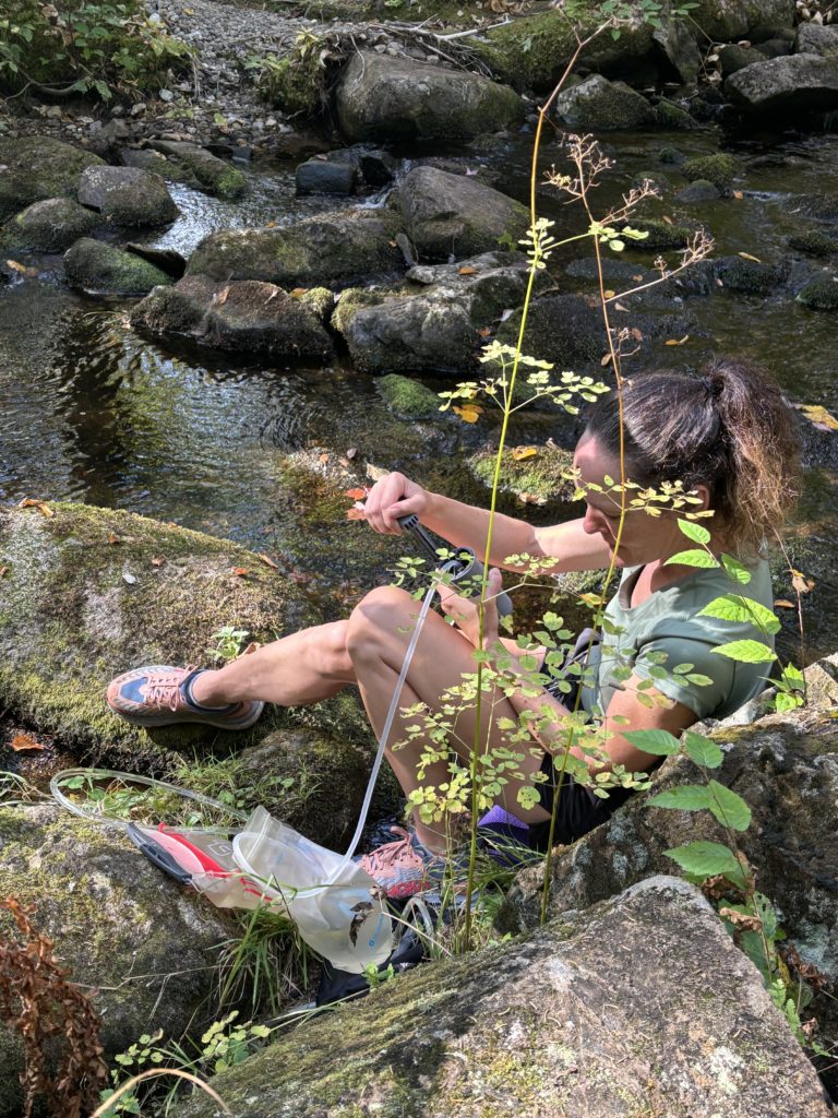
We packed up and headed on our way to Stewart Tentsite, which was about 8.5 miles away. The first part of the morning was spent hiking next to Wight Brook, a beautiful mountain stream. It would be a great place to try for a trout or take a dip… which I very seriously considered during my 1-day hike.
After passing the Town Corner Tentsite, the climb up 3000 foot Long Mountain begins and can best be described as a slog. The footing is relatively even, not a lot of rocks and roots, but it feels like it will never end. There’s no view because the trail skirts the true summit a bit. It looked like there may have been a bushwhack spur to a view (and the Far Out app shows a view), but I wasn’t interested in investigating. Maybe next time.
There is a long, gradual 2.5 mile descent after the peak that ends at Chase Hill Brook, after which the climb up Puzzle Mountain begins. Two weeks before my trip with Tammi and Jason, when I day hiked the route, the water source at Stewart Tentsite was meager at best. It is notoriously unreliable, and it hadn’t rained, so I didn’t trust it to be flowing. I opted to have us filter and fill our bladders before climbing Puzzle. Our packs got heavier, but it turned out to be the right choice. There was a trickle at Stewart, but I had to follow the stream quite a ways to find it, and I was glad I didn’t have to fill up three bladders with such a light flow.
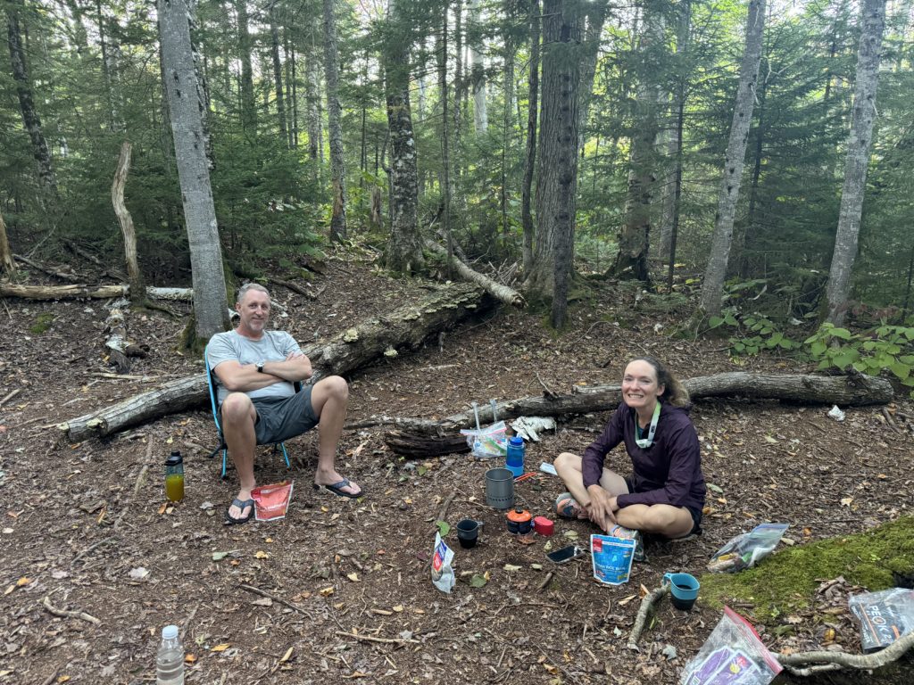
Stewart is a more open tentsite, just one large clearing. I read in the guidebook that there were more tentsites in the surrounding woods, but I didn’t see any obvious trails leading to them. We had no large visitors that night, and the next morning we were ready to climb the remainder of Puzzle Mountain and begin our final descent back to Rt 26.
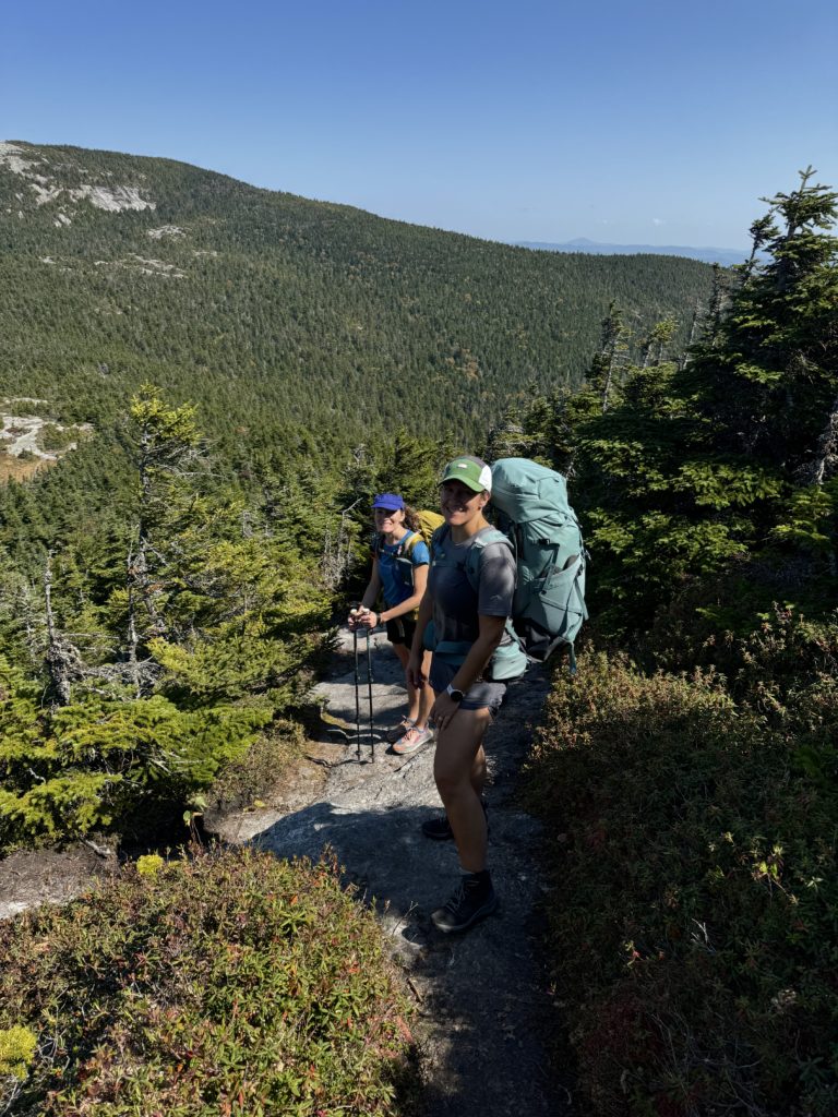
Puzzle Mountain is 3127 feet (and an awesome day hike!) and offers a spur trail option (Woodsum Spur) for an extra 2 miles and an alternative easterly view. Tammi and Ryan debated which route they wanted to take, and I assured them both had amazing vistas. We stuck the Grafton Loop and opted for a long break and morning snack at the summit of Puzzle. From there, we had 4 miles to go to reach the car.
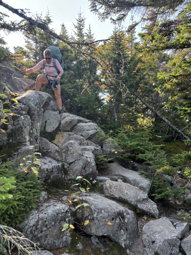
On both my day hike and our backpacking trip, we were lucky with weather. The descent off Puzzle can be treacherous when it’s wet. There are a lot of rocks, both flat ledge and scrambles, and steep sections of loose gravel. The elevation doesn’t let up a whole lot until the last mile, but then we got to cruise through the woods for our final stretch.
Throughout the hike, I checked in with Tammi and Ryan often about how they were feeling. They had both prepared and trained for the hike, carrying their heavy packs on trails near their homes and working out in other ways. The hike was harder than they anticipated, specifically the terrain, which is a very common experience for folks who have never hiked in New England. But they were tough, determined, and strong, remaining positive and funny even when the hike was hard. They asked for help when they needed it and communicated about how their bodies were feeling. They were an absolute pleasure to guide!
As for my 19-mile day on the Grafton Loop East… it was a long one! I was exhausted (remember those 2 hours of sleep I got?), and I thought I might keel over on the Long Mountain slog. But by the time I hit the Puzzle climb, I knew I was in the home stretch, and that was enough to boost my energy… or my survival adrenaline… but either way, I felt great. I also slept really well that night.
Grafton Loop Trail – east side stats
| Total elevation: 3127 ft, 3000 ft, 3576 ft | Elevation gain: 5935 ft |
| Mileage: 19 miles | Alpine exposure: minimal |
| Terrain: woods walk, rock scramble, exposed slab, steep sections | Challenges: steep scramble, overgrown trail, slippery ledge |
| View payoff: outstanding at 2 peaks | Dogs: Yes… if they can scramble |
Recap: The Grafton Loop – East Half is an awesome long distance day hike or a backpacking trip. The terrain is a little bit of everything, from deep woods to exposed peaks. The view from Baldpate is outstanding, and the forest streams along the way are truly magical. Be prepared for moose sightings and very remote trails once you’re off the Appalachian Trail section of the loop. Water filtration and a bear bags are musts if you’re backpacking.
Want to hike it but don’t want to go alone? This is a hike I guide! More info here.
No Comments