Dudley, Knife Edge, Saddle Trails
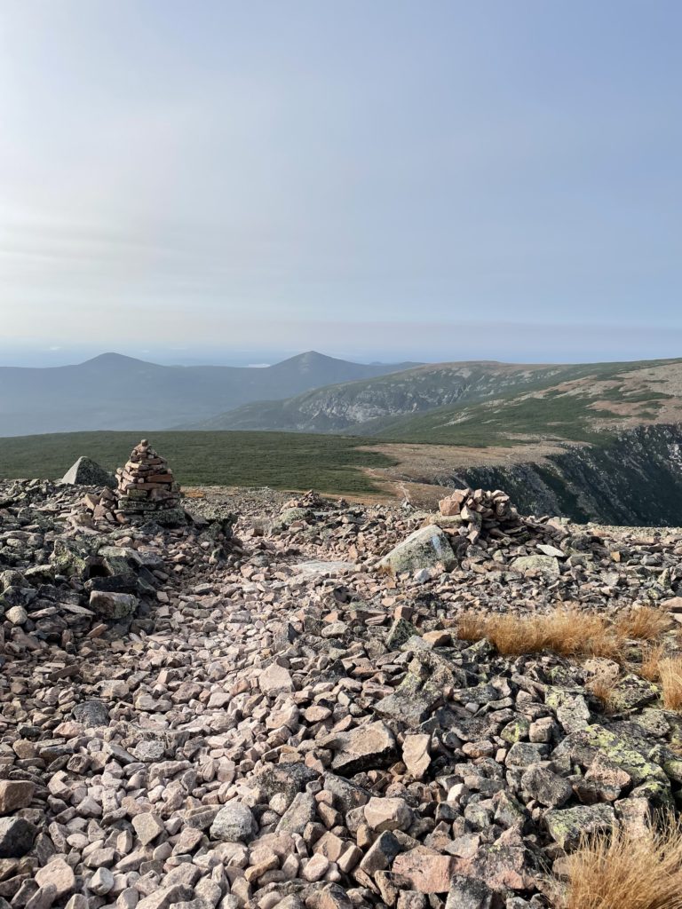
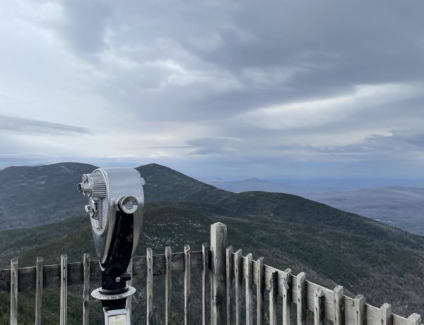
Pamola Peak 4900 ft & Baxter Peak 5268 ft
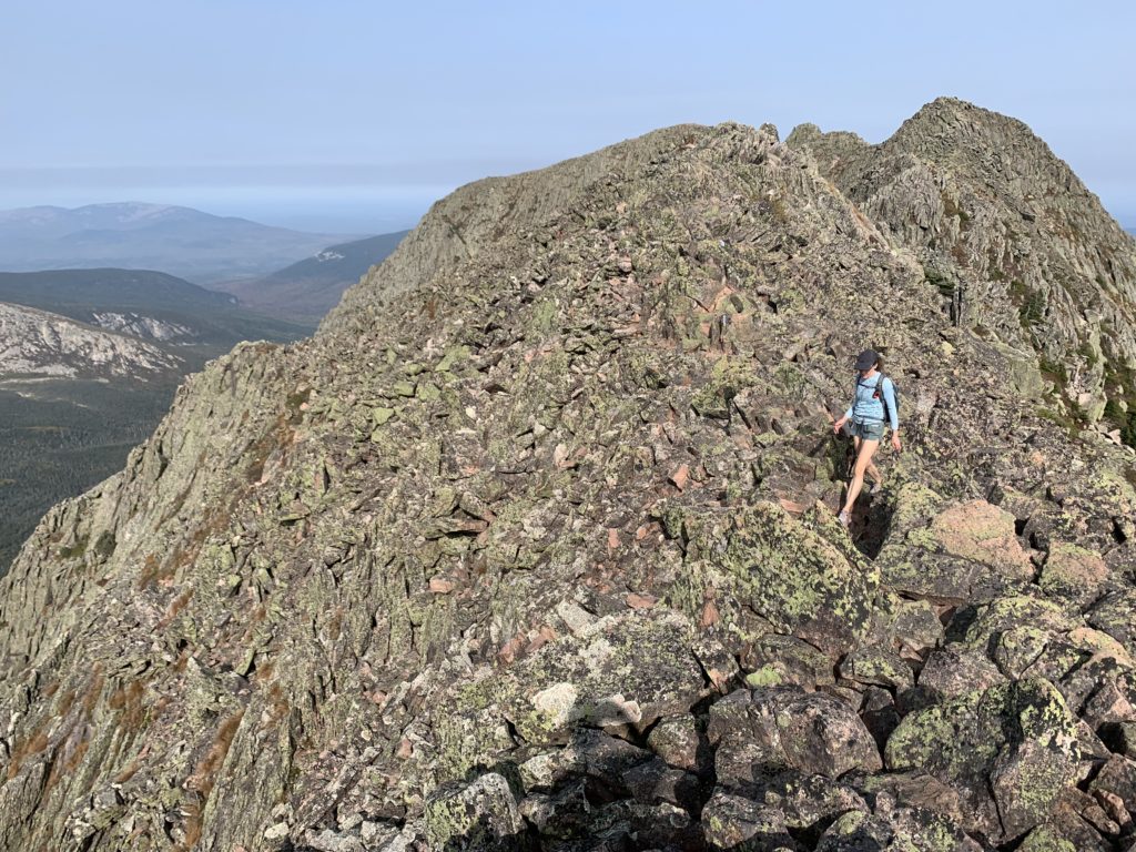
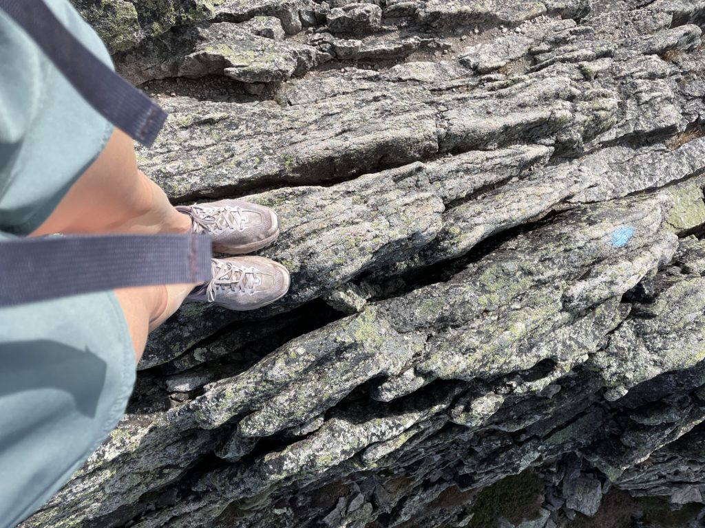
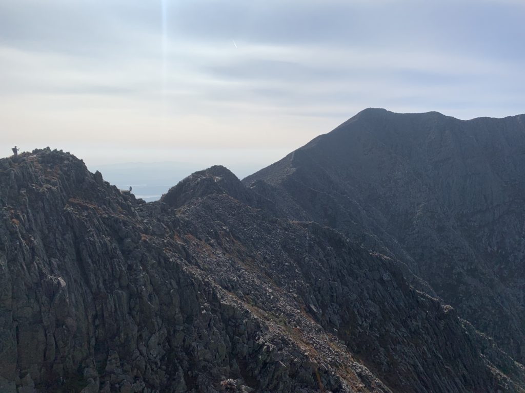
Knife Edge*. The name itself a sense of awe, wonder, and well-deserved trepidation. Since the park started keeping track in 1933, over sixty people have died on Katahdin, many of them on this wildly exposed mile-long ridge. Only three-feet wide in places with 1500 ft drops on either side, this trail requires steady nerves and careful foot placement. But if you’re prepared and you hit it on a good weather day, it is truly one of the most incredible hikes in the Northeast.
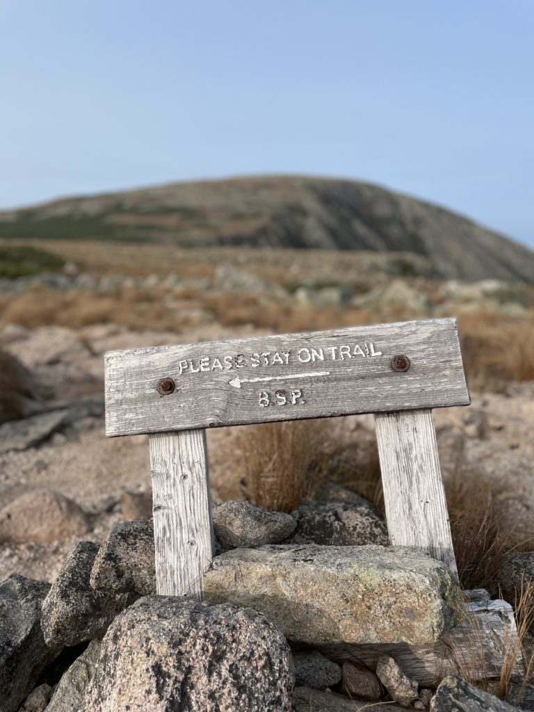
Before hiking Knife Edge, I’d summited Katahdin via the Hunt and Abol trails, which both approach from the southwest. Both are hard—all the trails up Katahdin are—and involve climbing over rocks the size of small cars. From Chimney Pond on the east side of Katahdin, hikers have the option to ascend via Dudley, Saddle, or Cathedral trails, but only Dudley takes you to east end of Knife Edge (Helon Taylor from Roaring Brook Campground also brings you there). It is generally considered *slightly less terrifying* to hike Knife Edge from east to west because you are climbing versus descending.
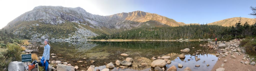
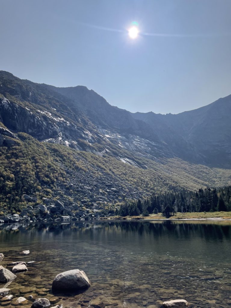
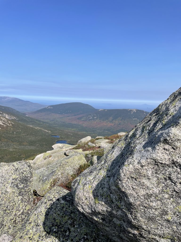
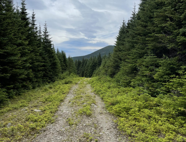
The Chimney Pond Trail from Roaring Brook parking is 3.3 miles and gains a moderate 1,425 feet of elevation. It follows an old logging tote road, traveling along Roaring Brook and passing the Basin Ponds, sites of a long-gone logging camp. The trail ascends into the Great Basin, a horseshoe-shaped glacial cirque that encloses Chimney Pond on three sides with its 2000 foot granite walls. Standing on the shore of the pond and staring up at the imposing wall of the basin in a truly humbling experience. The world is big and beautiful and magical and we are so, so tiny.
Situated on the edge of the pond, Chimney Pond Campground has lean-tos and a bunkhouse (no tent sites) and definitely necessitates reservations well in advance, especially for summer weekends. This is one of the most popular places in the park. You may be able to find an open spot on a random weekday, like I did, but flexibility is required if you’re planning less than a four months out. Like the rest of Baxter State Park, the water at Chimney Pond requires filtering and you are strongly encouraged to use the bear bag hoist system. There are also no campfires permitted at this campground, so bring a stove.
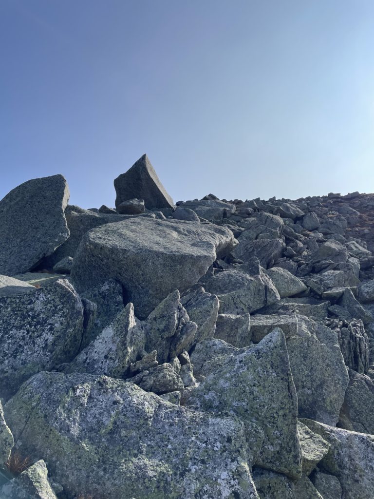
For this trip, I hiked in from Roaring Brook trailhead to Chimney Pond Campground, dropped my overnight gear at the lean-to, and got started up Dudley around noon. Dudley was closed from 2016 until 2021 due to unstable conditions caused by a rock slide (this section has been rerouted), and my hiking partner was excited to see the newly opened trail. The first mile travels through a boulder field at the base of Dudley Ridge. A half-mile up the wooded, eastern flank the tree growth ends and the trail becomes extremely steep and fully exposed. I was hiking this in late September, in full sun, and it was hot. I would imagine a similar day in July or August could be sweltering. At any time of year, especially on a sunny day, I would bring at least 3 liters of water, a lot of snacks, and salt tabs for dehydration cramps.
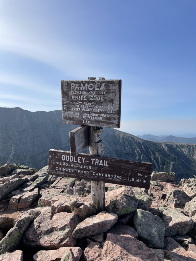
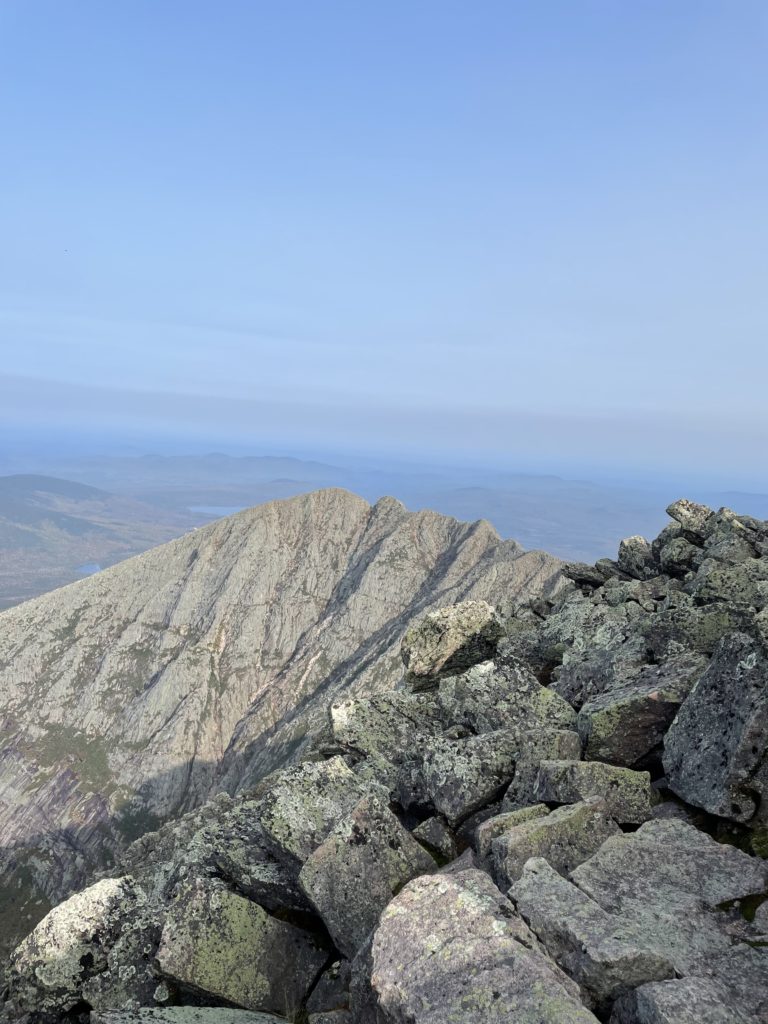
Dudley Trail ends at the 4,900 foot Paloma Peak. From there, Knife Edge descends STEEPLY into the col between Pamola and Chimney Peak. Three hundred feet down in .1 mile, and then right back up, requiring full contact (hands and feet) with the rocks at all times. This is the most technically challenging part of the hike. I climb rocks for fun, and I found this chimney pretty darn terrifying. This is an absolute no-go in bad weather. Actually, all of Knife Edge is a no-go in high-winds, lightning, or heavy rain. The rangers will, at times, close the summit to keep hikers safe. Disobeying their directive is not only disrespectful, it’s foolishly arrogant and downright dangerous. You could get hurt (or die), and if you do get hurt, others will have to put themselves at risk to help you. You’ll feel like an ass and will most likely be handed a hefty fine. So, don’t do it.
The official guidebook for Katahdin, complied and edited by Baxter State Park, gives the following warning:
“[Knife Edge] should not be attempted in poor or marginal conditions. Do not attempt to leave the ridge once you have started. Several ravines have the dangerously misleading appearance of an easy short-cut descent off the ridge toward Chimney Pond. These lead to almost vertical drops which are impossible to negotiate without technical equipment and experience.”
Katahdin, a guide to Baxter State Park
But, let’s assume it’s a gorgeous day in September and you’ve carefully made your way down and back up the chimney! Now you have a mile of jagged, narrow arete stretching out in front of you. And one of the most breathtaking sights you’ve ever seen. The path across the ridge is only three feet wide in places, with 2,000 foot drops on either side. There are sections that are wider, but the whole thing is rocky and uneven and requires thoughtful foot placement and balance.
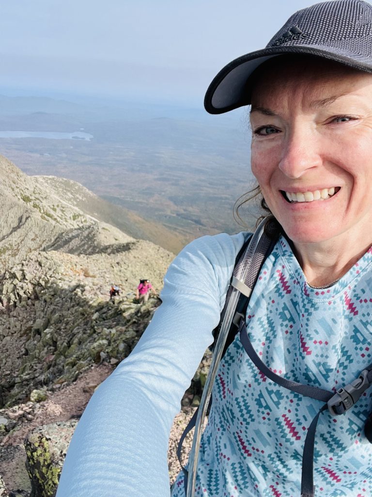
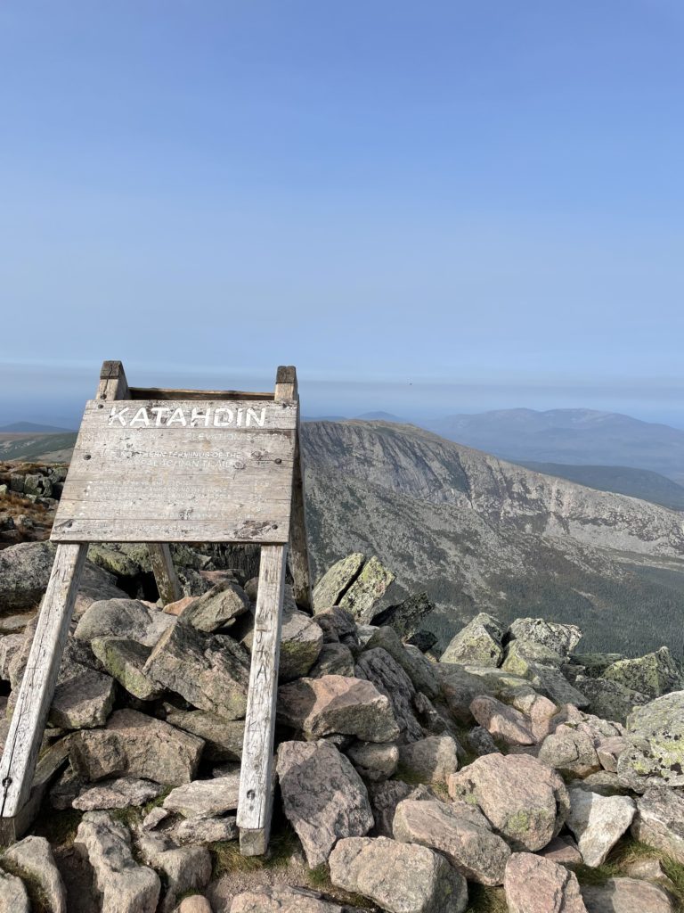
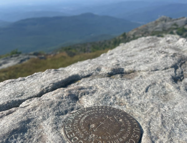
The trip across Knife Edge took about an hour. It could take a lot longer, depending on your comfort level with heights and precarious footing. It’s also a steady uphill from Chimney Peak to Baxter Peak, not a flat ridge, so be prepared to climb almost 400 feet. At Baxter Peak, you’ll get to touch the famous Katahdin sign, experience the northern terminus of the Appalachian Trail, and look back at the insane glacial feature you just crossed.
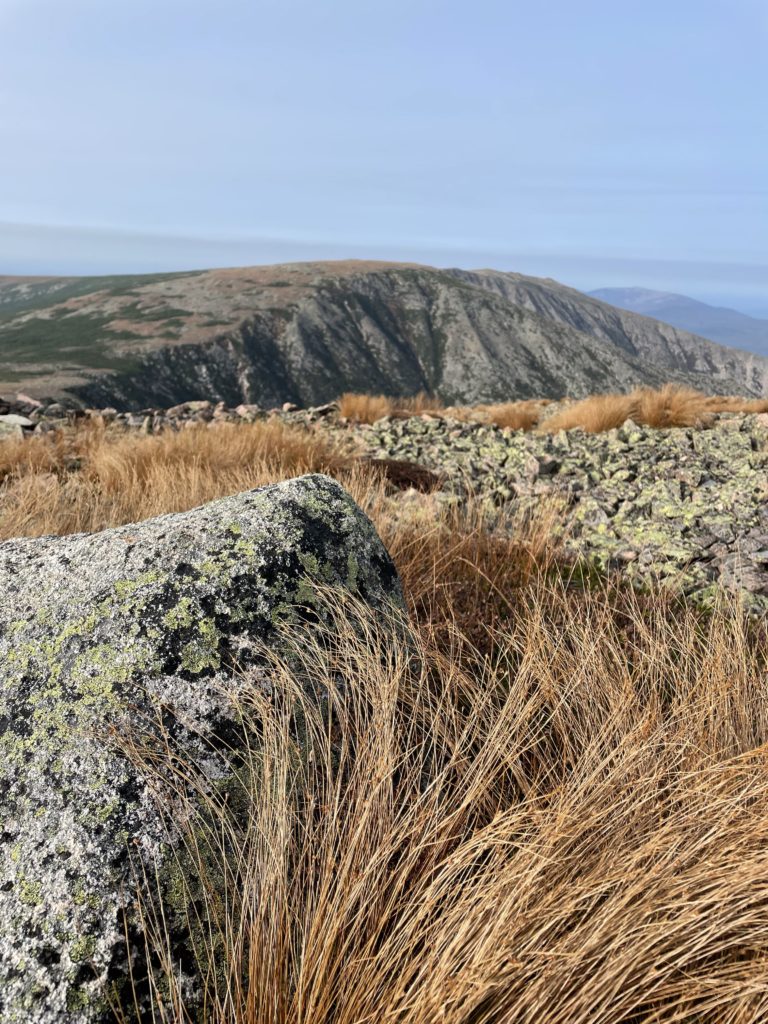
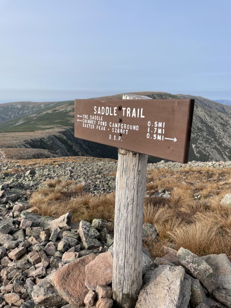
After taking lots of pictures, I headed down the Saddle Trail, which begins its descent gradually over the Tableland, a sloping alpine plateau made of pinkish rocks and scrubby grasses. At one mile, Saddle Trail turns right and drops over the rim of the Tableland, into the Saddle Slide. Of all the steep and rocky trails leading back to Chimney Pond, this is the least steep… which isn’t much of an endorsement for ease, but the worst of it only lasts about a quarter-mile. The footing here is loose and gravelly, and care must be taken not to dislodge rocks that could injure hikers below. After crossing a small brook at .4 miles from the drop, the trail becomes more gradual and reaches Chimney Pond at 2.2 miles total from Baxter Peak.
This whole loop took about 5.5 hours, and that included a long break at the summit and a stop to address heat cramping in my hiking partner’s legs. That said, I was really glad to be camping at Chimney Pond instead of pushing through another (albeit easier) 2.3 miles to reach Roaring Brook, which so many hikers we chatted with were doing. It’s absolutely doable as a day hike (plan on 10-12 hours), but if you can stay at Chimney Pond either before or after summiting, do it!
*I was recently informed by a commenter that the trail name is Knife Edge, not Knife’s Edge, which is how I’d previous denoted it. M’kay. For the record, officially the trail name is Knife Edge. Colloquially, locals call it Knife’s Edge. As in, the edge belonging possessively to the knife-like trail. I edited the name in my title to avoid confusion. But if you’re in Millinocket and a local calls it Knife’s Edge… don’t correct them.
Dudley, Knife Edge, Saddle Trails
| Total elevation: 5268 ft | Elevation gain: 2454 ft |
| Mileage: 3.8 miles (+2.3 to Chimney Pond) | Alpine exposure: significant |
| Terrain: straight up, all rock and scree | Challenges: steep scramble, narrow trail, open summit |
| View payoff: the best | Dogs: No! |
Recap: Knife Edge is arguably the most stunning and most storied feature of Katahdin. It is a truly breathtaking geological phenomenon and a bucket list item for any experienced hiker. However, this mile of narrow, jagged trail edged by nearly 2000 foot drops on either side is not a good choice for those with significant fear of heights, rock climbing, or falling. It is also something only to be attempted in good weather (not in heavy rain, wind, or lightning). Staying at Chimney Pond breaks up this very strenuous hike. Dudley Trail is a hard, fun climb over big boulders, and Saddle Trail is the easiest of all the not-easy-at-all options down. Use caution on the loose, gravelly terrain when descending.
Want to hike it but don’t want to go alone? This is a hike I guide! More info here.
12 Comments
Curt Smith
August 27, 2024 at 3:52 pmNice read. My son hiked the AT in 2018 and I was able to hike both ends with him. The hunt trail was sketchy to me and when we were on top he wanted to hike Knifes Edge. Hopefully we can go back up and he can hike it with my daughter’s, I’ll be camp cook. I was 58 then and that took all I had!!
Sarah Holman
August 30, 2024 at 10:35 amHi Curt, thanks for visiting and commenting! How awesome to start and finish that journey with your son. Hunt is tough for sure, and Knife’s Edge isn’t for everyone. But.. I can’t imagine anything better than a hot camp meal waiting after hiking it. I think you’re got a great plan in place!
Julie
September 12, 2024 at 12:48 pmThank you for the detailed read. I AM DEFINITELY AFRAID of falling off an edge. I’ve been reduced to crawling on hands and knees.
Is there a wider trail to the summit? (“3ft wide with 2000ft drops on either side” would end my hike)
Thanks
Sarah Holman
September 14, 2024 at 8:49 amHi Julie! There are plenty of wider trails to the summit! All options do involve some rock scrambling, but the narrowness of Knife’s Edge (and the 2000 foot drops!) are unique to that trail. The *least scary* trail up is Saddle Trail, which you access by hiking into Chimney Pond via the Roaring Brook trailhead. The rock scramble on the Saddle Slide is less exposed than any other trail up, so it feels less harrowing. I recommend that trail up and down to anyone afraid of heights. Please reach out with any other questions, and good luck!
Madeline Hartley
September 17, 2024 at 9:03 amIncredible thank you
Charles Russo
September 30, 2024 at 3:24 pmI did it with my son and grandson 9/23/24. I’ll be 70 in November. We hiked from Roaring Brook to Chimney Pond. Then up the Cathedral Trail, over Katahdin and the Knifes Edge to Helon-Taylor out to Roaring Brook. Took us 13 hours with a good break with pix at Chimney Pond, a very short stop at the summit and out. Very challenging but loved it and glad to have done it.
Sarah Holman
October 3, 2024 at 2:08 pmAmazing, Charles, congrats to you both! Cathedral Trail is the only trail to the summit I haven’t taken. I’m looking forward to tackling it next summer. Thanks for sharing!
Geo Gipson
October 19, 2024 at 8:09 pmNice write-up.
In January of 1986, three friends and I skied gear from the park gate to the Roaring Brook cabin, where we overnighted, and then skied to Chimney Pond Hut. We spent the next five days with the hut to ourselves, climbing our tails off.
One morning my partner and I cast off with headlamps, climbed the Cilley-Barber Route up sketchy ice, then hiked along the Knife Edge and eventually back down to the hut.
I’m 63, living in Colorado at 10,200′, and still climbing.
Happy trails!
Sarah Holman
October 20, 2024 at 7:25 amHi Geo, thanks so much for sharing this memory. I love hearing stories from people who hiked Katahdin in the pre-‘ultra-hiker’ days! Getting into Chimney Pond during the winter months is high on my adventure to-do list. The pictures I’ve seen look breathtaking. Keep climbing and sharing! Happy hiking!
Colin T
May 20, 2025 at 5:58 pmVery great write up, I enjoyed reading it.
So, the col in between Paloma and Chimney peak, as a non-climber but comfortable scrambler, is it doable? My partner and I are confident yet we do not want to underestimate this section of the hike.
Thank you in advance for your response!
Sarah Holman
May 20, 2025 at 6:08 pmHi Colin, great question! Yes, I believe it’s doable for anyone who is fit and comfortable scrambling. Just go slowly, one move at a time, 3 points of contact on the rocks at all times. It’s a short section but very technical. If you’re able, I highly recommend planning for two potential hiking days (ie reserve 2 trailhead passes or camp a few days in the park). That way you can choose the best weather day for your ascent. Knife’s Edge and the col specifically are next-level challenging when wet. It’s an incredible hike! Best of luck!
Colin T
May 21, 2025 at 9:22 amThank you for the info and words of advice, I greatly appreciate your perspective & experience. As a native east coaster, this will be one of my most anticipated summits.