Airline Trail
Mt. Adams 5774 ft
My first 4000 footer started as a mistake. I had four hikes in the Whites under my belt, and I was looking for something a little more challenging. New to the AllTrails app, I scanned for peaks with trailheads within two hours of Portland and a little higher than what I’d been climbing. I saw that Mt. Adams was just over 4,400 feet and the Airline trailhead was two hours away. It seemed like a challenge, but not impossible.
Mt Adams is not 4,400 feet. Keep reading.
The morning of September 11 was sunny and warm in Portland. I threw on a base layer and packed a Patagonia nano puff vest. At the last minute, I grabbed a super lightweight windbreaker (also Patagonia… I have a small (big) jacket-buying problem) and stuffed it in my pack.
The drive to the Appalachia Parking Lot in Randolph, New Hampshire takes you through Oxford, Maine. There is a speedway and a casino and… a New Balance Factory Store! It’s worth a stop, especially if you can time your visit to hit the annual tent sale for seriously big sales (I may also have a small (big) shoe-buying problem).
Shortly after Bethel, Maine you cross into New Hampshire on Route 2. The scenery kicks it up a notch here; the Androscoggin River flows on the right and the northern edge of the White Mountain National Forest rises on the left. Ahead of you, the mighty White Mountains stand guard. Every time I drive into them, I’m overwhelmed with conflicting feelings. Smallness and vastness. Limitation and possibility. Relief and anxiety. I’ve found it doesn’t matter which feeling claws its way to the forefront of my mind at any given moment. One thought is always louder than the rest: Take me to the mountains.
The Appalachia Parking Lot is on the left, on the edge of Rt. 2. It is large, but it fills up fast during the busy season. I arrived at 9am and it was nearing capacity. At the base of the mountains, the temperature was in the mid-60s and expected to reach the 70s later in the day. We’ll revisit this weather tidbit later.
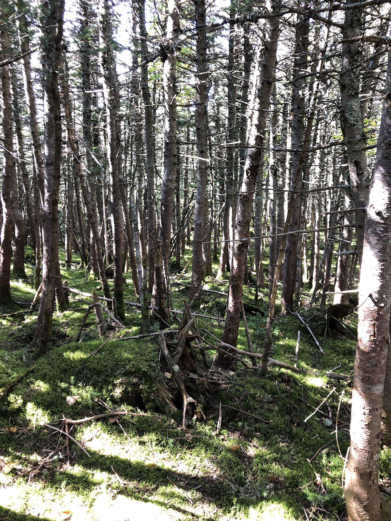
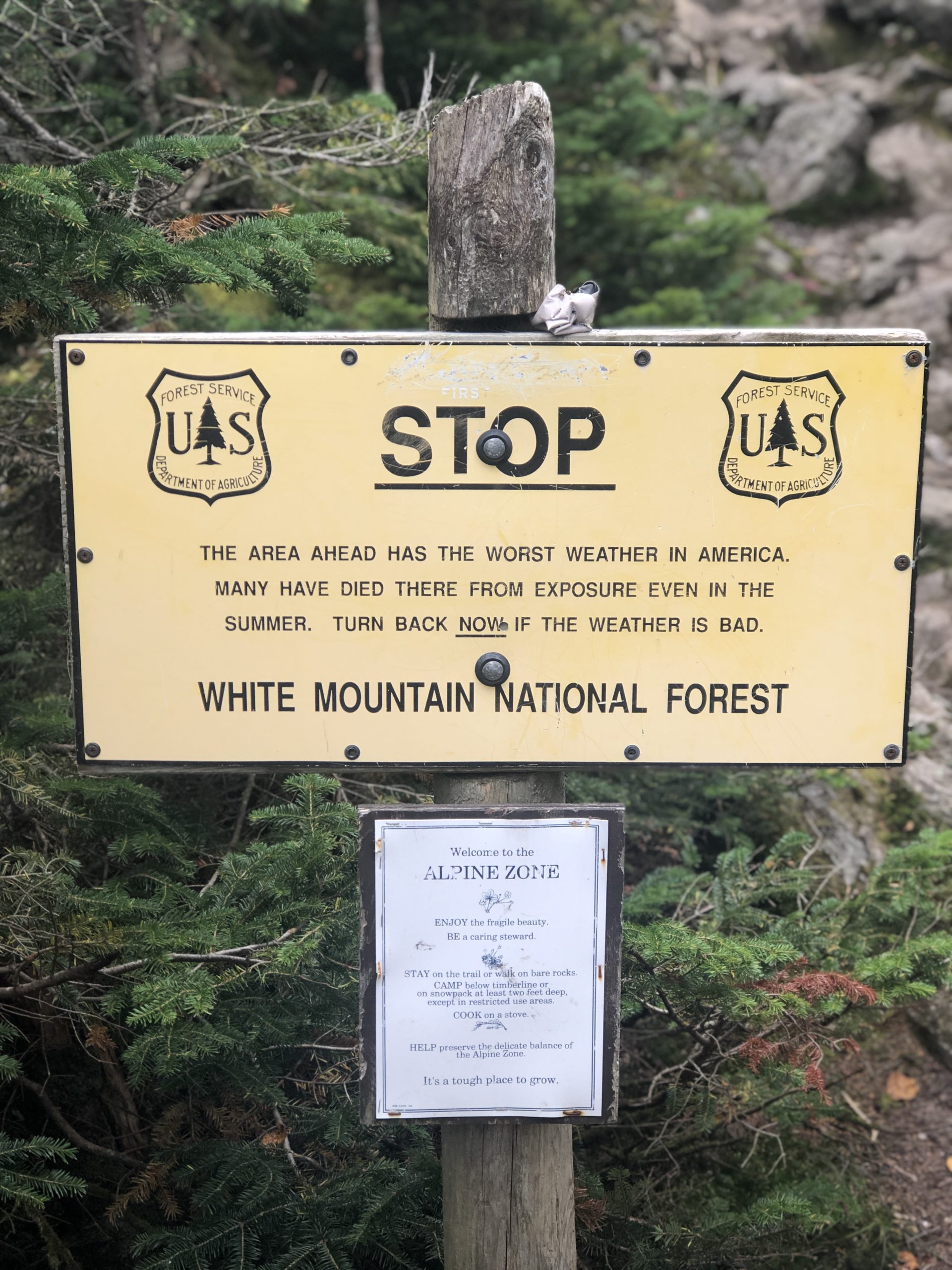
There are several ways to reach the summit of Mount Adams (check out the Appalachian Mtn Club website for a breakdown and descriptions of the options). I chose the Airline Trail, which follows Durand Ridge and is the shortest route to the top. It is also one of the steepest. The first mile and half are gradual in comparison to what follows, which is a half mile of very rough going. It’s steep and rocky and unrelenting. The trail eases up again, but only briefly. Around mile 3, I encountered my first alpine zone warning sign, courtesy of the Forest Service.
STOP. THE AREA AHEAD HAS THE WORST WEATHER IN AMERICA. MANY HAVE DIED THERE FROM EXPOSURE EVEN IN THE SUMMER. TURN BACK NOW IF THE WEATHER IS BAD.
Well, if that doesn’t force a quick evaluation of your life choices up to this point, I don’t know what will.
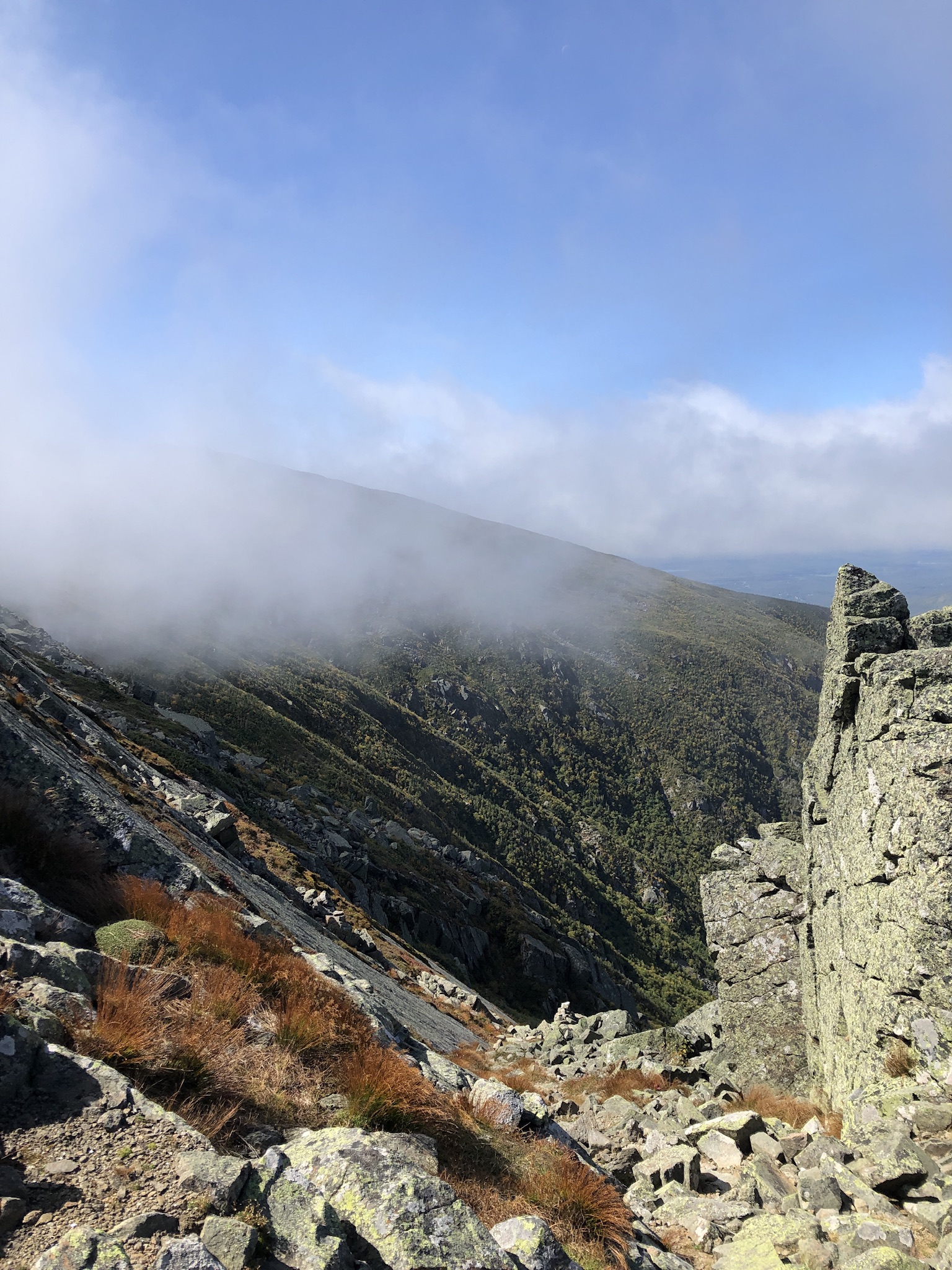
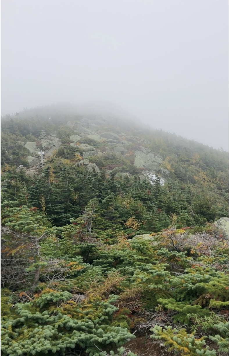
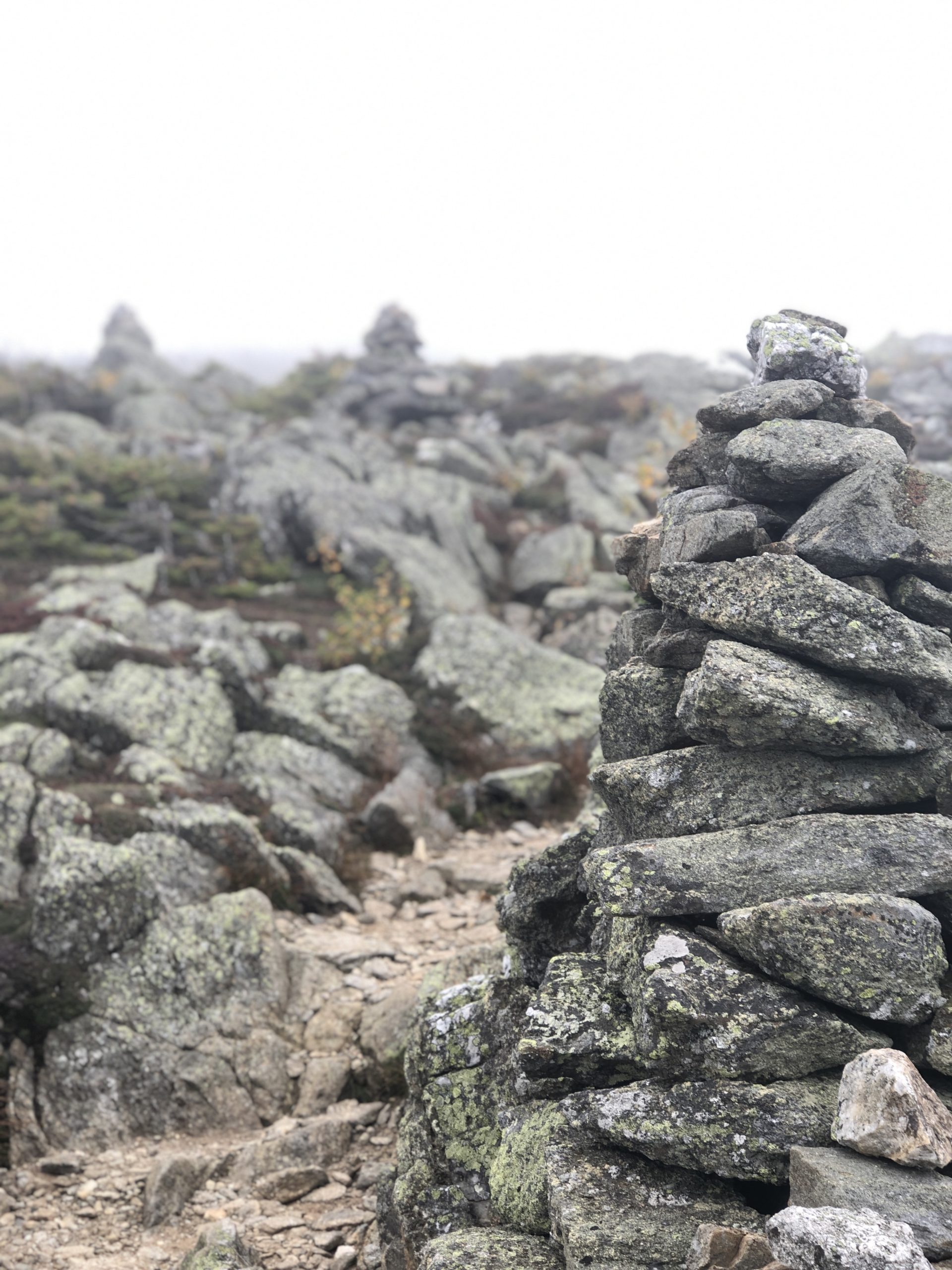
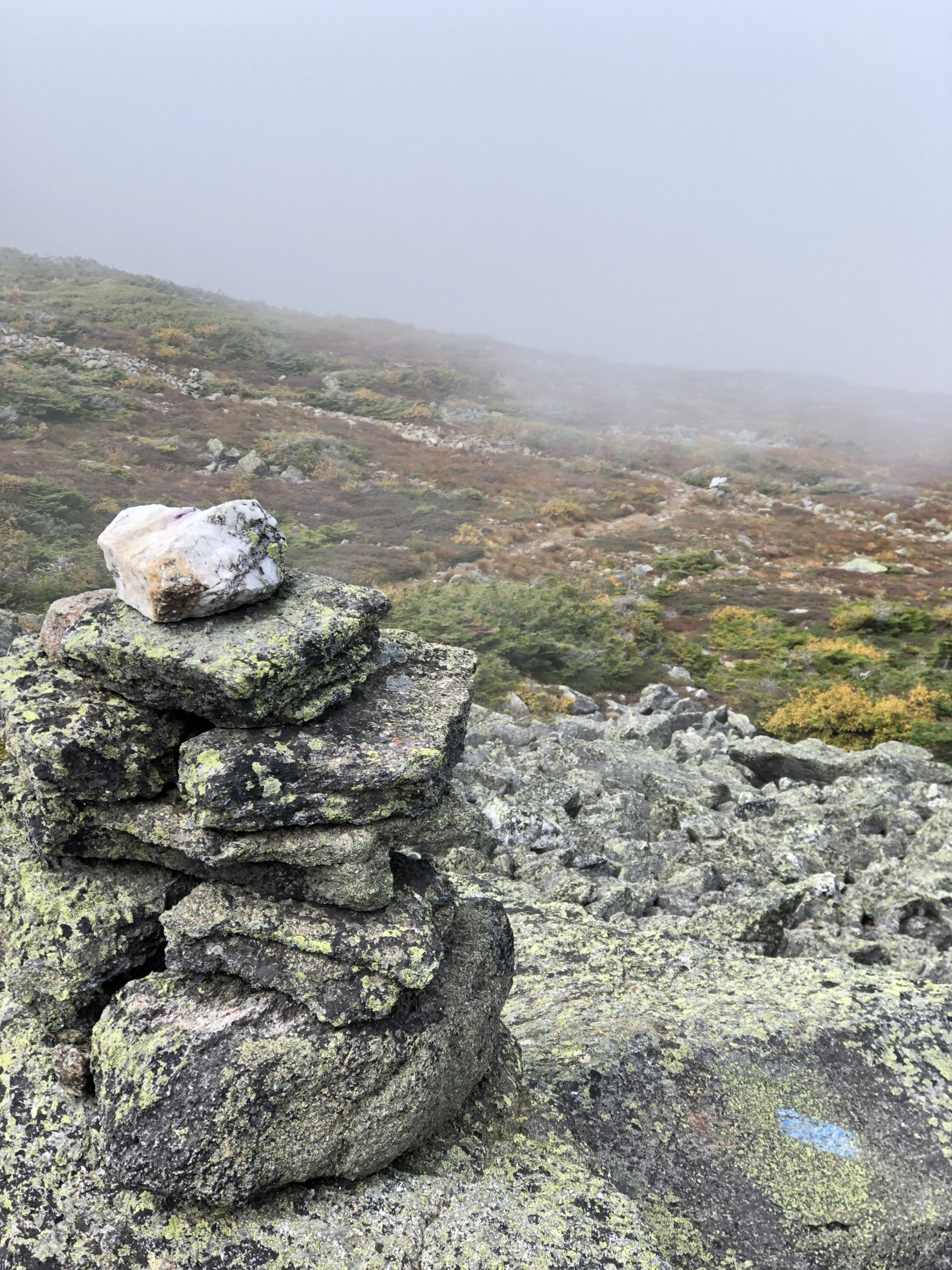
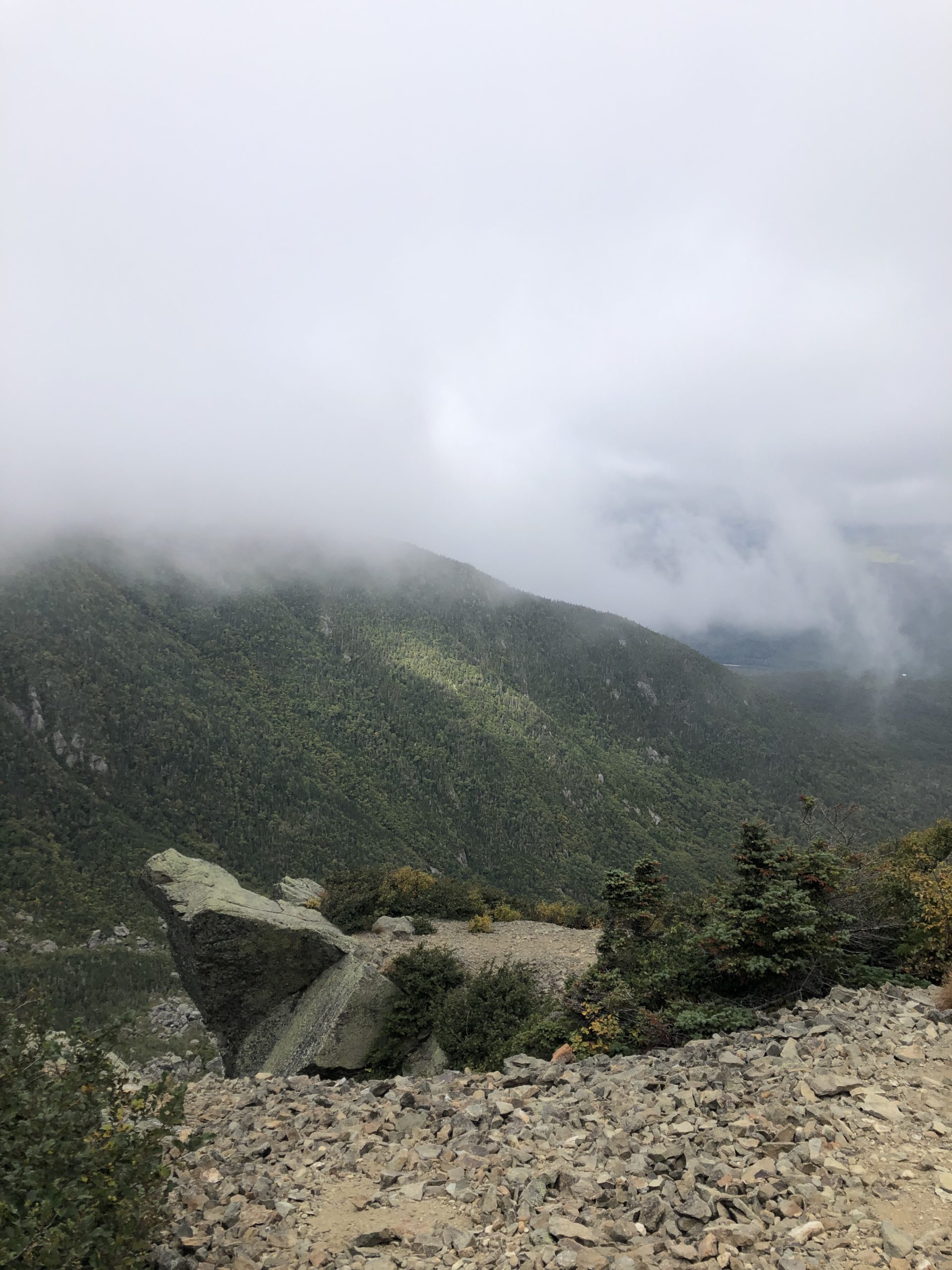
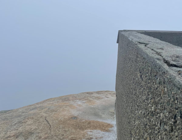
After passing the sign with a small knot in my stomach, I left the shelter of the woods behind. Above the treeline, the Airline Trail is fully exposed to the elements, and the temperature dropped sharply (the nano puff came out of my pack). The trail rose into the clouds, and mist was billowing past. I was taken aback by how different the scenery was from just moments ago, when I was still in the woods. The next section of trail brought me over Knife’s Edge, a ledgy crest that drops sharply into King’s Ravine on the right. This ravine, I learned in the AMC White Mountain Guide, is a U-shaped glacial cirque formed by glacial erosion, which has a different appearance than your basic V-shaped river valley.
It was impressive, regardless of how it got there. Huge slabs of rock dove at sharp angles toward the forest below, with scrubby plants and smaller rocks clinging to the edges of the crag. The trail was narrow, but not so thin that I felt anxious about falling. Someone with a fear of heights would want to stay in the middle of the trail; peeking over the edge isn’t reassuring.
Hiker term:
Glacial cirque
An amphitheater-like valley formed by glacial erosion.
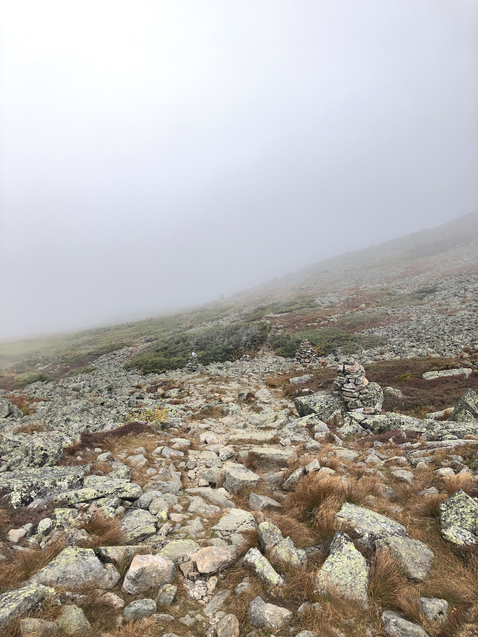
The final half-mile push to the summit is marked by cairns and blue blazes, and the only way to describe it is tough. The rocks are large and angular and require careful, balanced footing. There is no relief from the steep pitch. You just have to keep climbing. At this point, the wind was howling and I was getting very cold. I was incredibly grateful for my last-minute windbreaker pack addition. I had it zipped all the way up, hood on, hands curled into the bottoms of the sleeves. When I finally crested the summit, a hiker nearby was waving at me, saying something. I couldn’t hear him over the wind, but he was gesturing me closer to where he and two other hikers were resting, just beyond the edge of the summit. I stepped over the top and it was like someone had flipped the ‘off’ switch on the wind.
“It’s much warmer on this side!” he called.
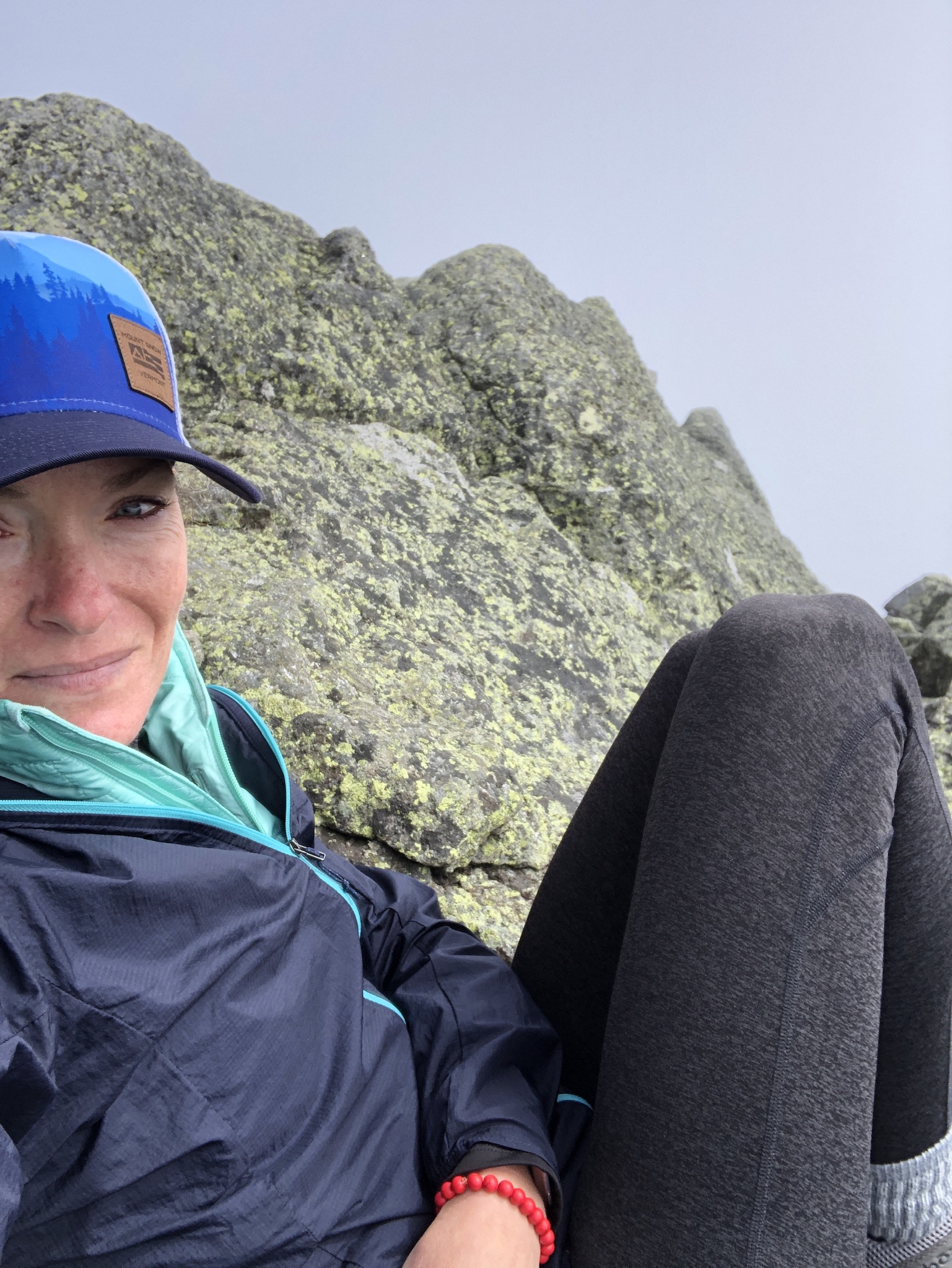
I sat facing south with my back against the rocks and checked my phone. It was 42 degrees. On the north side of the mountain it was probably closer to 30, even less with the windchill. I thought about what it would have felt like if I hadn’t grabbed the windbreaker, and in that moment I realized just how serious that alpine zone warning sign was. People die out here, usually because they’re not properly prepared for the weather. What followed this acute awareness of danger was an incredible sense of accomplishment.
My exact thought at that moment was: If I can reach this summit, I can do anything.
This is, of course, an overstatement when taken literally and an oversimplification when taking a deep dive into the profound emotional experience of hiking. Point is, I had a moment up there on the mountaintop, the kind of moment I hadn’t had in a very long time.
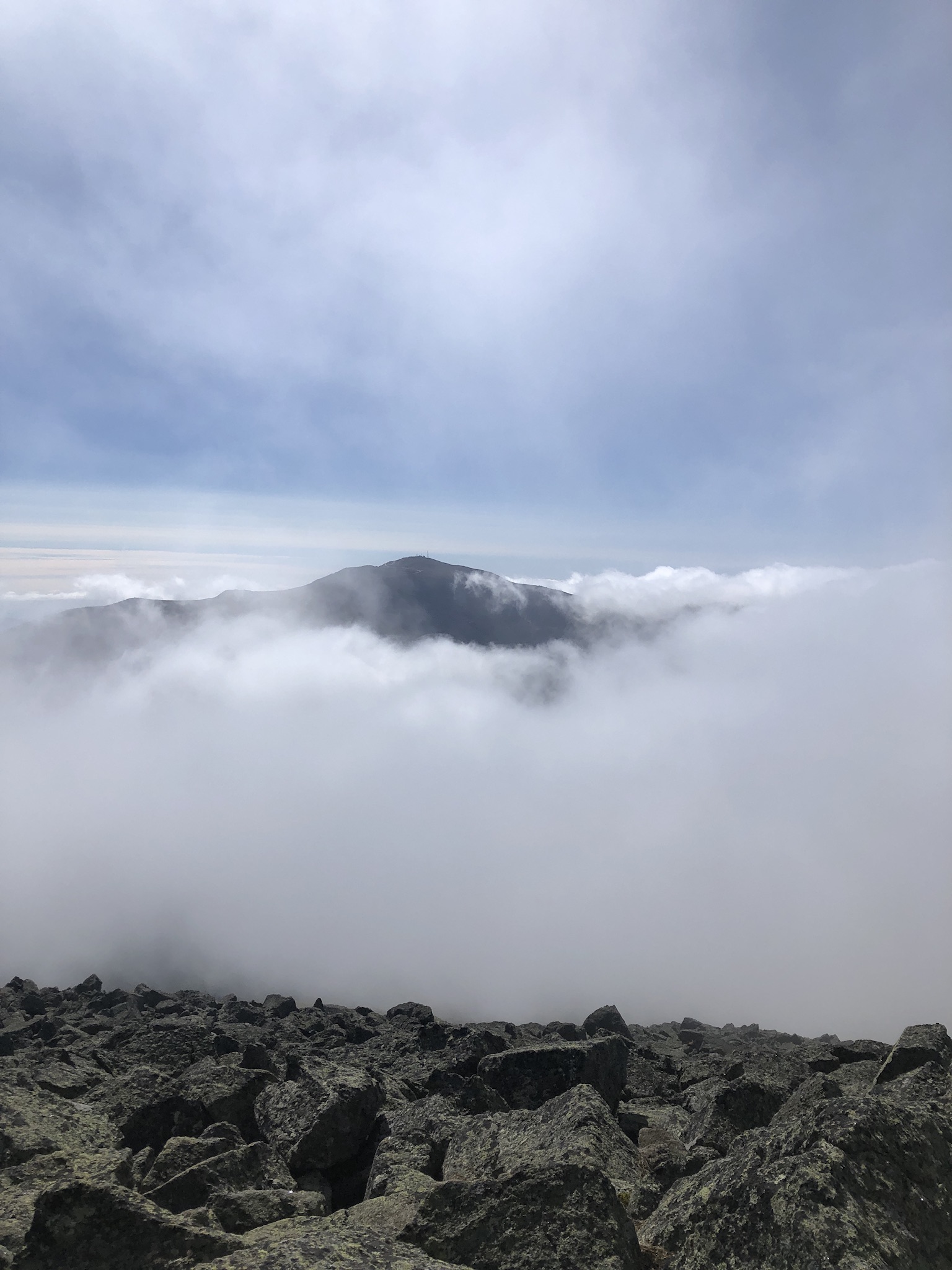
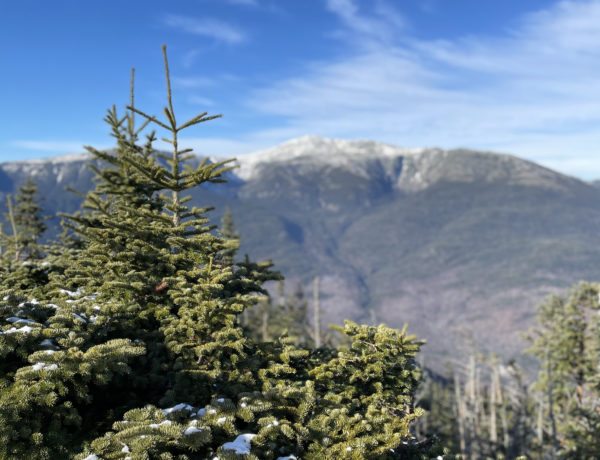
I had my phone in the air, capturing the dense clouds blanketing the summit, when a gust broke open the curtain of white. Mount Washington was right there. RIGHT THERE! For the past month I’d been telling myself the tallest of the presidential peaks was too much for me. Too challenging. Too dangerous. Too tall. But there it was, revealing itself, as if it was saying, ‘Hey, you over there. I see you. Look how far you’ve already come. Climb me. I know you can make it.’
Maybe, I thought to myself. Someday.
It should come as no surprise that the hike down Mt. Adams (I followed the Airline back) was as challenging as the hike up. The first mile of descent over the boulder field requires extreme concentration on footing and balance, and the final three miles alternate between tough and reeeeeally tough. But this hike is so worth it. Sooooo worth every step.
The first thing I did when I got back to my car was send a text to my family letting them know, 1. I was alive, and 2. I would be hiking the NH48. This is shorthand for the 48 peaks with elevations over 4000 feet in New Hampshire.
My mother, whose ability to be shocked by my overly ambitious goal-setting habit has waned over the years, said, “Why am I not surprised.”
Back in Portland, I printed off a list of the 4000 footers. It was only after I printed the list that I realized Mt. Adams is not, in fact, 4,432 feet. It is 5,774 feet, second only in size to Mt. Washington. I was reading the elevation gain of the tail on AllTrails, not the overall elevation of the peak. When I realized this, two things became clear. I needed to learn to read hiking maps, for one. More importantly, Mt. Washington is only 500 feet higher than Mt. Adams, which meant…
I could absolutely hike Mount Washington.
Summit lesson: Self-doubt is a feeling, not a fact.
Mt. Adams: Airline Trail
| Total elevation: 5,774 ft | Elevation gain: 4,500 ft |
| Mileage: 8.6 miles | Alpine exposure: significant, unsheltered |
| Terrain: some woods walk, mostly very steep, exposed ridges, rock steps, rock slopes, boulders | Challenges: high wind, bouldering, balance, scrambling, loose rock, cold summit temps |
| View payoff: stunning | Dogs: on leash, very challenging after treeline |
Recap: Hard work for the whole trip, although there are a few spots where the trail evens out briefly. Above the treeline the terrain is all ledge and boulder field, and it is very steep. Views along Durand Ridge and from the summit are breathtaking. Bring layers. Even if it’s seventy degrees at the trailhead, you’ll need them,
1 Comment
Mt. Jefferson | 5712 ft | NH - She Hikes Mountains
April 17, 2021 at 11:07 am[…] realized Mt. Adams is the second highest peak in New Hampshire, I felt totally empowered to take on all the presidents while the weather was […]